
Robin Hood Lane (Hall Green): Difference between revisions
From International Robin Hood Bibliography
m (Text replacement - "|service=leaflet}}" to "|service=leaflet|enablefullscreen=yes}}") |
rh>Henryfunk m (Text replacement - "</div> {{ImgGalleryIntro}}" to "</div> <div id="gallery"> {{ImgGalleryIntro}}") |
||
| Line 10: | Line 10: | ||
</div> | </div> | ||
<div id="gallery"> | |||
{{ImgGalleryIntro}} | {{ImgGalleryIntro}} | ||
<gallery widths="195px"> | <gallery widths="195px"> | ||
| Line 15: | Line 16: | ||
File:Anonymous 1912b-r.jpg|{{:Anonymous 1912b}} / Private collection. | File:Anonymous 1912b-r.jpg|{{:Anonymous 1912b}} / Private collection. | ||
</gallery> | </gallery> | ||
</div> | |||
{{PnItemNav}} | {{PnItemNav}} | ||
Revision as of 23:31, 14 May 2020
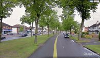
Robin Hood Lane (Hall Green).
[[File:|thumb|right|500px|Robin Hood Lane, Hall Green / Google Earth Street View.]]
By Henrik Thiil Nielsen, 2018-01-12. Revised by 3.145.119.199, 2020-05-14.
Robin Hood Lane is a major street in Hall Green, connecting Cole Valley Road/Sarehold Road and Stratford Road.Template:PnItemQry
Gazetteers
- Not included in Dobson, R. B., ed.; Taylor, J., ed. Rymes of Robyn Hood: an Introduction to the English Outlaw (London, 1976), pp. 293-311.
Robin Hood Lane, Hall Green / Google Earth Street View.

