Robin Hood (Wakefield): Difference between revisions
From International Robin Hood Bibliography
mNo edit summary |
mNo edit summary |
||
| Line 1: | Line 1: | ||
__NOTOC__{{PnItemTop|Lat=53.741278|Lon=-1.508186|AdmDiv=Yorkshire|Vicinity=c. 2.5 km SW of Rothwell|Type=Settlement|Interest=Robin Hood name|Status=Extant|Demonym=|Riding=West|GreaterLondon=|Year=1841|Aka=|Century=|Cluster1=Robin Hood (Wakefield)|Cluster2=Wakefield|Cluster3=|Image=robin hood rothwell.jpg|Postcards=|ExtraCat1=|ExtraCat2=|ExtraCat3=|ExtraCat4=|ExtraCat5=|GeopointPrefix=|GeopointSuffix=|StatusSuffix=|DatePrefix=|DateSuffix=}} | __NOTOC__{{PnItemTop|Lat=53.741278|Lon=-1.508186|AdmDiv=Yorkshire|Vicinity=c. 2.5 km SW of Rothwell|Type=Settlement|Interest=Robin Hood name|Status=Extant|Demonym=|Riding=West|GreaterLondon=|Year=1841|Aka=|Century=|Cluster1=Robin Hood (Wakefield)|Cluster2=Wakefield|Cluster3=|Image=robin hood rothwell.jpg|Postcards=|ExtraCat1=|ExtraCat2=|ExtraCat3=|ExtraCat4=|ExtraCat5=|GeopointPrefix=|GeopointSuffix=|StatusSuffix=|DatePrefix=|DateSuffix=}} | ||
{{#display_map:{{#var:Coords}}|width=34%}}<div class="pnMapLegend">Robin Hood.</div> | {{#display_map:{{#var:Coords}}|width=34%}}<div class="pnMapLegend">Robin Hood.</div> | ||
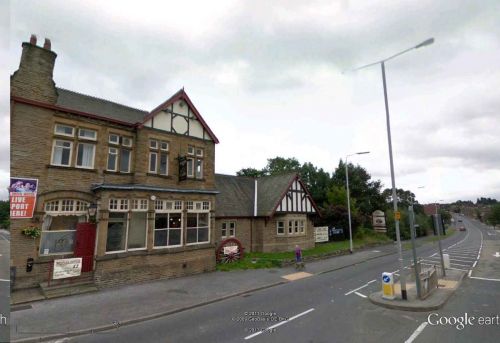
[[File:robin hood rothwell.jpg|500px|thumb|right|Street view in center of Robin Hood | [[File:robin hood rothwell.jpg|500px|thumb|right|Street view in center of Robin Hood / Google Earth Street View.]] | ||
<p id="byline">By Henrik Thiil Nielsen, 2013-08-07. Revised by {{#realname:{{REVISIONUSER}}}}, {{REVISIONYEAR}}-{{REVISIONMONTH}}-{{REVISIONDAY2}}.</p> | <p id="byline">By Henrik Thiil Nielsen, 2013-08-07. Revised by {{#realname:{{REVISIONUSER}}}}, {{REVISIONYEAR}}-{{REVISIONMONTH}}-{{REVISIONDAY2}}.</p> | ||
<div class="no-img"> | <div class="no-img"> | ||
The first mention of a hamlet or village named Robin Hood c. 2.5 km south-west of Rothwell is found in an 1841 MS Tithe Award.<ref>{{:Smith, Albert Hugh 1961a}}, pt. II, p. 138</ref> Dobson & Taylor refer to an O.S. map from the same year.<ref>{{:Dobson, Richard Barrie 1976a}}, p. 308.</ref> The village grew after a mine was opened there in the mid-19th century and miners settled in the neighbourhood. The mine closed in the 1960s; the village is now a residential area. Several localities in the area are/were named after Robin Hood (the village and/or the outlaw). | The first mention of a hamlet or village named Robin Hood c. 2.5 km south-west of Rothwell is found in an 1841 MS Tithe Award.<ref>{{:Smith, Albert Hugh 1961a}}, pt. II, p. 138</ref> Dobson & Taylor refer to an O.S. map from the same year.<ref>{{:Dobson, Richard Barrie 1976a}}, p. 308.</ref> The village grew after a mine was opened there in the mid-19th century and miners settled in the neighbourhood. The mine closed in the 1960s; the village is now a residential area. Several localities in the area are/were named after Robin Hood (the village and/or the outlaw).{{#ask:[[Category:Records ({{#ifeq:{{#pos:{{PAGENAME}}|(|}}||{{PAGENAME}}|{{#sub:{{PAGENAME}}|0| {{#expr:{{#pos:{{PAGENAME}}|(|}}-1}} }},{{#sub:{{PAGENAME}}|{{#expr:{{#pos:{{PAGENAME}}|(|}}-1}}|1}}{{#sub:{{PAGENAME}}|{{#expr:{{#pos:{{PAGENAME}}|(|}}+1}}}}}}]]| format=embedded|embedformat=h4|columns=1|limit=1000|sort=Utitle|intro=<h3>Records</h3>}}{{#ask:[[Category:Allusions ({{#ifeq:{{#pos:{{PAGENAME}}|(|}}||{{PAGENAME}}|{{#sub:{{PAGENAME}}|0| {{#expr:{{#pos:{{PAGENAME}}|(|}}-1}} }},{{#sub:{{PAGENAME}}|{{#expr:{{#pos:{{PAGENAME}}|(|}}-1}}|1}}{{#sub:{{PAGENAME}}|{{#expr:{{#pos:{{PAGENAME}}|(|}}+1}}}}}}]]| format=embedded|embedformat=h4|columns=1|limit=1000|sort=Utitle|intro=<h3>Allusions</h3>}} | ||
=== Gazetteers === | === Gazetteers === | ||
* {{:Dobson, Richard Barrie 1976a}}, p. 308, ''s.n.'' 'Robin Hood'. | * {{:Dobson, Richard Barrie 1976a}}, p. 308, ''s.n.'' 'Robin Hood'. | ||
| Line 14: | Line 14: | ||
=== Background === | === Background === | ||
* [http://en.wikipedia.org/wiki/Robin_Hood,_West_Yorkshire Wikipedia: Robin Hood, West Yorkshire]; brief but useful on the village, but the discussion of its alleged Robin Hood associations is misguided. | * [http://en.wikipedia.org/wiki/Robin_Hood,_West_Yorkshire Wikipedia: Robin Hood, West Yorkshire]; brief but useful on the village, but the discussion of its alleged Robin Hood associations is misguided. | ||
{{PnItemAlsoSee}} | {{PnItemAlsoSee}} | ||
=== Notes === | === Notes === | ||
<references/> | <references/> | ||
| Line 22: | Line 20: | ||
</div> | </div> | ||
{{PnItemNav}} | {{PnItemNav}} | ||
Revision as of 19:04, 25 May 2018
Robin Hood.
By Henrik Thiil Nielsen, 2013-08-07. Revised by Henrik Thiil Nielsen, 2018-05-25.
The first mention of a hamlet or village named Robin Hood c. 2.5 km south-west of Rothwell is found in an 1841 MS Tithe Award.[1] Dobson & Taylor refer to an O.S. map from the same year.[2] The village grew after a mine was opened there in the mid-19th century and miners settled in the neighbourhood. The mine closed in the 1960s; the village is now a residential area. Several localities in the area are/were named after Robin Hood (the village and/or the outlaw).
Gazetteers
- Dobson, R. B., ed.; Taylor, J., ed. Rymes of Robyn Hood: an Introduction to the English Outlaw (London, 1976), p. 308, s.n. 'Robin Hood'.
Sources
- Smith, A.H. The Place-Names of the West Riding of Yorkshire (English Place-Name Society, vols. XXX-XXXVII) (Cambridge, 1961-63), pt. II, p. 138.
Background
- Wikipedia: Robin Hood, West Yorkshire; brief but useful on the village, but the discussion of its alleged Robin Hood associations is misguided.
Notes

