
Robin Hood (Norton)
From International Robin Hood Bibliography
| Locality | |
|---|---|
| Coordinate | 53.058172, -2.163914 |
| Adm. div. | Staffordshire |
| Vicinity | 316 Ford Green Road, Norton, Stoke-on-Trent |
| Type | Public house |
| Interest | Robin Hood name |
| Status | Extant |
| First Record | 1845 |
The Robin Hood, Norton.

The Robin Hood, Norton: Ford Green Road (the B5051) on the right, Spragg House Lane in front / David Weston, 29 June. 2014, Creative Commons, via Geograph.
By Henrik Thiil Nielsen, 2020-11-01. Revised by Henrik Thiil Nielsen, 2021-01-06.
The still thriving Robin Hood pub on the corner of Ford Green Road and Spragg House Lane in Norton, Stoke-on-Trent, was in existence by 1845.
In that year a newspaper reported that two colliers had misbehaved in the pub, being 'disguised in drink'.[1] The pub is included in all the early O.S. maps listed below. Template:PlaceNamesItemQuery
Gazetteers
- Not included in Dobson, R. B., ed.; Taylor, J., ed. Rymes of Robyn Hood: an Introduction to the English Outlaw (London, 1976), pp. 293-311.
Sources
Maps
- 25" O.S. map Staffordshire XII.6 (1881; rev. 1876–77)
- 25" O.S. map Staffordshire XII.6 (1899; rev. 1898)
- 25" O.S. map Staffordshire XII.6 (1899; rev. 1898) (georeferenced)
- 25" O.S. map Staffordshire XII.6 (c. 1925; rev. c. 1922). No Copy in NLS
- 25" O.S. map Staffordshire XII.6 (1940; rev. 1937)
- 6" O.S. map Staffordshire XII.NW (1900; rev. 1898) (georeferenced)
- 6" O.S. map Staffordshire XII.NW (1889; surveyed 1878)
- 6" O.S. map Staffordshire XII.NW (1900; rev. 1898)
- 6" O.S. map Staffordshire XII.NW (1925; rev. 1922)
- 6" O.S. map Staffordshire XII.NW (c. 1947; rev. 1938)
- 6" O.S. map Staffordshire XII.NW (1951; rev. 1937–45).
Background
Notes

The Robin Hood, Norton: Ford Green Road (the B5051) on the right, Spragg House Lane in front / David Weston, 29 June. 2014, Creative Commons, via Geograph.
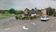
The Robin Hood seen from Ford Green Road / Google Earth Street View.

The Robin Hood seen from Spragg House Lane / Google Earth Street View.

