Robin Hood (Gorton, Manchester): Difference between revisions
From International Robin Hood Bibliography
m (Text replacement - "AdmDiv" to "AdministrativeDivision") |
m (Text replacement - "PnItemTop" to "PlaceNamesItemTop") |
||
| Line 1: | Line 1: | ||
__NOTOC__{{ | __NOTOC__{{PlaceNamesItemTop|Lat=53.468813|Lon=-2.191847|AdministrativeDivision=Lancashire|Vicinity=76 Gorton Lane; corner of Gorton Lane and Brougham Street|Type=Public house|Interest=Robin Hood name| | ||
Status=Defunct|Demonym=|Riding=|GreaterLondon=|Year=1876|Aka=|Century=|Cluster1=Manchester|Cluster2=|Cluster3=|Image=robin-hood-gorton-manchester-google-earth-street-view.jpg|Postcards=|ExtraCat1=|ExtraCat2=|ExtraCat3=|ExtraCat4=|ExtraCat5=|ExtraLink1=|ExtraLink2=|ExtraLink3=|ExtraLink4=|ExtraLink5=|ExtraLinkName1=|ExtraLinkName2=|ExtraLinkName3=|ExtraLinkName4=|ExtraLinkName5=|GeopointPrefix=|GeopointSuffix=|VicinitySuffix=|StatusSuffix=|DatePrefix=|DateSuffix=}} | Status=Defunct|Demonym=|Riding=|GreaterLondon=|Year=1876|Aka=|Century=|Cluster1=Manchester|Cluster2=|Cluster3=|Image=robin-hood-gorton-manchester-google-earth-street-view.jpg|Postcards=|ExtraCat1=|ExtraCat2=|ExtraCat3=|ExtraCat4=|ExtraCat5=|ExtraLink1=|ExtraLink2=|ExtraLink3=|ExtraLink4=|ExtraLink5=|ExtraLinkName1=|ExtraLinkName2=|ExtraLinkName3=|ExtraLinkName4=|ExtraLinkName5=|GeopointPrefix=|GeopointSuffix=|VicinitySuffix=|StatusSuffix=|DatePrefix=|DateSuffix=}} | ||
{{#display_map:{{#var:Coords}}~{{#replace:{{PAGENAME}}|'|'}}|width=34%|enablefullscreen=yes}}<div class="pnMapLegend">Approximate site of the Robin Hood.</div> | {{#display_map:{{#var:Coords}}~{{#replace:{{PAGENAME}}|'|'}}|width=34%|enablefullscreen=yes}}<div class="pnMapLegend">Approximate site of the Robin Hood.</div> | ||
Revision as of 23:57, 5 January 2021
| Locality | |
|---|---|
| Coordinate | 53.468813, -2.191847 |
| Adm. div. | Lancashire |
| Vicinity | 76 Gorton Lane; corner of Gorton Lane and Brougham Street |
| Type | Public house |
| Interest | Robin Hood name |
| Status | Defunct |
| First Record | 1876 |
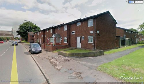
Approximate site of the Robin Hood.
By Henrik Thiil Nielsen, 2019-03-04. Revised by Henrik Thiil Nielsen, 2021-01-05.
A pub named the Robin Hood on 76 Gorton Lane, at or very near the junction of that road and Brougham Street, in Gorton, South Manchester, is recorded in a trade directory of 1876 and the 1881 census.
The Pub History site provides just those two references for the pub.[1] It may be added that it figures in the 1891 census simply as "Beer House".[2]Template:PnItemQry
Gazetteers
- Not included in Dobson, R. B., ed.; Taylor, J., ed. Rymes of Robyn Hood: an Introduction to the English Outlaw (London, 1976), pp. 293-311.
MS sources
- The Genealogist: Lancashire 1881, Piece 03902, Image 00216 (subscription required)
- The Genealogist: Lancashire 1891, Piece 03173, Image 00100 (subscription required).
Printed and web sources
Maps
- 25" O.S. map Lancashire CIV.12 (c. 1893; surveyed c. 1889-91). No Copy in NLS
- 25" O.S. map Lancashire CIV.12 (c. 1908; rev. c. 1904). No Copy in NLS
- 25" O.S. map Lancashire CIV.12 (1922; rev. 1915-16) (georeferenced)
- 25" O.S. map Lancashire CIV.12 (1922; rev. 1915-16)
- 25" O.S. map Lancashire CIV.12 (1935; rev. 1933)
- 6" O.S. map Lancashire CIV (1848; surveyed 1845)
- 6" O.S. map Lancashire CIV.SE (1894; surveyed 1888-90)
- 6" O.S. map Lancashire CIV.SE (1909; rev. 1905) (georeferenced)
- 6" O.S. map Lancashire CIV.SE (1909; rev. 1905)
- 6" O.S. map Lancashire CIV.SE (1923; rev. 1915-16)
- 6" O.S. map Lancashire CIV (1923; rev. 1915-21)
- 6" O.S. map Lancashire CIV.SE (1938; rev. 1932-33)
- 6" O.S. map Lancashire CIV.SE (1946; rev. 1938).

