
Robin Hood (Enfield)
[[File:|thumb|right|500px|The Robin Hood public house, Enfield; on The Ridgeway (A1005) / J. M. Thomas, 3 Sep. 2016, Creative Commons via Geograph.]]
By Henrik Thiil Nielsen, 2013-08-07. Revised by Henrik Thiil Nielsen, 2019-03-17.
Maps
- 6" O.S. map Middlesex II (1868; surveyed 1866)
- 6" O.S. map Middlesex II.SW (1897; rev. 1895) (georeferenced)
- 6" O.S. map Middlesex II.SW (1897; rev. 1895)
- 6" O.S. map Hertfordshire XLI.SW (1920; rev. 1912)
- 6" O.S. map Hertfordshire XLI.SW (c. 1946; rev. 1938)
- 25" O.S. map Middlesex II.13 (1866; surveyed 1866)
- 25" O.S. map Middlesex II.13 (1896; rev. 1895) (georeferenced)
- 25" O.S. map Middlesex II.13 (1896; rev. 1895)
- 25" O.S. map Middlesex II.13 (1913; rev. 1911)
- 25" O.S. map Middlesex II.13 (1937; rev. 1935).
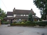
The Robin Hood public house, Enfield; on The Ridgeway (A1005) / J. M. Thomas, 3 Sep. 2016, Creative Commons via Geograph.
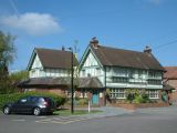
The Robin Hood, The Ridgeway, Enfield / Christine Matthews, 25 Mar. 2008, Creative Commons via Geograph.
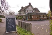
The Robin Hood, Botany Bay / Stephen Dawson, 14 May 2005, Creative Commons via Geograph.
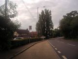
Bus stop by the Robin Hood pub, The Ridgeway / Davi Howard, 19 July 2012, Creative Commons via Geograph.
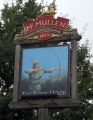
Sign for the Robin Hood public house, Enfield / J. M. Thomas, 3 Sep. 2016, Creative Commons via Geograph.

The Robin Hood / Google Earth Street View.


