Robin Hood (Doncaster): Difference between revisions
From International Robin Hood Bibliography
mNo edit summary |
m (Text replacement - "UK Pub History" to "Pub History") |
||
| (19 intermediate revisions by 2 users not shown) | |||
| Line 1: | Line 1: | ||
__NOTOC__{{ | __NOTOC__{{PlaceNamesItemTop|Lat=53.526811|Lon=-1.141794|AdministrativeDivision=Yorkshire|Vicinity=W of North Bridge Road|Type=Public house|Interest=Robin Hood name|Status=Defunct|Demonym=English|Riding=West|GreaterLondon=|Year=1837|Aka=|Century=|Cluster1=Doncaster|Cluster2=|Cluster3=|Image=robin-hood-doncaster-google-earth-street-view.jpg|Postcards=|ExtraCat1=|ExtraCat2=|ExtraCat3=|ExtraCat4=|ExtraCat5=|ExtraLink1=|ExtraLink2=|ExtraLink3=|ExtraLink4=|ExtraLink5=|ExtraLinkName1=|ExtraLinkName2=|ExtraLinkName3=|ExtraLinkName4=|ExtraLinkName5=|GeopointPrefix=|GeopointSuffix=|StatusSuffix=|DatePrefix=|DateSuffix=}} | ||
{{#display_map:{{#var:Coords}}~{{#replace:{{PAGENAME}}|'|'}}|width=34%}}<div class="pnMapLegend">Marsh Gate.</div> | {{#display_map:{{#var:Coords}}~{{#replace:{{PAGENAME}}|'|'}}|width=34%|enablefullscreen=yes}}<div class="pnMapLegend">Marsh Gate.</div> | ||
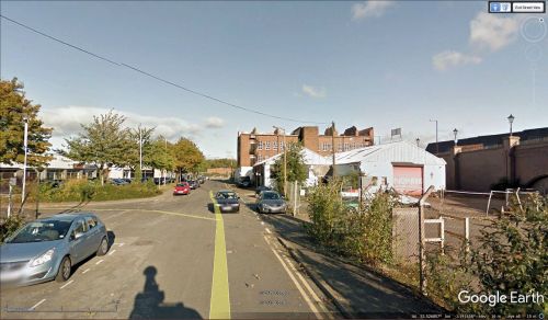
[[File:{{#var: | [[File:{{#var:Image}}|thumb|right|500px|Marsh Gate / Google Earth Street View.]]<div class="no-img"> | ||
<p id="byline">By Henrik Thiil Nielsen, 2018-10-25. Revised by {{#realname:{{REVISIONUSER}}}}, {{REVISIONYEAR}}-{{REVISIONMONTH}}-{{REVISIONDAY2}}.</p | <p id="byline">By Henrik Thiil Nielsen, 2018-10-25. Revised by {{#realname:{{REVISIONUSER}}}}, {{REVISIONYEAR}}-{{REVISIONMONTH}}-{{REVISIONDAY2}}.</p> | ||
Doncaster's long gone Robin Hood pub was located at 34 Marsh Gate. Information on publicans etc. for the years 1837 to 1911 can be found at | Doncaster's long gone Robin Hood pub was located at 34 Marsh Gate. Information on publicans etc. for the years 1837 to 1911 can be found at Pub History.<ref>[https://pubhistory.co.uk//Yorkshire/Doncaster/RobinHood.shtml Pub History: Robin Hood, 34 Marsh gate, Doncaster.]</ref> | ||
During the years in question there seem to have been five or six public houses in Marsh Gate. They are generally included on the O.S. maps listed below as "Inn" or "P.H." The one map that includes the names of a couple of them does not do so for the Robin Hood.<ref>[https://pubhistory.co.uk//Yorkshire/Doncaster/index.shtml | During the years in question there seem to have been five or six public houses in Marsh Gate. They are generally included on the O.S. maps listed below as "Inn" or "P.H." The one map that includes the names of a couple of them does not do so for the Robin Hood.<ref>[https://pubhistory.co.uk//Yorkshire/Doncaster/index.shtml Pub History: Public Houses, Inns & Taverns of Doncaster, Yorkshire] lists five, incl. Robin Hood, but omitting the Falcon, which is included in [https://maps.nls.uk/view/102345154#zoom=6&lat=1043&lon=961&layers=BT 6" O.S. map ''Yorkshire'' 277 (1854; surveyed 1849-50).]</ref> It is quite likely that one could establish the exact location of the Robin Hood by comparing data from censuses to the map evidence. Pending this, the coordinate used on this page is that of a point near the centre of Marsh Gate.{{PlaceNamesItemAllusionsAndRecords}} | ||
== Gazetteers == | == Gazetteers == | ||
* Not included in {{:Dobson, Richard Barrie 1976a}}, pp. | * Not included in {{:Dobson, Richard Barrie 1976a}}, pp. 293-11. | ||
== Sources == | == Sources == | ||
* [https://pubhistory.co.uk//Yorkshire/Doncaster/RobinHood.shtml | * [https://pubhistory.co.uk//Yorkshire/Doncaster/RobinHood.shtml Pub History: Robin Hood, 34 Marsh gate, Doncaster.] | ||
== Maps == | == Maps == | ||
| Line 28: | Line 28: | ||
<!--== Discussion ==--> | <!--== Discussion ==--> | ||
== Background == | == Background == | ||
* [https://pubhistory.co.uk//Yorkshire/Doncaster/index.shtml | * [https://pubhistory.co.uk//Yorkshire/Doncaster/index.shtml Pub History: Public Houses, Inns & Taverns of Doncaster, Yorkshire.] | ||
<!--== Brief mention ==--> | <!--== Brief mention ==--> | ||
{{ | {{PlaceNamesItemAlsoSee}} | ||
== Notes == | == Notes == | ||
<references/> | <references/> | ||
</div> | |||
<!--<div id="gallery"> | |||
{{ | {{ImageGalleryIntroduction}} | ||
<gallery widths="195px"> | <gallery widths="195px"> | ||
FOR EACH IMAGE: File:_FILENAME.jpg|_LEGEND / [_URL _PHOTOGRAPHER, _DAY _MON. _YEAR, Creative Commons.] | FOR EACH IMAGE: File:_FILENAME.jpg|_LEGEND / [_URL _PHOTOGRAPHER, _DAY _MON. _YEAR, Creative Commons.] | ||
</gallery>--> | </gallery> | ||
</div>--> | |||
{{PlaceNamesItemNavigation}} | |||
{{ | |||
Latest revision as of 15:29, 5 May 2022
| Locality | |
|---|---|
| Coordinate | 53.526811, -1.141794 |
| Adm. div. | West Riding of Yorkshire |
| Vicinity | W of North Bridge Road |
| Type | Public house |
| Interest | Robin Hood name |
| Status | Defunct |
| First Record | 1837 |
Marsh Gate.
By Henrik Thiil Nielsen, 2018-10-25. Revised by Henrik Thiil Nielsen, 2022-05-05.
Doncaster's long gone Robin Hood pub was located at 34 Marsh Gate. Information on publicans etc. for the years 1837 to 1911 can be found at Pub History.[1]
During the years in question there seem to have been five or six public houses in Marsh Gate. They are generally included on the O.S. maps listed below as "Inn" or "P.H." The one map that includes the names of a couple of them does not do so for the Robin Hood.[2] It is quite likely that one could establish the exact location of the Robin Hood by comparing data from censuses to the map evidence. Pending this, the coordinate used on this page is that of a point near the centre of Marsh Gate.
Gazetteers
- Not included in Dobson, R. B., ed.; Taylor, J., ed. Rymes of Robyn Hood: an Introduction to the English Outlaw (London, 1976), pp. 293-11.
Sources
Maps
- 25" O.S. map Yorkshire CCLXXVII.13 (1894; surveyed 1888-90)
- 25" O.S. map Yorkshire CCLXXVII.13 (1906; rev. 1901-1904) (georeferenced)
- 25" O.S. map Yorkshire CCLXXVII.13 (1906; rev. 1901-1904)
- 25" O.S. map Yorkshire CCLXXVII.13 (1930; rev. 1929)
- 25" O.S. map Yorkshire CCLXXVII.13 (1940; rev. 1937-38)
- 6" O.S. map Yorkshire 277 (1854; surveyed 1849-50)
- 6" O.S. map Yorkshire CCLXXVII.SW (1893; surveyed 1888-90)
- 6" O.S. map Yorkshire CCLXXVII.SW (1907; rev. 1901-1904) (georeferenced)
- 6" O.S. map Yorkshire CCLXXVII.SW (1907; rev. 1901-1904)
- 6" O.S. map Yorkshire CCLXXVII.SW (1931; rev. 1929)
- 6" O.S. map Yorkshire CCLXXVII.SW (1947; rev. 1938)
- 6" O.S. map Yorkshire CCLXXVII.SW (1950; rev. 1948).
Background
Also see
Notes
- ↑ Pub History: Robin Hood, 34 Marsh gate, Doncaster.
- ↑ Pub History: Public Houses, Inns & Taverns of Doncaster, Yorkshire lists five, incl. Robin Hood, but omitting the Falcon, which is included in 6" O.S. map Yorkshire 277 (1854; surveyed 1849-50).

