Robin Hood (Denmead): Difference between revisions
From International Robin Hood Bibliography
m (Text replacement - "No Copy in NLS" to "No copy in NLS") |
m (Text replacement - "map ''Hampshire and Isle of Wight'' " to "map ''Hampshire & Isle of Wight'' ") |
||
| Line 15: | Line 15: | ||
== Maps == | == Maps == | ||
* 26" O.S. map ''Hampshire | * 26" O.S. map ''Hampshire & Isle of Wight'' LXVII.16 (''c.'' 1868; surveyed 1866–68). No copy in NLS | ||
* [https://maps.nls.uk/geo/explore/#zoom=16&lat=50.88818&lon=-1.06456&layers=168&b=5 25" O.S. map ''Hampshire | * [https://maps.nls.uk/geo/explore/#zoom=16&lat=50.88818&lon=-1.06456&layers=168&b=5 25" O.S. map ''Hampshire & Isle of Wight'' LXVII.16 (1897; rev. 1895)] (georeferenced) | ||
* [https://maps.nls.uk/view/105987613#zoom=4&lat=4018&lon=14533&layers=BT 25" O.S. map ''Hampshire | * [https://maps.nls.uk/view/105987613#zoom=4&lat=4018&lon=14533&layers=BT 25" O.S. map ''Hampshire & Isle of Wight'' LXVII.16 (1897; rev. 1895)] | ||
* [https://maps.nls.uk/view/105987610#zoom=4&lat=4627&lon=14789&layers=BT 25" O.S. map ''Hampshire | * [https://maps.nls.uk/view/105987610#zoom=4&lat=4627&lon=14789&layers=BT 25" O.S. map ''Hampshire & Isle of Wight'' LXVII.16 (1908; rev. 1907)] | ||
* [https://maps.nls.uk/view/105987607#zoom=4&lat=5026&lon=15110&layers=BT 25" O.S. map ''Hampshire | * [https://maps.nls.uk/view/105987607#zoom=4&lat=5026&lon=15110&layers=BT 25" O.S. map ''Hampshire & Isle of Wight'' LXVII.16 (1946; rev. 1941)] | ||
* [https://maps.nls.uk/view/102343128#zoom=4&lat=1624&lon=14304&layers=BT 6" O.S. map ''Hampshire & Isle of Wight'' LXVII (1870; surveyed 1868)] | * [https://maps.nls.uk/view/102343128#zoom=4&lat=1624&lon=14304&layers=BT 6" O.S. map ''Hampshire & Isle of Wight'' LXVII (1870; surveyed 1868)] | ||
* [https://maps.nls.uk/geo/explore/#zoom=16&lat=50.88634&lon=-1.06484&layers=6&b=5 6" O.S. map ''Hampshire & Isle of Wight'' LXVII.SE (1897; rev. 1895)] (georeferenced) | * [https://maps.nls.uk/geo/explore/#zoom=16&lat=50.88634&lon=-1.06484&layers=6&b=5 6" O.S. map ''Hampshire & Isle of Wight'' LXVII.SE (1897; rev. 1895)] (georeferenced) | ||
Latest revision as of 17:44, 2 May 2022
| Locality | |
|---|---|
| Coordinate | 50.886385, -1.062334 |
| Adm. div. | Hampshire |
| Vicinity | Denmead; somewhere near Closewood Farm, Piper's Hill Farm, Sheep Wash Farm, and Mead End |
| Type | Public house |
| Interest | Robin Hood name |
| Status | Defunct |
| First Record | 1891 |
| A.k.a. | Robinhood |
Denmead.
By Henrik Thiil Nielsen, 2020-05-29. Revised by Henrik Thiil Nielsen, 2022-05-02.
A pub named the Robin Hood existed in Denmead, Hampshire, in 1891.
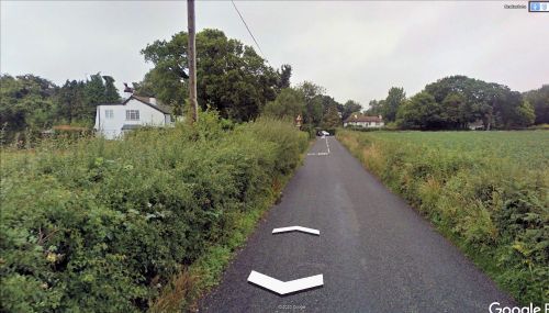
The pub's name is recorded in the 1891 census of Hapshire as 'The Robinhood'.[1] The census-taker visited the place during the part of his route that brought him to Closewood Farm, Piper's Hill Farm, Sheep Wash Farm, and Mead End. Based on this, it seems a reasonable guess that the pub was situated somewhere in the southeast or at least east part of Denmead. The coordinate entered in the infobox and indicated on the interactive map simply points to a random location in this area.
Gazetteers
- Not included in Dobson, R. B., ed.; Taylor, J., ed. Rymes of Robyn Hood: an Introduction to the English Outlaw (London, 1976), pp. 293-311.
Sources
- 1891 census of Hampshire, Piece 00943, 00065, at the Genealogist (£)
- Pub Wiki: Robinhood, Denmead, Hampshire.
Maps
- 26" O.S. map Hampshire & Isle of Wight LXVII.16 (c. 1868; surveyed 1866–68). No copy in NLS
- 25" O.S. map Hampshire & Isle of Wight LXVII.16 (1897; rev. 1895) (georeferenced)
- 25" O.S. map Hampshire & Isle of Wight LXVII.16 (1897; rev. 1895)
- 25" O.S. map Hampshire & Isle of Wight LXVII.16 (1908; rev. 1907)
- 25" O.S. map Hampshire & Isle of Wight LXVII.16 (1946; rev. 1941)
- 6" O.S. map Hampshire & Isle of Wight LXVII (1870; surveyed 1868)
- 6" O.S. map Hampshire & Isle of Wight LXVII.SE (1897; rev. 1895) (georeferenced)
- 6" O.S. map Hampshire & Isle of Wight LXVII.SE (1909; rev. 1907).
Also see
Notes

