
Robin Hood (Borrowdale)
| Locality | |
|---|---|
| Coordinates | 54.4474, -2.2786 |
| Adm. div. | Westmorland |
| Vicinity | c. 4.6 km E of Sadgill and c. 800 m E of Borrowdale |
| Type | Natural feature |
| Interest | Robin Hood name |
| Status | Extant |
| First Record | 1859 |
| A.k.a. | Robin Hood Wood; |

By Henrik Thiil Nielsen, 2017-08-28. Revised by Henrik Thiil Nielsen, 2017-08-28.
'Robin Hood' is the name of a moorland top on the ridge between the upper reaches of Crookdale and Borrowdale. The earliest known record is an 1859 MS Ordnance Survey name book in which the locality is listed as 'Robin Hood Wood'.[1]
A.H. Smith's Place-Names of Westmorland, refers to an 1865 O.S. map[2], but the place-name is in fact indicated on a slightly earlier (1863) 6" O.S. map of the area (see Maps section below).
Gazetteers
- Dobson, R. B., ed.; Taylor, J., ed. Rymes of Robyn Hood: an Introduction to the English Outlaw (London, 1976), p. 305, s.n. Robin Hood.
Sources
- Smith, A.H. The Place-Names of Westmorland (English Place-Name Society, vols. XLII, XLIII) (Cambridge, 1967), pt. II, p. 176; pt. I, p. lxvi for expansion of abbreviated source references.
Maps
- 6" O.S. map Westmorland XXVII (1863; surveyed 1858)
- 6" O.S. map Westmorland XXVII.NE (1899; rev. 1897)
- 6" O.S. map Westmorland XXVII.NE (1899; rev. 1897) (georeferenced)
- 6" O.S. map Westmorland XXVII.NE (1920; rev. 1911-12)
- 6" O.S. map Westmorland XXVII.NE (c. 1939; rev. 1911-12)
- 6" O.S. map Westmorland XXVII.NE (c. 1946; rev. 1911-12).
Background
Brief mention
Notes
- ↑ Smith, A.H. The Place-Names of Westmorland (English Place-Name Society, vols. XLII, XLIII) (Cambridge, 1967), pt. II, p. 176. Dobson & Taylor (see Gazetteers section), whose entry on this place-name is based on the information in Smith, mistakenly refer to an 1859 O.S. map. Smith's source reference is 'OS', not 'OS'. Somewhat unusually, the county volumes of the English Place-Name Society use italics for inline source references to MSS, but ordinary type for those to printed ones, and the italicized reference in Smith is to an MS O.S. name book, cf. Smith, pt. I, p. lxvi.
- ↑ Smith, A.H. The Place-Names of Westmorland (English Place-Name Society, vols. XLII, XLIII) (Cambridge, 1967), pt. II, p. 176.
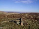
Cairn on the west top of Robin Hood / Michael Graham, 10 Feb. 2008, Geograph, Creative Commons.
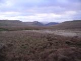
Robin Hood and High House Bank on the left. looking down Borrowdale from Borrowdale Moss / Michael Graham, 4 Jan. 2007, Geograph, Creative Commons.
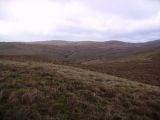
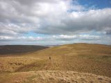
Ascending Robin Hood, looking towards Sleddale Fell / Michael Graham, 4 Jan. 2007, Geograph, Creative Commons.
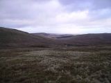
Crookdale seen from the slopes of Robin Hood / Michael Graham, 4 Jan. 2007, Geograph, Creative Commons.
Heading for Robin Hood / Karl and Ali, 19 Apr. 2014, Geograph, Creative Commons.


"th" can not be assigned to a declared number type with value 19.