
Robin Hood's Well (Higham)
From International Robin Hood Bibliography
Robin Hood's Well (Higham).
[[File:|thumb|right|500px|Ford over the River Calder / Chris Heaton, 20 Jul. 2014, Creative Commons, via Geograph.]]
By Henrik Thiil Nielsen, 2019-02-23. Revised by Henrik Thiil Nielsen, 2019-02-23.
_TEXT_ Template:PnItemQry
Gazetteers
- Not included in Dobson, R. B., ed.; Taylor, J., ed. Rymes of Robyn Hood: an Introduction to the English Outlaw (London, 1976), pp. 293-311.
Maps
- 6" O.S. map Lancashire LVI (1848; surveyed 1844)
- 6" O.S. map Lancashire LVI.SW (1895; surveyed 1890-91)
- 6" O.S. map Lancashire LVI.SW (1914; rev. 1909-10) (georeferenced)]
- 6" O.S. map Lancashire LVI.SW (1914; rev. 1909-10)
- 6" O.S. map Lancashire LVI.SW (1933; rev. 1929)
- 6" O.S. map Lancashire LVI.SW (1947; rev. 1938)
- 25" O.S. map Lancashire LVI.13 (1893; surveyed 1890-91)
- 25" O.S. map Lancashire LVI.13 (1912; rev. 1910) (georeferenced)
- 25" O.S. map Lancashire LVI.13 (1912; rev. 1910)
- 25" O.S. map Lancashire LVI.13 (1932; rev. 1930).
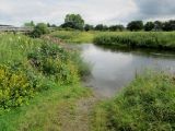
Ford over the River Calder, near the Higham/Ightenhill Bridge and the site of Robin Hood's Well / Chris Heaton, 20 Jul. 2014, Creative Commons, via Geograph.
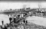
Stepping stones on River Calder, near the site of Robin Hood's Well / Google Maps

