
Robin Hood's Well (Colwell): Difference between revisions
mNo edit summary |
mNo edit summary |
||
| Line 35: | Line 35: | ||
{{ImageGalleryIntroduction}} | {{ImageGalleryIntroduction}} | ||
<gallery widths="195px"> | <gallery widths="195px"> | ||
3rdSeptember2014RobinHoodsWellFirstViewFromFoo.jpg|Robin Hood's Well, holy well in Northumberland / [https://www.megalithic.co.uk/article.php?sid=27520 Courtesy Anne T.; taken on or shortly before 4 Sep. 2014. Used with the kind permission of Andy Burnham, founder of [https://www.megalithic.co.uk The Megalithic Portal.] | 3rdSeptember2014RobinHoodsWellFirstViewFromFoo.jpg|Robin Hood's Well, holy well in Northumberland / [https://www.megalithic.co.uk/article.php?sid=27520 Courtesy Anne T.; taken on or shortly before 4 Sep. 2014. Used with the kind permission of Andy Burnham, founder of [https://www.megalithic.co.uk The Megalithic Portal.] | ||
3rdSeptember2014RobinHoodsWellFromRoad.jpg|Robin Hood's Well seen from the B6342. The marker post can be seen behind the pallett, near the centre of the photo / [https://www.megalithic.co.uk/article.php?sid=27520 Courtesy Anne T.; taken on or shortly before 4 Sep. 2014. Used with the kind permission of Andy Burnham, founder of [https://www.megalithic.co.uk The Megalithic Portal.] | 3rdSeptember2014RobinHoodsWellFromRoad.jpg|Robin Hood's Well seen from the B6342. The marker post can be seen behind the pallett, near the centre of the photo / [https://www.megalithic.co.uk/article.php?sid=27520 Courtesy Anne T.; taken on or shortly before 4 Sep. 2014. Used with the kind permission of Andy Burnham, founder of [https://www.megalithic.co.uk The Megalithic Portal.] | ||
robin-hoods-well-colwell-google-earth.jpg|Robin Hood's Well is in the area with the tall grass / Google Earth Street View. | |||
</gallery> | </gallery> | ||
{{PlaceNamesItemNavigation}} | {{PlaceNamesItemNavigation}} | ||
Revision as of 16:20, 8 May 2022
| Locality | |
|---|---|
| Coordinate | 55.068905, -2.073724 |
| Adm. div. | Northumberland |
| Vicinity | 550 m SSE of Colwell, Chollerton, on the east side of B6342 |
| Type | Natural feature |
| Interest | Robin Hood name |
| Status | Extant |
| First Record | 1866 |

By Henrik Thiil Nielsen, 2017-05-08. Revised by Henrik Thiil Nielsen, 2022-05-08. Photos and information courtesy Anne T., used with the kind permission of Andy Burnham, founder of The Megalithic Portal.
Situated some 550 metres south-southeast of Colwell (Chollerton), on the east side of the B6342, Robin Hood's Well is a medieval holy well whose Robin Hood-related name is first recorded in 1866.
The usually informative Heritage Gateway describes it as a 'piped spring' which is '[e]nclosed by a post and wire fence', implies that it was considered a holy well in the Middle Ages but can offer little other information on this well.[1] It is included on a list of sites in the vicinity of Swinburn Castle[2] and briefly mentioned on a web page with historical information for tourists.[3] The Megalithic Portal has a page on the well, which includes Anne T.'s excellent photos, which we are glad to be able to include here. Yet so far we have found no 19th century literary allusions or descriptions of this well. The earliest record of the name 'Robin Hood's Well' as applied to this spring is a 6" O.S. map of the area published in 1866, based on a survey carried out in 1862. The well is indicated and labelled on subsequent versions of the map until at least 1952 (see Maps below).
Gazetteers
- Not included in Dobson, R. B., ed.; Taylor, J., ed. Rymes of Robyn Hood: an Introduction to the English Outlaw (London, 1976), pp. 293-311.
Sources
- Heritage Gateway: Historic England Research Records: Monument Number 19055
- The Megalithic Portal: Robin Hood's Well (Chollerton).
Maps
- 6" O.S. map Northumberland LXXVII (1866; surveyed 1862)
- 6" O.S. map Northumberland LXXVII.SE (1897; rev. 1895)
- 6" O.S. map Northumberland LXXVII.SE (1897; rev. 1895) (georeferenced)
- 6" O.S. map Northumberland nLXXXII (1925; rev. 1920)
- 6" O.S. map Northumberland nLXXXII (1952; rev. 1946).
Brief mention
Also see
Notes
Image gallery
Click any image to display it in the lightbox, where you can navigate between images by clicking in the right or left side of the current image.
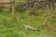
Robin Hood's Well, holy well in Northumberland / Courtesy Anne T.; taken on or shortly before 4 Sep. 2014. Used with the kind permission of Andy Burnham, founder of [https://www.megalithic.co.uk The Megalithic Portal.

Robin Hood's Well seen from the B6342. The marker post can be seen behind the pallett, near the centre of the photo / Courtesy Anne T.; taken on or shortly before 4 Sep. 2014. Used with the kind permission of Andy Burnham, founder of [https://www.megalithic.co.uk The Megalithic Portal.
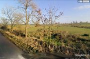
Robin Hood's Well is in the area with the tall grass / Google Earth Street View.

