
Public houses named the Green Man: Difference between revisions
m (→Allusions) |
m (Text replacement - "=== Also see ===" to "== Also see ==") |
||
| Line 304: | Line 304: | ||
* {{:Willsher, Betty 1992a}} | * {{:Willsher, Betty 1992a}} | ||
* [http://people.bath.ac.uk/liskmj/greenman/index.htm Wiltshire Green Men]; has very useful bibliography page. | * [http://people.bath.ac.uk/liskmj/greenman/index.htm Wiltshire Green Men]; has very useful bibliography page. | ||
== Also see == | |||
* [[Public houses named after Robin Hood]] | * [[Public houses named after Robin Hood]] | ||
== Notes == | == Notes == | ||
Revision as of 14:22, 18 October 2018
Template:PnNavMapEnglishPlaceNames
By Henrik Thiil Nielsen, 2015-07-17. Revised by Henrik Thiil Nielsen, 2018-10-18.
The pubs are added to the map as time permits. So far only Bedfordshire, Berkshire and Buckinghamshire have been added. A list of sources discussing "Green Man" pub names and the possibly related "green man" depictions follows the list of pub names.
Gazetteer
Map views linked to below are centred on the pub in question (or at least include it if it is too near an edge of the map to allow centring on it). Unless otherwise stated, the green men are indicated as "(P.H.)" (public house) on the maps. Where the pub is named "Green Man" eo nomine, I do not cite this. Where the map indicates the pub as "B.H.", i.e. a beer house, this is noted.
Bedfordshire
- 6" O.S. map Bedfordshire XXII.NE (includes: Chicksands; Shefford; Southill.) (1884; surveyed 1881-82). Stanford. Coordinate: 52.0565,-0.3105
- 6" O.S. map Bedfordshire XXII.SE (includes: Campton; Chicksands; Clifton; Meppershall; Shefford.) (1885; surveyed 1881-82). Coordinate: 52.0397,-0.3343
- 6" O.S. map Bedfordshire XXVII.SW (includes: Arlesey; Hitchin Urban; Holwell; Ickleford; Letchworth; Stotfold.) (1887; surveyed 1880-81). Coordinate: 51.9699,-0.2807
- Greenman Farm – 6" O.S. map Bedfordshire XXIX.SW (includes: Chalgrave; Houghton Regis; Tilsworth.) (1886; surveyed 1879-80). Coordinate: 51.9019,-0.5454.
Berkshire
- 6" O.S. map Berkshire XXXVIII (includes: Hurst St Nicholas; Winnersh; Wokingham Within; Wokingham Without.) (1883; surveyed 1871-72). Whistley Green. Coordinate: 51.4597,-0.8495.
- 6" O.S. map Berkshire XXXIX (includes: Warfield; Winkfield.) (1881; surveyed 1869-71). Old Bracknell. Coordinate; 51.4067,-0.7589
- 6" O.S. map Berkshire XL (includes: Egham.) (1881; surveyed 1868-69); 6" O.S. map Buckinghamshire LVIII.NE (includes: Egham; Staines; Wyrardisbury) (1900; rev. 1897-98). Wyrardisbury. 51.4588,-0.5490.
Buckinghamshire
- 6" O.S. map Buckinghamshire XV (includes: Bletchley; Bow Brickhill; Walton) (1885; surveyed 1880). Little Brickhill. Coordinate: 51.9835,-0.6782.
- 6" O.S. map Buckinghamshire XIX (includes: Great Horwood; Little Horwood; Mursley; Swanbourne; inslow) (1885; surveyed 1878-80). Mursley. Coordinate: 51.9510,-0.8127.
- 6" O.S. map Buckinghamshire XLIX (includes: Rickmansworth Urban; Ruislip; Uxbridge) (1876-83; surveyed 1872-74). Batchworth Heath. Coordinate: 51.6212,-0.4456.
Cambridgeshire
- 6" O.S. map Cambridgeshire XXXIV.SE (includes: Cottenham; Landbeach; Waterbeach) (c. 1887; surveyed 1887)
- B.H. – 6" O.S. map Cambridgeshire XLV.SW (includes: Gamlingay; Little Gransden; Tetworth; Waresley) (1887; surveyed 1886)
- Green Man Farm – 6" O.S. map Cambridgeshire XLV.SW (includes: Gamlingay; Little Gransden; Tetworth; Waresley) (1887; surveyed 1886)
- Green Man Inn – 6" O.S. map Cambridgeshire XLVII.SW (includes: Cambridge; Grantchester; Great Shelford; Harston; Haslingfield; Hauxton) (1886; surveyed 1885)
- Green Man Inn – 6" O.S. map Cambridgeshire XLVIII.NE (includes: Bottisham; Brinkley; Burrough Green; Carlton; Dullingham; Little Wilbraham; Swaffham Bulbeck; Westley Waterless) (1886; surveyed 1885)
- Green Man Inn – 6" O.S. map Cambridgeshire L.SW (includes: Cowlinge; Lidgate; Stradishall; Wickhambrook) (1903; rev. 1901)
- 6" O.S. map Cambridgeshire LVII.NE (includes: Abington Pigotts; Guilden Morden; Litlington; Steeple Morden) (1886; surveyed 1886)
- 6" O.S. map Cambridgeshire LVII.NE (includes: Abington Pigotts; Guilden Morden; Litlington; Steeple Morden) (1886; surveyed 1877-85).
Derbyshire
- 6" O.S. map Derbyshire XXIV.NW (includes: Baslow and Bubnell; Chatsworth; Edensor) (1883; surveyed 1876-78)
- Anonymous, compil. The Wordsworth Dictionary of Pub Names (Wordsworth Reference Series) (Ware, Hertfordshire, ©2006), s.n. 'Green Man and Black's Head Royal': In Ashbourne.
Dorset
Essex
- Arkesden. UK Pub History
- Belchamp Otten, Clare. UK Pub History
- Bradwell-on-Sea, Maldon. UK Pub History
- Braintree. New Stree. UK Pub History
- Chingford. 6" O.S. map Essex LXV (includes: Chingford; Walthamstow; Wanstead; Woodford) (1876; surveyed 1863) – UK Pub HistoryChristy, Miller. The Trade Signs of Essex: A Popular Account of the Origins and Meanings of the Public House & Other Signs Now or Formerly Found in the County of Essex (Chelmsford; London, 1887), p. 7.
- Colne Green: Green Man Inn. 6" O.S. map Essex V (includes: Ashen; Belchamp St Paul; Clare; Ovington; Stoke by Clare) 1880; surveyed 1876
- Epping. UK Pub History[2]
- Finchingfield, Braintree. UK Pub History
- Gosfield: Green Man Inn. 6" O.S. map Essex XVI (includes: Gosfield; Sible Hedingham; Wethersfield) (1881; surveyed 1876) – UP Pub History
- Grays Thurrock. Orsett Road/High Street. UP Pub History[3]
- Great Saling. UP Pub History
- Great Waltham, Chelmsford. Howe Street. UK Pub History
- Great Easton, Dunmow. Mill End Green. UK Pub History
- Harlow.[4]
- Heybridge. UK Pub History
- Heydon. UK Pub History
- Highwood. Edney Common. UK Pub History
- Ingrave, Brentwood. UK Pub History
- Kelvedon: Greenman Pond. 6" O.S. map Essex XXXV (includes: Feering; Great Braxted; Kelvedon; Messing Cum Inworth) (181; surveyed 1874-1875)
- Leyton.[5]
- Leytonstone E11. 762 High Road. UK Pub History[6]
- Little Braxted. 6" O.S. map Essex XLV (includes: Great Braxted; Great Totham; Little Braxted; Little Totham; Tolleshunt Major) (1880; surveyed: 1874-75) – UK Pub History
- Magdalen Laver. 6" O.S. map Essex L (includes: Epping; High Ongar; North Weald Bassett; Stanford Rivers; Theydon Garnon) (1881; surveyed 1873-74) – UK Pub History[7]
- Moreton.[8]
- Navestock. Navestock, Side: Green Man Inn. 6" O.S. map Essex LIX (includes: Blackmore; Brentwood; Doddinghurst; Kelvedon Hatch; Stondon Massey) (1881; surveyed 1871-73); situated next to a green labelled "The Green" on the map. UK Pub History
- Plashet Grove, East Ham. UK Pub History
- Roydon Hamlet, Roydon, Harlow. UK Pub History[9]
- Stambourne.[10]
- Stanford Rivers, Romford. UK Pub History[11]
- Stebbing, Chelmsford. UK Pub History
- Stratford E15. 196 High Street: Green Man Distillery. UK Pub History – UK Pub History
- Takeley, Dunmow. UK Pub History
- Thorley Houses. 6" O.S. map Essex XXXI (includes: Great Hallingbury; High Wych; Little Hallingbury; Sawbridgeworth; Thorley) (1880; surveyed 1874) – UK Pub History
- Toot Hill, Stanford Rivers: Green Man Inn. UK Pub History
- Toppesfield, Halstead. UK Pub History
- Waltham Abbey. 6" O.S. map Essex LVII (includes: Enfield St Andrew; Waltham Holy Cross) (1881; surveyed 1870-72) – UK Pub History[12]
- Waterside, Southminster. UK Pub History
- Writtle. 6" O.S. map Essex LII (includes: Chelmsford; Writtle) (1881; surveyed 1874).
Hampshire
- Farnham. East Street – UK Pub History
- Hambledon: 6" O.S. map Hampshire & Isle of Wight LXVII (includes: Boarhunt; Denmead; Hambledon; Soberton) (1870; surveyed 1868).
Hertfordshire
- Beale's Oaken. 6" O.S. map Hertfordshire XXXVII (includes: Great Parndon; Nazeing; Roydon.) (1880-82; surveyed 1870-80)
- Chipping Barnet. High Street. UK Pub History
- Great Offley. UK Pub History
- Great Wymondley. 6" O.S. map Hertfordshire XII (includes: Graveley; Ippollitts; Stevenage; Wymondley.) (1884; surveyed 1878-81) – UK Pub History
- Hanstead, St Alban's. UK Pub History
- Heydon, Royston. UK Pub History
- Ickleford. UK Pub History
- Market Hill, Royston. UK Pub History
- Mulberry Green, Harlow. UK Pub History
- Rickmansworth Rural. 6" O.S. map Hertfordshire XLIII.SE (includes: Rickmansworth Urban; Uxbridge.) (1920; rev. 1912-13)
- Sacombe, Ware. UK Pub History
- Thorley, Bishop Stortford. UK Pub History
- Tring. High Street. UK Pub History
- Upper Hale, Hendon. UK Pub History
- Watford. High Street. UK Pub History
- Whetstone. UK Pub History
- Wormley, Cheshunt. UK Pub History.
Huntingdonshire
- Blackheath. UK Pub History
- Chatham. High Street. UK Pub History
- Gamlingay Cinques: Green Man Farm – 6" O.S. map Huntingdonshire XXVIII.SW (includes: Gamlingay; Little Gransden; Tetworth; Waresley.) (1903; rev. 1900)
- Longfield Hill: Green Man Inn – 6" O.S. map Huntingdonshire XVI.NE (includes: Brington and Molesworth; Catworth; Leighton; Old Weston.) (1887; surveyed 1884-87) – UK Pub History
- Plumstead, Woolwich. UK Pub History
- Southend, Lewisham. UK Pub History
- St Margaret-at-Cliffe, Dover. UK Pub History
- Staple, Wingham. UK Pub History.
Kent
- Green Man & Railway Tavern – 6" O.S. map Kent XVIII (includes: Cobham; Luddesdown; Meopham.) (1869; surveyed 1864-67)
- 6" O.S. map Kent XLVII (includes: Adisham; Aylesham; Goodnestone; Ickham and Well; Littlebourne; Wingham.) (1877; surveyed 1872-73)
- 1 Dartmouth Row, Blackheath, Greenwich SE10 – UK Pub History.
Lincolnshire
- 6" O.S. map Lincolnshire LXIV.NE (includes: Asterby; Cawkwell; Maidenwell; Scamblesby; Tathwell.) (1887; surveyed 1887)
- Green Man Plantation – 6" O.S. map Lincolnshire LXV.NE (includes: Authorpe; Belleau; Burwell; Muckton; Swaby; Walmsgate.) (1888; surveyed 1888)
- Green Man Wood – 6" O.S. map Lincolnshire LXXXVI.NE (includes: Boothby Graffoe; Coleby; Navenby.) (1887; surveyed 1886)
- Green Man Wood – 6" O.S. map Lincolnshire LXXXVII.NW (includes: Blankney; Metheringham; Scopwick; Temple Bruer with Temple High Grange.) (1887; surveyed 1887)
- Green Man Lane – 6" O.S. map Lincolnshire LXXXVII.NW (includes: Blankney; Metheringham; Scopwick; Temple Bruer with Temple High Grange.) (1887; surveyed 1887)
- In Lincoln: Cameron, Kenneth; Field, John; Insley; Cameron. The Place-Names of Lincolnshire (English Place-Name Society, vols. 58, 64/65-66, 71, 73, 77, 85) (Nottingham, 1985-2010), pt. I, p. 167: recorded 1790, 1826, 1828.
London
No doubt some items listed here belong under one of the home counties. Also see 'Kent' above and 'Middlesex', 'Surrey' and 'Sussex' below.
- 6" O.S. map London II.NE (includes: Finchley; Hendon.) (1894-96; rev. 1893-95)
- 6" O.S. map London II.SW (includes: Hendon; Wembley; Willesden.) (1894-96; rev. 1891-94)
- Green Man Pond – 6" O.S. map London IV.SW (includes: Cann Hall; Leyton; Wanstead; West Ham.) (1894-96; rev. 1893-94)
- E1. 24 Jane Street – London Pubology – UK Pub History
- E1. 40 Newcastle Street (now Tyne Street) – London Pubology – UK Pub History[13]
- E2. 287 Cambridge Road, Bethnal Green – UK Pub History: Green Man, 287 Cambridge Road, Bethnal Green E2 – UK Pub History
- E2. 1 Darkhouse Lane, Bethnal Green: Green Man & Bell – UK Pub History
- E4 6RB. 195 Old Church Road: Greene Man – London Pubology
- E6 1DA. 190 Plashet Grove – London Pubology – UK Pub History
- E8. 71 Shacklewell Lane, Hackney – UK Pub History
- E11. 762 High Road, Leytonstone – UK Pub History
- E14. 68 High Street, Poplar – UK Pub History
- EC1R. 5 Coppice Row (Farringdon Road): Green Man and Still – London Pubology – UK Pub History
- EC1M 6DU. 18 Cowcross Street: Green Man and Still – London Pubology – UK Pub History
- EC1Y. 37 Featherstone Street – London Pubology – UK Pub History
- EC1Y 8JL. 161 Whitecross Street: Green Man and Still – London Pubology – UK Pub History
- EC4. 7 & 9 Bucklersbury – UK Pub History
- EC3R. 16 Lower Thames Street: Green Man and Bell – London Pubology – UK Pub History
- HA7 1AP. Honeypot Lane – London Pubology
- N1 5LG. 257 Hoxton Street – London Pubology – UK Pub History
- N1 8LX. 144a Essex Road – London Pubology
- N1. Islington. 36 Green Man Street – UK Pub
- N1. Islington. 2a Prospect Row, Balls Pond – UK Pub History
- N2. 394 High Road – London Pubology
- N20 9HJ. 1308 High Road – London Pubology
- NW1 3AU. 383 Euston Road: Greene Man – London Pubology – UK Pub History
- NW9 8YG. 125 Slough Lane – London Pubology
- SE16. 83 Bermondsey Wall – London Pubology – UK Pub History
- SE18. 67 High Street, Plumstead – UK Pub History
- SW9 8RR. 225 Coldharbour Lane, Camberwell – London Pubology – UK Pub History
- TW14 0PZ. Green Man Lane – London Pubology
- UB9 5BH. Village Road – London Pubology
- UB10 0AD. 7-9 Hillingdon Road – London Pubology
- W1F 8SR. 57-58a Berwick Street – London Pubology – UK Pub History
- W1K. 7 Green Street – London Pubology – UK Pub History
- W1S. 101 New Bond Street – London Pubology – UK Pub History
- W1W 7EP. 36 Riding House Street – London Pubology – UK Pub History
- W2. Marylebone. 308 Edgware Road – UK Pub History
- W13. 64 Broadway, Uxbridge Road – London Pubology
- WC2. 45 Bedford Street – UK Pub History
- WC2. 54 St Martin's Lane: Green Man & French Horn UK Pub History
- WC2. Charing Cross. 1738. Castro, J. Paul de. 'Principal London Coffee-Houses, Taverns, and Inns in the Eighteenth Century', Notes & Queries, Series 12, vol. VI (1920), pp. 84-85, see p. 85; MacMichael, J. Holden. The Story of Charing Cross and Its Immediate Neighbourhood (London, 1906), p. 55
- Bermondsey. Jamaica Level – UK Pub History
- Blackheath. 1732. Castro, J. Paul de. 'Principal London Coffee-Houses, Taverns, and Inns in the Eighteenth Century', Notes & Queries, Series 12, vol. IX (1921), pp. 186-88, see p. 187 s.n. Green Man
- Blackman Street, Southwark. 1732. Castro, J. Paul de. 'Principal London Coffee-Houses, Taverns, and Inns in the Eighteenth Century', Notes & Queries, Series 12, vol. IX (1921), pp. 186-88, see p. 187 s.n. Green Man
- Chelsea. 1 Beaufort Street – UK Pub History
- Coleman Street. Green-man-Yard. Lockie, John, compil. Lockie's Topography of London, Giving a Concise Local Description of, and Accurate Direction to, Every Square, Street, Lane, Court, Dock, Wharf, Inn, Public Office, &c. in the Metropolis and its Environs. Second Edition (London, 1813), s.n. Green-man-Yard: "Green-Man-Yard, Coleman-St.—4 — 3 doors on the L. from London-wall".
- Covent Garden. South Row, Covent Garden Market, St Paul – UK Pub History
- Dulwich. 1745. Castro, J. Paul de. 'Principal London Coffee-Houses, Taverns, and Inns in the Eighteenth Century', Notes & Queries, Series 12, vol. IX (1921), pp. 186-88, see p. 187 s.n. Green Man
- Finchley Common. 1745. Castro, J. Paul de. 'Principal London Coffee-Houses, Taverns, and Inns in the Eighteenth Century', Notes & Queries, Series 12, vol. IX (1921), pp. 186-88, see p. 187 s.n. Green Man
- Goodmans Fields. 44 Mansell Street: Green Man/Hercules – UK Pub History
- Great Portland Street Railway Station, near. Farthing Pie House (1721); Green Man (1745). Castro, J. Paul de. 'Principal London Coffee-Houses, Taverns, and Inns in the Eighteenth Century', Notes & Queries, Series 12, vol. IX (1921), pp. 143-45, see p. 144 s.n. Farthing Pie House.
- Newington. 259 Kent Street – UK Pub History
- Oxford Street. Lockie, John, compil. Lockie's Topography of London, Giving a Concise Local Description of and Accurate Direction to Every Square, Street, Lane, Court, Dock, Wharf, Inn, Public Office, &c. in the Metropolis and its Environs (London, 1810), s.n. Green-Man and Still Waggon-Office: "Green-Man and Still Waggon-Office, Oxford-Street,—at 321, the corner of Swallow-st. Note, the Coach office is nearly opposite." Similarly Lockie, John, compil. Lockie's Topography of London, Giving a Concise Local Description of, and Accurate Direction to, Every Square, Street, Lane, Court, Dock, Wharf, Inn, Public Office, &c. in the Metropolis and its Environs. Second Edition (London, 1813), s.n. Green-Man and Still Waggon-Office.
- Soho W. 96 Dean Street: Green Man & French Horn – UK Pub History
- Southwark. 14 Green Street – UK Pub History
- Southwark. 276 Old Kent Road – UK Pub History
- St Martins in Fields. 19 New Street – UK Pub History
- Stroud Green, Islington. 1732. Castro, J. Paul de. 'Principal London Coffee-Houses, Taverns, and Inns in the Eighteenth Century', Notes & Queries, Series 12, vol. IX (1921), pp. 186-88, see p. 187 s.n. Green Man
- Well Walk, Hampstead. 1754. Demolished c. 1850. Castro, J. Paul de. 'Principal London Coffee-Houses, Taverns, and Inns in the Eighteenth Century', Notes & Queries, Series 12, vol. IX (1921), pp. 186-88, see p. 187 s.n. Green Man[14]
- Wembley Hill, Wembley, Harrow: Green Man Inn – UK Pub History
- Anonymous, compil. The Wordsworth Dictionary of Pub Names (Wordsworth Reference Series) (Ware, Hertfordshire, ©2006), s.n Green Man: this is "[a] common sign, not only in rural areas (London has 30 such signs)".
- Anonymous, compil. The Wordsworth Dictionary of Pub Names (Wordsworth Reference Series) (Ware, Hertfordshire, ©2006), s.n. 'Green Man and Still': London EC1.
Middlesex
- Acton. Wembley Hill. UK Pub History
- Batchworth Heath. 6" O.S. map Middlesex IV (includes: Chorleywood; Rickmansworth Urban; Uxbridge.) (1868; surveyed 1864-65)
- Chingford. 6" O.S. map Middlesex VIII (includes: Buckhurst Hill; Chigwell; Loughton; Waltham Holy Cross.) (1868; surveyed 1866)
- Ealing. Uxbridge Road. UK Pub History
- Farm Hill, Waltham Abbey. 6" O.S. map Middlesex III (includes: Epping Upland; Waltham Holy Cross.) (1880-82; surveyed 1866-74)
- Finchley. Finchley Common. UK Pub History
- Great Stanmore: B.H. 6" O.S. map Middlesex XI (includes: Hendon; Wembley; Willesden.) (1873; surveyed 1864-65)
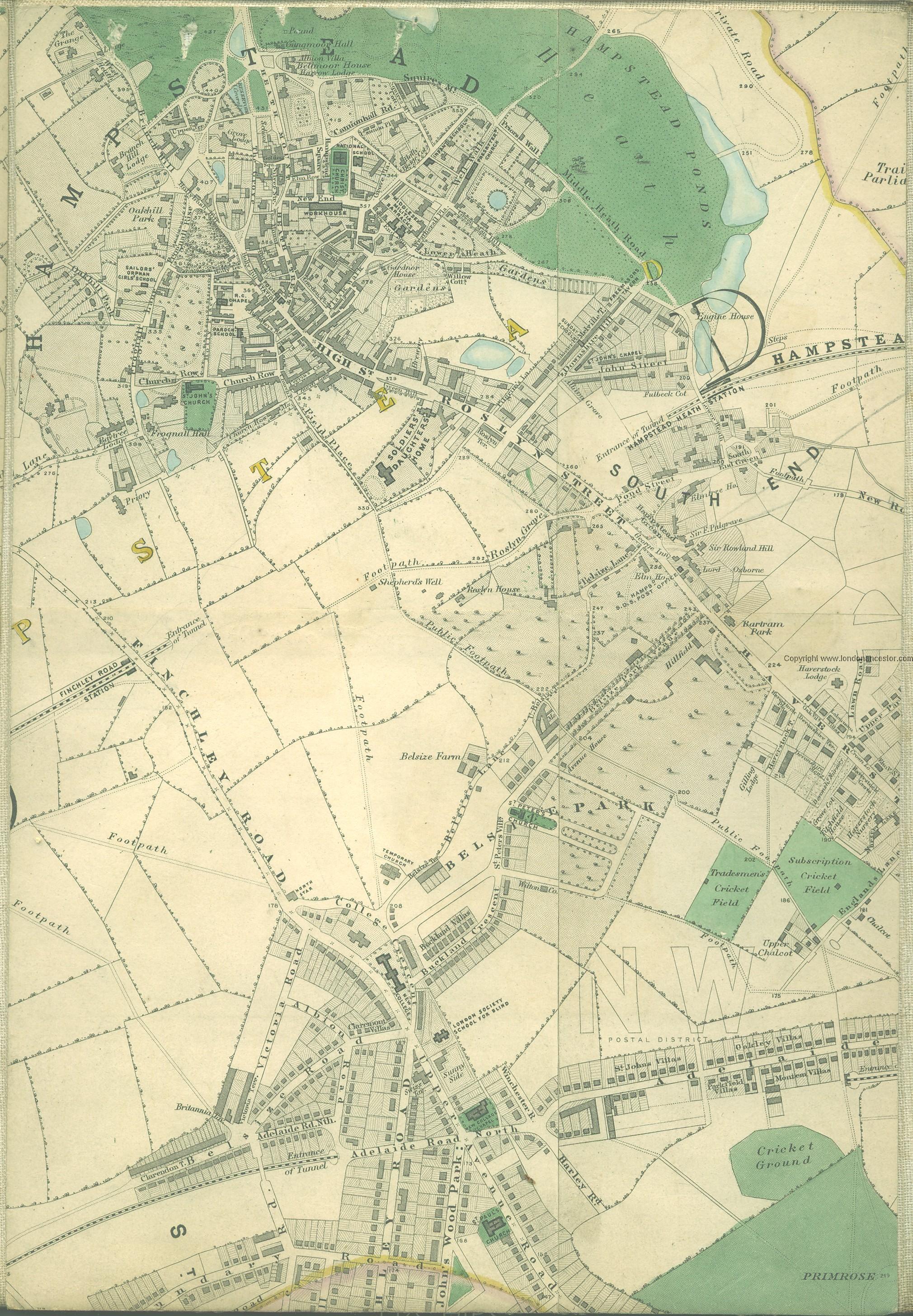
- Hampstead. Green Man Hill. Edward Stanford's Library Map of London (1862-71), Belsize Park section
- Harrow Road. 1732. Castro, J. Paul de. 'Principal London Coffee-Houses, Taverns, and Inns in the Eighteenth Century', Notes & Queries, Series 12, vol. IX (1921), pp. 186-88, see p. 187 s.n. Green Man
- Hatton. 6" O.S. map Middlesex XX (includes: Heston and Isleworth; Twickenham St Mary the Virgin.) (1869; surveyed 1864-65) – UK Pub History
- Hornsey. Muswell Hill. UK Pub History
- Kingsbury. 6" O.S. map Middlesex XI (includes: Hendon; Wembley; Willesden.) (1873; surveyed 1864-65)
- Potter's Bar. 6" O.S. map Middlesex I (includes: North Mimms; Ridge; South Mimms.) (1868; surveyed 1866)
- Putney. 6" O.S. map Middlesex XXI (includes: Barnes; Fulham; Wandsworth Borough.) (1873; surveyed 1865-66)
- Shacklewell Green. UK Pub History
- Upper Hale. 6" O.S. map Middlesex VI (includes: Arkley; Chipping Barnet; Hendon; Rowley; Totteridge.) (1868; surveyed 1863-66)
- Uxbridge. Hillingdon Road. UK Pub History
- Westminster: 5 Little George Street, St Margaret – UK Pub History.
- Whetstone. 6" O.S. map Middlesex VI (includes: Arkley; Chipping Barnet; Hendon; Rowley; Totteridge.) (1868; surveyed 1863-66)
- Willesden. Harlesden Green. UK Pub History
Norfolk
- B.H. – 6" O.S. map Norfolk XVI.SE (includes: Barsham; Fakenham; Great Snoring; Little Snoring.) (1886: surveyed 1885)
- 6" O.S. map Norfolk XXXVII.SE (includes: Bawdeswell; Bylaugh; Foxley; Sparham.) (1885; surveyed 1882-85)
- 6" O.S. map Norfolk LII.SW (includes: Rackheath; Salhouse; Wroxham.) (1887; surveyed 1881)
- 6" O.S. map Norfolk LXXIV.NE (includes: Great Melton; Hethersett; Little Melton.) (1887; surveyed 1881-82)]
- Green man Lane – 6" O.S. map Norfolk LXXXVIII.SW (includes: Brooke; Hedenham; Kirstead; Seething; Woodton.) (1884; surveyed 1883-84).
Oxfordshire
Staffordshire
- Hixon. 6" O.S. map Staffordshire XXXVIII (includes: Blithfield; Colwich; Stowe.) (1924; rev. 1921-22)
- Milwich. 6" O.S. map Staffordshire XXXI.NW (includes: Fradswell; Leigh; Milwich.) (1887; surveyed 1879-81)
- Totmonslow. 6" O.S. map Staffordshire XIII.NE (includes: Bradnop and Cawdry; Ipstones; Onecote.) (1888; surveyed 1878-80).
Suffolk
- 6" O.S. map Suffolk XXXIV.NE (includes: Bardwell; Langham; Stanton.) (1883; surveyed 1882-83)
- Green Man Inn – 6" O.S. map Suffolk XLVII.SW (includes: Earl Stonham; Little Stonham; Mendlesham; Mickfield; Wetheringsett.) (1884; surveyed 1884)
- Green Man Inn – 6" O.S. map Suffolk LIII.SW (includes: Cowlinge; Lidgate; Stradishall; Wickhambrook.) (1884; surveyed 1884)
- 6" O.S. map Suffolk LIV.SW (includes: Brockley; Hartest; Lawshall; Somerton; Whepstead.) (1884; surveyed 1884)
- 6" O.S. map Suffolk LXVIII.NE (includes: Campsey Ash; Rendlesham; Tunstall; Wantisden.) (1883; surveyed 1881-83)
- Anonymous, compil. The Wordsworth Dictionary of Pub Names (Wordsworth Reference Series) (Ware, Hertfordshire, ©2006), s.n. 'Green Man': near Snape, Tunstall.
Surrey
- East Bedfont. 6" O.S. map Surrey Vi (includes: Hanworth; Twickenham St Mary the Virgin.) (1871; surveyed 1867-68)
- Ewell, Epsom. UK Pub History
- Farnham. East Street. UK Pub History
- Kingston Malden. 6" O.S. map Surrey XVIII (includes: Cobham; Fetcham; Great Bookham; Leatherhead; Stoke Dabernon.) (1871; surveyed 1867-69)
- Putney. 6" O.S. map Surrey ViI (includes: Wandsworth Borough; Wimbledon St Mary.) (1874; surveyed 1865). – UK Pub History
- Southwark. 214 Tooley Street. UK Pub History.
Sussex
- Ringmer, Lewes – UK Pub History
- Wadhurst: Greenman Farm – 6" O.S. map Sussex XVIII (includes: Wadhurst.) (1878; surveyed 1873)
- West Grinstead: Old Green Man Inn – 6" O.S. map Sussex XXXVII (includes: Ashington; Shipley; Washington; West Grinstead; Wiston.) (1879; surveyed 1875) – UK Pub History.
Warwickshire
- Birches Green. Old Green Man Inn – 6" O.S. map Warwickshire VIII.SE (1887; surveyed 1887).
Allusions
Discussion
Public houses
- Anonymous, compil. The Wordsworth Dictionary of Pub Names (Wordsworth Reference Series) (Ware, Hertfordshire, ©2006), s.nn. 'Green Man', 'Green Man and Black's Head Royal', 'Green Man and Still'
- A., S. 'Inn Signs', Notes & Queries, Series 1, vol. IX (1854), p. 494. A query, answered by Cooper, Thompson; R., M.H., below
- Cooper, Thompson. 'Inn Signs', Notes & Queries, Series 1, vol. X (1854), p. 33. Answer to query by A., S., above
- Christy, Miller. The Trade Signs of Essex: A Popular Account of the Origins and Meanings of the Public House & Other Signs Now or Formerly Found in the County of Essex (Chelmsford; London, 1887), pp. 137-38. On the tendency to interpret the Green Man as Robin Hood; notes that the outlaw appears on many of the 17th century tokens issued by Essex public houses named the Green Man.
- R., M.H. 'Inn Signs', Notes & Queries, Series 1, vol. X (1854), p. 214. Answer to query by A., S., above
The Green Man in folklore and architecture
The concept of the "Green Man" in folklore is problematical. There is, for instance, no evidence that gargoyles and similar architectural ornaments and figures are anything more than decorative. There is no compelling reason to regard them as representations of a quasi-mythological entity or other mental construct, let alone interpret green men of 19th century May Day processions as representations of this same speculative entity or construct. Still more unfortunate is the fact that the Green Man concept has been appropriated by New Age fringe writers.
- Anderson, William. Green Man: the Archetype of Our Oneness with the Earth (London, 1990)
- Anderson, William. Green Man: the Archetype of Our Oneness with the Earth (San Francisco, 1991)
- Anderson, William. Green Man: the Archetype of Our Oneness with the Earth (Fakenham, 1998)
- Anderson, William. Green Man: the Archetype of Our Oneness with the Earth (New York; London, 1998)
- Anderson, William. Gurīnman: Yōroppashi O Ikinuita Mori No Shinboru (Tokyo, 1998)
- Anderson, William. 'The Green Man and the Goddess: Exploration of a Living Myth', Orion, vol. 14 (1995), pp. 7-15
- Basford, Kathleen. 'The Foliate Head', Folklore, vol. 79 (1968), pp. 59-61
- Basford, Kathleen. 'Quest for the Green Man', in: Davidson, Hilda Roderick Ellis, ed. Symbols of Power (Mistletoe Series) (Cambridge, 1977), pp. 101-20
- Basford, Kathleen. The Green Man (Cambridge, [England]; Totowa, N. J., 1978)
- Basford, Kathleen, review. 'A New View of Green Man Sculptures', Folklore, vol. 102 (1991), pp. 237-39
- Carter, R. O. M.; Carter, H. M. 'The Foliate Head in England', Folklore, vol. 78 (1967), pp. 269-74
- Carter, R. O. M.; Carter, H. M. 'Correction: the Foliate Head in England', Folklore, vol. 79 (1968), p. 47
- Centerwall, Brandon S. 'The Name of the Green Man', Folklore, vol.108 (1997), pp. 25-33
- Coulter, James. The Green Man Unmasked: a New Interpretation of an Ancient Riddle (Bloomington, IN; Milton Keynes, UK, 2006)
- Doel, Fran; Doel, Geoff. The Green Man in Britain (Stroud, 2001)
- Enigma of the Green Man; has very useful bibliography page.
- Ettlinger, Ellen E., review. '[Review of: Basford, Kathleen. The Green Man (Cambridge, [England]; Totowa, N.J., 1978)]', Folklore, vol. 90 (1979), pp. 108-109
- Grundy, Thirlie. The Green Man of Carlisle Cathedral (Carlisle, 1998)
- Grundy, Thirlie. Going in Search of The Green Man In Cumbria (Carlisle, 2000)
- Grundy, Thirlie. The Green Man in Northumbria and County Durham (Carlisle, 2001)
- Grundy, Thirlie. 'The Oaken Myths of Post-Conquest Britain: Symbolic Carvings from 1066 (Carlisle, 2003)
- Harding, Mike. A Little Book of The Green Man (London, 1998)
- Harte, Jeremy; O'Hanlon, Maggie, ed. The Green Man (Pitkin Guides) (Norwich, 2001)
- Hayward, Anthony. 'The Green Men of Birmingham' (Erdington, 2000)
- Hayward, L.H. 'The "Green Man" in Church Architecture', Folklore, vol. 50 (1939), p.188
- Hicks, Clive. The Green Man – A Field Guide (Fakenham, 2000)
- MacDermott, Mercia. Explore Green Men (Loughborough, 2003)
- Millar, Ronald. The Green Man Companion and Gazetteer: his Origins, his History, his Folklore, his Meaning and Where to Find him (Seaford, 1997)
- Negus, Tina. 'Medieval Foliate Heads: a Photographic Study of Green Men and Green Beasts in Britain', Folklore, vol. 114 (2003), pp.247-70
- Raglan, Lady. 'The "Green Man" in Church Architecture', Folklore, vol. 50 (1939), pp. 45-57
- Satchell, John. 'The Green Man in Cumbria', Folklore, vol. 110 (1999), pp.98-99
- Wikipedia: Green Man; sane.
- Willsher, Betty. 'The Green Man as an Emblem on Scottish Tombstones', Markers: Annual Journal of the Association for Gravestone Studies, vol. 9 (1992), pp. 58-77
- Wiltshire Green Men; has very useful bibliography page.
Also see
Notes
- ↑ Wikipedia: Green Man.
- ↑ Christy, Miller. The Trade Signs of Essex: A Popular Account of the Origins and Meanings of the Public House & Other Signs Now or Formerly Found in the County of Essex (Chelmsford; London, 1887), p. 137.
- ↑ Christy, Miller. The Trade Signs of Essex: A Popular Account of the Origins and Meanings of the Public House & Other Signs Now or Formerly Found in the County of Essex (Chelmsford; London, 1887), p. 138.
- ↑ Christy, Miller. The Trade Signs of Essex: A Popular Account of the Origins and Meanings of the Public House & Other Signs Now or Formerly Found in the County of Essex (Chelmsford; London, 1887), pp. 7, 137.
- ↑ Christy, Miller. The Trade Signs of Essex: A Popular Account of the Origins and Meanings of the Public House & Other Signs Now or Formerly Found in the County of Essex (Chelmsford; London, 1887), p. 137.
- ↑ Kennedy, John. A History of the Parish of Leyton, Essex (Leyton, 1894), pp. 127, 280 (bis). Gilbert, William. 'The Token Coinage of Essex in the Seventeenth Century, [Part II]', Transactions of the Essex Archæological Society, New Series, vol. XIV (1915), pp. 1-15; see p. 6. Christy, Miller. The Trade Signs of Essex: A Popular Account of the Origins and Meanings of the Public House & Other Signs Now or Formerly Found in the County of Essex (Chelmsford; London, 1887), p. 137.
- ↑ Christy, Miller. The Trade Signs of Essex: A Popular Account of the Origins and Meanings of the Public House & Other Signs Now or Formerly Found in the County of Essex (Chelmsford; London, 1887), pp. 7, 137.
- ↑ Christy, Miller. The Trade Signs of Essex: A Popular Account of the Origins and Meanings of the Public House & Other Signs Now or Formerly Found in the County of Essex (Chelmsford; London, 1887), pp. 7, 137.
- ↑ Christy, Miller. The Trade Signs of Essex: A Popular Account of the Origins and Meanings of the Public House & Other Signs Now or Formerly Found in the County of Essex (Chelmsford; London, 1887), pp. 7, 137.
- ↑ Christy, Miller. The Trade Signs of Essex: A Popular Account of the Origins and Meanings of the Public House & Other Signs Now or Formerly Found in the County of Essex (Chelmsford; London, 1887), p. 61.
- ↑ Christy, Miller. The Trade Signs of Essex: A Popular Account of the Origins and Meanings of the Public House & Other Signs Now or Formerly Found in the County of Essex (Chelmsford; London, 1887), pp. 7, 137.
- ↑ Christy, Miller. The Trade Signs of Essex: A Popular Account of the Origins and Meanings of the Public House & Other Signs Now or Formerly Found in the County of Essex (Chelmsford; London, 1887), pp. 7, 137.
- ↑ Also see Anonymous. Police Report of May, 1817. Relative to Public House Licences. Report of the Committee on the State of the Police of the Metropolis, with the Minutes of Evidence and an Appendix (London, 1817), p. 446.
- ↑ Also see Anonymous. Police Report of May, 1817. Relative to Public House Licences. Report of the Committee on the State of the Police of the Metropolis, with the Minutes of Evidence and an Appendix (London, 1817), p. 444.