
Pindar Place (Grays Inn Road): Difference between revisions
m (Text replacement - "{{#ask:[[Category:Records ({{#ifeq:{{#pos:{{PAGENAME}}|(|}}||{{PAGENAME}}|{{#sub:{{PAGENAME}}|0| {{#expr:{{#pos:{{PAGENAME}}|(|}}-1}} }},{{#sub:{{PAGENAME}}|{{#expr:{{#pos:{{PAGENAME}}|(|}}-1}}|1}}{{#sub:{{PAGENAME}}|{{#expr:{{#pos:...) |
m (Text replacement - "{{#ask:[[Category:Records ({{#ifeq:{{#pos:{{PAGENAME}}|(|}}||{{PAGENAME}}|{{#sub:{{PAGENAME}}|0| {{#expr:{{#pos:{{PAGENAME}}|(|}}-1}} }},{{#sub:{{PAGENAME}}|{{#expr:{{#pos:{{PAGENAME}}|(|}}-1}}|1}}{{#sub:{{PAGENAME}}|{{#expr:{{#pos:...) |
||
| Line 8: | Line 8: | ||
For a while at least, the cul-de-sac, which is shown on all the 25" and 6" O.S. maps listed below, was known as Black Horse Yard (see the 25" O.S. map from 1877). {{#lst:Pindar of Wakefield (Grays Inn Road)|graysinnroad}} | For a while at least, the cul-de-sac, which is shown on all the 25" and 6" O.S. maps listed below, was known as Black Horse Yard (see the 25" O.S. map from 1877). {{#lst:Pindar of Wakefield (Grays Inn Road)|graysinnroad}} | ||
{{ | {{PnItemQry}} | ||
== Gazetteers == | == Gazetteers == | ||
* Not included in {{:Dobson, Richard Barrie 1976a}}, pp. 293-311. | * Not included in {{:Dobson, Richard Barrie 1976a}}, pp. 293-311. | ||
Revision as of 03:05, 17 July 2018
[[File:|thumb|right|500px|Between Cromer and Harrison streets: the former Pindar Place / Google Earth Street View.]]

By Henrik Thiil Nielsen, 2018-01-16. Revised by Henrik Thiil Nielsen, 2018-07-17.
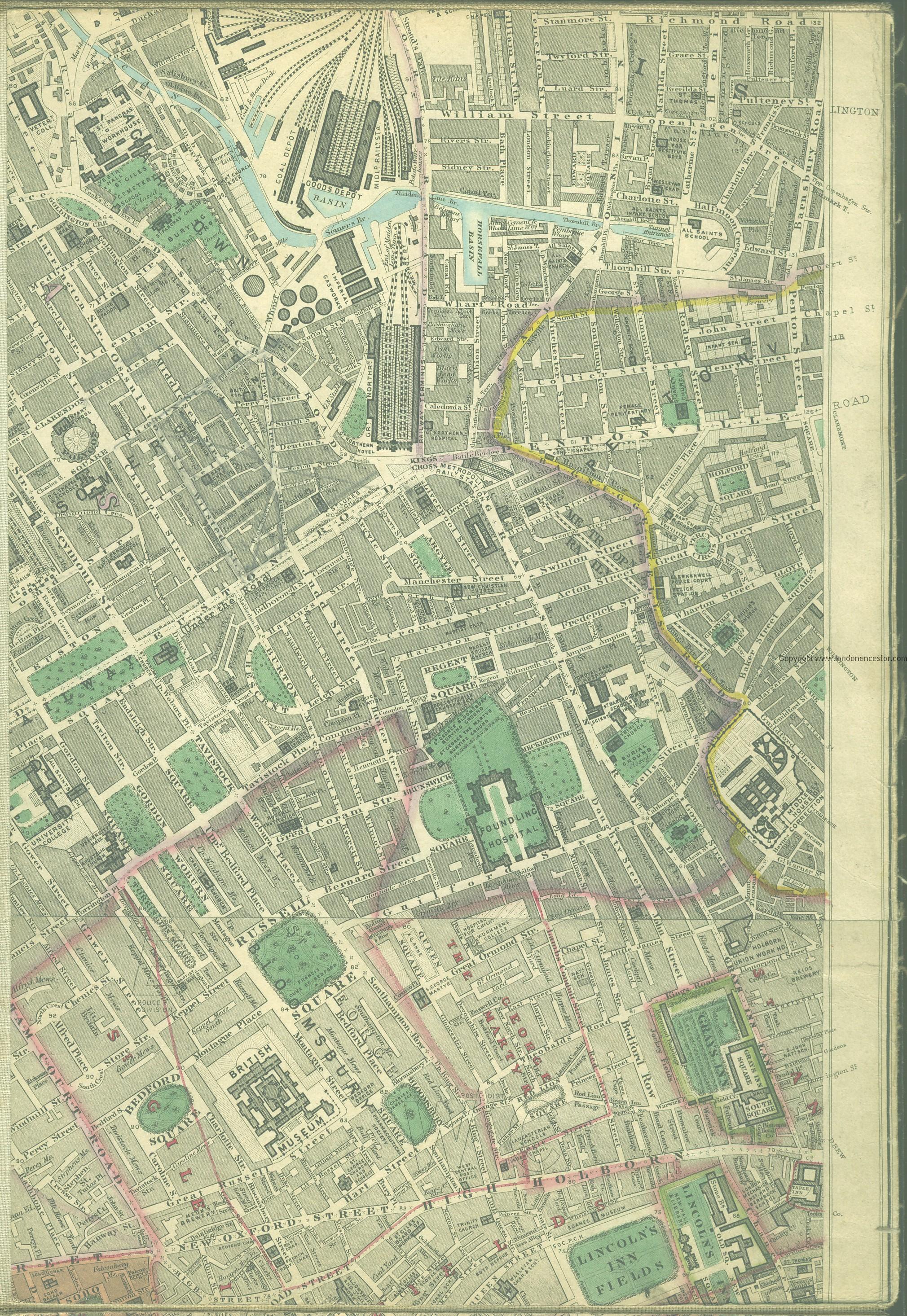
'Pindar Place' was the 19th century name for the west side of Grays Inn Road between Cromer and Harrison streets and also probably for the short, narrow cul-de-sac that then existed between these two side streets (see detail of Edward Stanford's 1862-71 Library Map of London elsewhere on this page). There were flats and several shops in this area (see records below). Most likely Pindar Place was named after the Pindar of Wakefield on Grays Inn Road.
For a while at least, the cul-de-sac, which is shown on all the 25" and 6" O.S. maps listed below, was known as Black Horse Yard (see the 25" O.S. map from 1877). Pindar of Wakefield (Grays Inn Road) Template:PnItemQry
Gazetteers
- Not included in Dobson, R. B., ed.; Taylor, J., ed. Rymes of Robyn Hood: an Introduction to the English Outlaw (London, 1976), pp. 293-311.
Maps
- Edward Stanford's Library Map of London (1862-71), Bloomsbury section.
- 25" O.S. map London XXVI (1877; surveyed 1871)
- 25" O.S. map London sheet V.6 (1916; rev. 1913)
- 6" O.S. map Middlesex XVII (1880-82; surveyed 1868-73)
- 6" O.S. map London VII.NW (1894-96; rev. 1893-94)
- 6" O.S. map London sheet K (1920; rev. 1913-14)
- 6" O.S. map London sheet K (c. 1946; rev. 1938).
Notes
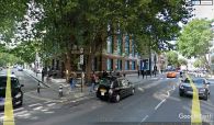
Between Cromer and Harrison streets: the former Pindar Place / Google Earth Street View.
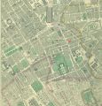
'Pindar Place' is shown just left of the red ellipse / Edward Stanford's Library Map of London (1862-71), Bloomsbury section.
