
Pindar Place (Grays Inn Road): Difference between revisions
m (Text replacement - "Pnimage" to "Image") |
m (Text replacement - "AdmDiv" to "AdministrativeDivision") |
||
| Line 1: | Line 1: | ||
__NOTOC__{{PnItemTop|Lat=51.528134|Lon=-0.119184| | __NOTOC__{{PnItemTop|Lat=51.528134|Lon=-0.119184|AdministrativeDivision=Middlesex|Vicinity=West side of Grays Inn Road between Cromer and Harrison streets|Type=Thoroughfare|Interest=Robin Hood name| | ||
Status=Defunct|Demonym=English|Riding=|GreaterLondon=Yes|Year=1825|Aka=Pindar's Place|Century=19|Cluster1=Grays Inn Road|Cluster2=|Cluster3=|Image=pindars-place-google-earth-street-view.jpg|Postcards=|ExtraCat1=Places named after the pinder of Wakefield|ExtraCat2=|ExtraCat3=|ExtraCat4=|ExtraCat5=|ExtraLink1=|ExtraLink2=|ExtraLink3=|ExtraLink4=|ExtraLink5=|ExtraLinkName1=|ExtraLinkName2=|ExtraLinkName3=|ExtraLinkName4=|ExtraLinkName5=|GeopointPrefix=|GeopointSuffix=|VicinitySuffix=|StatusSuffix=|DatePrefix=|DateSuffix=}} | Status=Defunct|Demonym=English|Riding=|GreaterLondon=Yes|Year=1825|Aka=Pindar's Place|Century=19|Cluster1=Grays Inn Road|Cluster2=|Cluster3=|Image=pindars-place-google-earth-street-view.jpg|Postcards=|ExtraCat1=Places named after the pinder of Wakefield|ExtraCat2=|ExtraCat3=|ExtraCat4=|ExtraCat5=|ExtraLink1=|ExtraLink2=|ExtraLink3=|ExtraLink4=|ExtraLink5=|ExtraLinkName1=|ExtraLinkName2=|ExtraLinkName3=|ExtraLinkName4=|ExtraLinkName5=|GeopointPrefix=|GeopointSuffix=|VicinitySuffix=|StatusSuffix=|DatePrefix=|DateSuffix=}} | ||
{{#display_map:{{#var:Coords}}~{{#replace:{{PAGENAME}}|'|'}}|width=34%|enablefullscreen=yes}}<div class="pnMapLegend">{{PAGENAME}}.</div> | {{#display_map:{{#var:Coords}}~{{#replace:{{PAGENAME}}|'|'}}|width=34%|enablefullscreen=yes}}<div class="pnMapLegend">{{PAGENAME}}.</div> | ||
Revision as of 21:22, 5 January 2021
[[File:|thumb|right|500px|Between Cromer and Harrison streets: the former Pindar Place / Google Earth Street View.]]

By Henrik Thiil Nielsen, 2018-01-16. Revised by Henrik Thiil Nielsen, 2021-01-05.
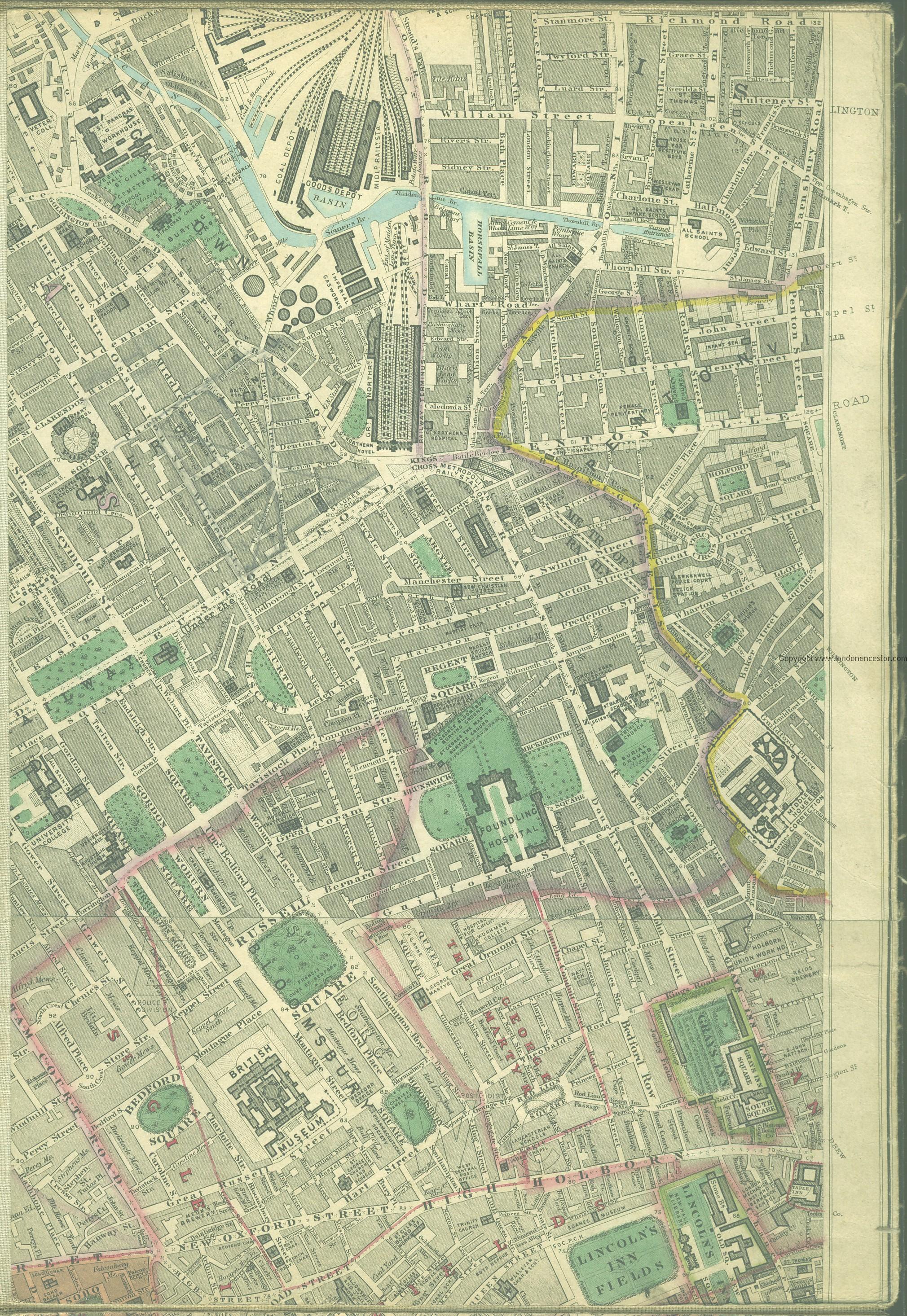
'Pindar Place' was the 19th century name for the west side of Grays Inn Road between Cromer and Harrison streets and also probably for the short, narrow cul-de-sac that then existed between these two side streets (see detail of Edward Stanford's 1862-71 Library Map of London elsewhere on this page). There were flats and several shops in this area (see records below). Most likely Pindar Place was named after the Pinder of Wakefield on Grays Inn Road.
For a while at least, the cul-de-sac, which is shown on all the 25" and 6" O.S. maps listed below, was known as Black Horse Yard (see the 25" O.S. map from 1877). Note with regard to Grays Inn Road, where the pub was situated, that nomenclature has shifted over time. Lockie in his Topography (editions of 1810 and 1813) refers to the entire course of Grays Inn Road as "Gray's-Inn-Lane"[1] – he has no entry under, or cross-reference from, "Grays Inn Road"; Edward Stanford's 1862-71 Library Map of London and its Suburbs labels the narrower part of the street along Grays Inn "Grays Inn Lane" but uses "Grays Inn Road" for the street north of Grays Inn where it becomes wider.[2] Nowadays the entire length is named "Grays Inn Road". Template:PnItemQry
Gazetteers
- Not included in Dobson, R. B., ed.; Taylor, J., ed. Rymes of Robyn Hood: an Introduction to the English Outlaw (London, 1976), pp. 293-311.
Maps
- Edward Stanford's Library Map of London (1862-71), Bloomsbury section.
- 25" O.S. map London XXVI (1877; surveyed 1871)
- 25" O.S. map London sheet V.6 (1916; rev. 1913)
- 6" O.S. map Middlesex XVII (1880-82; surveyed 1868-73)
- 6" O.S. map London VII.NW (1894-96; rev. 1893-94)
- 6" O.S. map London sheet K (1920; rev. 1913-14)
- 6" O.S. map London sheet K (c. 1946; rev. 1938).
Notes
- ↑ Lockie, John, compil. Lockie's Topography of London, Giving a Concise Local Description of and Accurate Direction to Every Square, Street, Lane, Court, Dock, Wharf, Inn, Public Office, &c. in the Metropolis and its Environs (London, 1810), s.n. Gray's-Inn-Lane. Lockie, John, compil. Lockie's Topography of London, Giving a Concise Local Description of, and Accurate Direction to, Every Square, Street, Lane, Court, Dock, Wharf, Inn, Public Office, &c. in the Metropolis and its Environs. Second Edition (London, 1813), s.n. Gray's-Inn-Lane.
- ↑ Map of North West London, 1862 - 1871: Bloomsbury
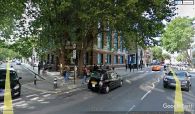
Between Cromer and Harrison streets: the former Pindar Place / Google Earth Street View.
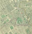
'Pindar Place' is shown just left of the red ellipse / Edward Stanford's Library Map of London (1862-71), Bloomsbury section.
