
Little John (Markfield): Difference between revisions
From International Robin Hood Bibliography
mNo edit summary |
mNo edit summary |
||
| Line 1: | Line 1: | ||
__NOTOC__{{PnItemTop|Lat=52.6702|Lon=-1.2603|AdmDiv=Leicestershire|Vicinity=1.3 km SSE of Markfield|Type=Natural feature|Interest=Robin Hood name| | __NOTOC__{{PnItemTop|Lat=52.6702|Lon=-1.2603|AdmDiv=Leicestershire|Vicinity=1.3 km SSE of Markfield|Type=Natural feature|Interest=Robin Hood name| | ||
Status=Extant|Demonym=English|Riding=|GreaterLondon=|Year=1899|Aka=John's Hill|Century=19|Cluster1=|Cluster2=|Cluster3=|Image=geograph-514030-by-Mat-Fascione | Status=Extant|Demonym=English|Riding=|GreaterLondon=|Year=1899|Aka=John's Hill|Century=19|Cluster1=|Cluster2=|Cluster3=|Image=geograph-514030-by-Mat-Fascione.jpg|Postcards=|ExtraCat1=Places named after Little John|ExtraCat2=|ExtraCat3=|ExtraCat4=|ExtraCat5=|ExtraLink1=|ExtraLink2=|ExtraLink3=|ExtraLink4=|ExtraLink5=|ExtraLinkName1=|ExtraLinkName2=|ExtraLinkName3=|ExtraLinkName4=|ExtraLinkName5=|GeopointPrefix=|GeopointSuffix=|VicinitySuffix=|StatusSuffix=|DatePrefix=|DateSuffix=}} | ||
{{#display_map:{{#var:Coords}}|width=34%}}<div class="pnMapLegend">{{PAGENAME}}.</div> | {{#display_map:{{#var:Coords}}|width=34%}}<div class="pnMapLegend">{{PAGENAME}}.</div> | ||
[[File:{{#var:Pnimage}}|thumb|right|500px|_LEGEND / [_URL _PHOTOGRAPHER_, _DAY_ _MON_. _YEAR_, Creative Commons.]]] | [[File:{{#var:Pnimage}}|thumb|right|500px|_LEGEND / [_URL _PHOTOGRAPHER_, _DAY_ _MON_. _YEAR_, Creative Commons.]]] | ||
| Line 35: | Line 35: | ||
{{ImgGalleryIntro}} | {{ImgGalleryIntro}} | ||
<gallery widths="195px"> | <gallery widths="195px"> | ||
geograph-514030-by-Mat-Fascione | geograph-514030-by-Mat-Fascione.jpg|Little John / [http://www.geograph.org.uk/photo/514030 Mat Fascione, 29 Jul. 2007, Creative Commons, via Geograph.] | ||
geograph-514031-by-Mat-Fascione.jpg|View of Leicester from the summit of Little John / [http://www.geograph.org.uk/photo/514031 Mat Fascione, 29 Jul. 2007, Creative Commons, via Geograph.] | geograph-514031-by-Mat-Fascione.jpg|View of Leicester from the summit of Little John / [http://www.geograph.org.uk/photo/514031 Mat Fascione, 29 Jul. 2007, Creative Commons, via Geograph.] | ||
geograph-514032-by-Mat-Fascione.jpg|Leicester City Skyline, looking southeast from Little John / [http://www.geograph.org.uk/photo/514032 Mat Fascione, 29 Jul. 2007, Creative Commons, via Geograph.] | geograph-514032-by-Mat-Fascione.jpg|Leicester City Skyline, looking southeast from Little John / [http://www.geograph.org.uk/photo/514032 Mat Fascione, 29 Jul. 2007, Creative Commons, via Geograph.] | ||
geograph-514033-by-Mat-Fascione.jpg|Houses located along the A50, Bradgate Hill, seen from Little John / [http://www.geograph.org.uk/photo/514033 Mat Fascione, 29 Jul. 2007, Creative Commons, via Geograph.] | geograph-514033-by-Mat-Fascione.jpg|Houses located along the A50, Bradgate Hill, seen from Little John / [http://www.geograph.org.uk/photo/514033 Mat Fascione, 29 Jul. 2007, Creative Commons, via Geograph.] | ||
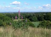
geograph-514034-by-Mat-Fascione.jpg|Looking southwest from the summit of Little John / [http://www.geograph.org.uk/photo/514034 Mat Fascione, 29 Jul. 2007, Creative Commons, via Geograph.] | |||
Looking southwest from the summit of Little John / [http://www.geograph.org.uk/photo/514034 Mat Fascione, 29 Jul. 2007, Creative Commons, via Geograph.] | |||
</gallery> | </gallery> | ||
{{PnItemNav}} | {{PnItemNav}} | ||
Revision as of 00:21, 18 February 2018
Little John (Markfield).
[[File:|thumb|right|500px|_LEGEND / [_URL _PHOTOGRAPHER_, _DAY_ _MON_. _YEAR_, Creative Commons.]]]
By Henrik Thiil Nielsen, 2018-02-17. Revised by Henrik Thiil Nielsen, 2018-02-18.
Gazetteers
- Not included in Dobson, R. B., ed.; Taylor, J., ed. Rymes of Robyn Hood: an Introduction to the English Outlaw (London, 1976), pp. 293-311.
Maps
- 25" O.S. map Leicestershire XXX.3 (1903; rev. 1901) (georeferenced)
- 6" O.S. map Leicestershire XXX.NE (1904; rev. 1901) (georeferenced)
- 1:25,000 O.S. map Leicestershire XXX.NE (1904; rev. 1901) (georeferenced)
- 1:1 mill.–1:10k, SK501083 (1900s) (georeferenced)
- 1:1m to 1:63, SK501082k (1920s-1940s) (georeferenced)
- 1" O.S. map Atherstone (Hills), Sheet 155, Revised: 1898, Published: 1899 (georeferenced)
- 1" O.S. map Atherstone (Outline), Sheet 155, Revised: 1898, Published: 1899 (georeferenced)
- 1" O.S. map Derby and Leicester (1959; surveyed 1950-56) (georeferenced).
Background
Notes
View of Leicester from the summit of Little John / Mat Fascione, 29 Jul. 2007, Creative Commons, via Geograph.
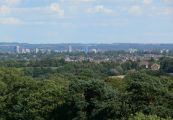
Leicester City Skyline, looking southeast from Little John / Mat Fascione, 29 Jul. 2007, Creative Commons, via Geograph.
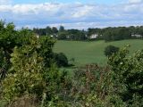
Houses located along the A50, Bradgate Hill, seen from Little John / Mat Fascione, 29 Jul. 2007, Creative Commons, via Geograph.

Looking southwest from the summit of Little John / Mat Fascione, 29 Jul. 2007, Creative Commons, via Geograph.


