Ivanhoe Drive (Ashby-de-la-Zouch): Difference between revisions
From International Robin Hood Bibliography
m (Text replacement - "[[Category:{{#var:County}} place-names]]" to "Category:English place-names [[Category:{{#var:County}} place-names]]") |
mNo edit summary |
||
| Line 11: | Line 11: | ||
|data5=[[pntype::Thoroughfare]] | |data5=[[pntype::Thoroughfare]] | ||
|label6=Interest | |label6=Interest | ||
|data6=[[pninterest:: | |data6=[[pninterest::Robin Hood name]] | ||
|label7=Status | |label7=Status | ||
|data7=[[pnstatus::Extant]] | |data7=[[pnstatus::Extant]] | ||
| Line 44: | Line 44: | ||
[[Category:{{#var:PnClusterRef}} place-name cluster]] | [[Category:{{#var:PnClusterRef}} place-name cluster]] | ||
[[Category:Places named after Ivanhoe]] | [[Category:Places named after Ivanhoe]] | ||
[[Category: | [[Category:Robin Hood name]] | ||
{{#set:Utitle={{#replace:{{uc:{{PAGENAME}}}}|'|'}}}} | {{#set:Utitle={{#replace:{{uc:{{PAGENAME}}}}|'|'}}}} | ||
{{#set:Pnimage=ivanhoe-drive-google-earth-streetview.jpg}} | {{#set:Pnimage=ivanhoe-drive-google-earth-streetview.jpg}} | ||
Revision as of 23:39, 5 September 2017
| Locality | |
|---|---|
| Coordinates | 52.749598, -1.486416 |
| Adm. div. | Leicestershire |
| Vicinity | In west part of Ashby-de-la-Zouch, connecting Ingle Drive and Prestop Drive |
| Type | Thoroughfare |
| Interest | Robin Hood name |
| Status | Extant |
| First Record | 20th cent. |
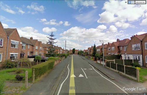
Ivanhoe Drive.
By Henrik Thiil Nielsen, 2017-05-08. Revised by Henrik Thiil Nielsen, 2017-09-05.
Ivanhoe Drive, a residential street running between Ingle Drive and Prestop Drive, in the west of Ashby-de-la-Zouch, was clearly constructed and developped in the 20th century, probably post-WW II.
Gazetteers
- Not included in Dobson, R. B., ed.; Taylor, J., ed. Rymes of Robyn Hood: an Introduction to the English Outlaw (London, 1976), pp. 293-311.
Sources
Also see

