
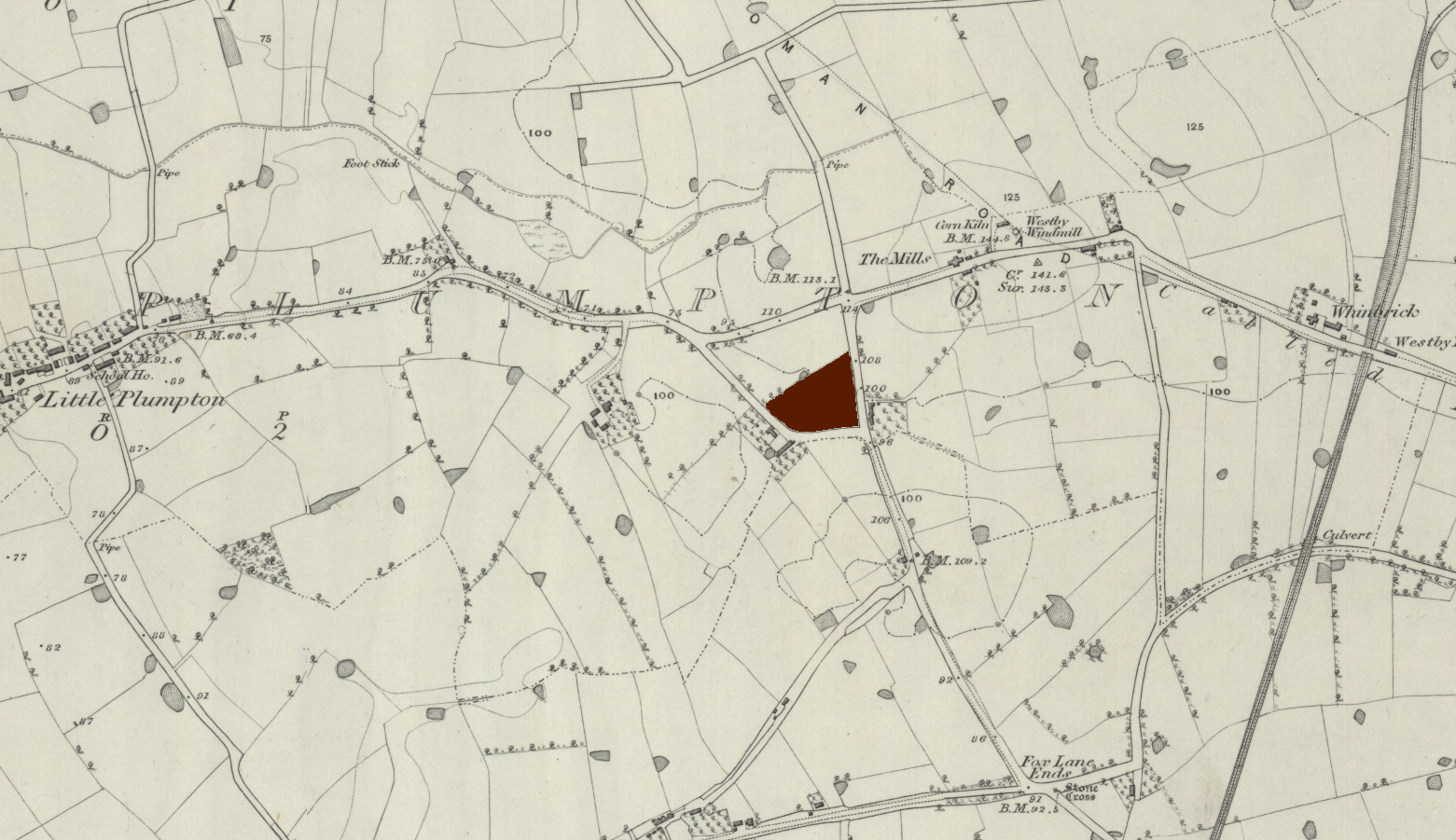
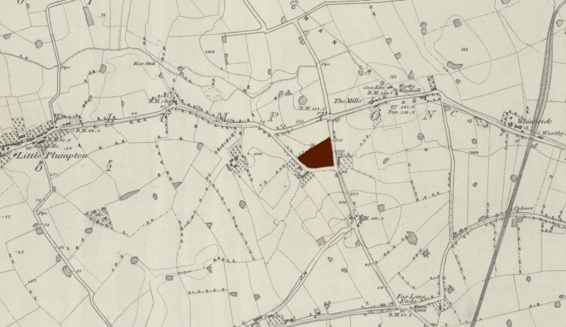
File:Plumpton-park-westby-with-plumptons-NLS.jpg
From International Robin Hood Bibliography
Revision as of 02:12, 30 January 2021 by Henryfunk (talk | contribs) (Detail of 6" O.S. map ''Lancashire'' LIX (surveyed 1844; 1847); reprod. with perm. of NLS; under Creative Commons Attrib. (CC-BY) license;] adapt. Henrik Thiil Nielsen. https://maps.nls.uk/copyright.html#exceptions https://maps.nls.uk/view/102343940#zoom=6&lat=8657&lon=12071&layers=BT https://maps.nls.uk NLS)
Size of this preview: 800 × 462 pixels. Other resolution: 1,561 × 901 pixels.
Original file (1,561 × 901 pixels, file size: 936 KB, MIME type: image/jpeg)
Summary
Detail of 6" O.S. map Lancashire LIX (surveyed 1844; 1847); reprod. with perm. of NLS; under Creative Commons Attrib. (CC-BY) license;] adapt. Henrik Thiil Nielsen.
https://maps.nls.uk/copyright.html#exceptions
https://maps.nls.uk/view/102343940#zoom=6&lat=8657&lon=12071&layers=BT
File history
Click on a date/time to view the file as it appeared at that time.
| Date/Time | Thumbnail | Dimensions | User | Comment | |
|---|---|---|---|---|---|
| current | 02:12, 30 January 2021 | | 1,561 × 901 (936 KB) | Henryfunk (talk | contribs) | Detail of 6" O.S. map ''Lancashire'' LIX (surveyed 1844; 1847); reprod. with perm. of NLS; under Creative Commons Attrib. (CC-BY) license;] adapt. Henrik Thiil Nielsen. https://maps.nls.uk/copyright.html#exceptions https://maps.nls.uk/view/102343940#zoom=6&lat=8657&lon=12071&layers=BT https://maps.nls.uk NLS |
You cannot overwrite this file.
File usage
The following page uses this file: