Loading map...
{"format":"leaflet","minzoom":false,"maxzoom":false,"limit":2000,"offset":0,"link":"all","sort":[""],"order":[],"headers":"show","mainlabel":"","intro":"","outro":"","searchlabel":"... further results","default":"","import-annotation":false,"width":"34%","height":"550px","centre":false,"title":"","label":"","icon":"","lines":[],"polygons":[],"circles":[],"rectangles":[],"copycoords":true,"static":false,"zoom":8,"defzoom":9,"layers":["OpenStreetMap","NLS","Stamen.Terrain"],"image layers":[],"overlays":[],"resizable":false,"fullscreen":true,"scrollwheelzoom":true,"cluster":true,"clustermaxzoom":20,"clusterzoomonclick":true,"clustermaxradius":50,"clusterspiderfy":true,"geojson":"","clicktarget":"","showtitle":true,"hidenamespace":true,"template":"PlaceNamesPopUp","userparam":"","activeicon":"","pagelabel":false,"ajaxcoordproperty":"","ajaxquery":"","locations":[{"text":"\u003Cb\u003E\u003Ca href=\"/w/index.php/Joaney_How_(Luccombe)\" title=\"Joaney How (Luccombe)\"\u003EJoaney How (Luccombe)\u003C/a\u003E\u003C/b\u003E\u003Chr /\u003E\u003Cdiv class=\"thumb tleft\"\u003E\u003Cdiv class=\"thumbinner\" style=\"width:302px;\"\u003E\u003Cimg alt=\"Joanie-how-roger-cornfoot-geograph.jpg\" src=\"/w/images/thumb/4/42/Joanie-how-roger-cornfoot-geograph.jpg/300px-Joanie-how-roger-cornfoot-geograph.jpg\" decoding=\"async\" width=\"300\" height=\"225\" class=\"popupimg thumbimage\" srcset=\"/w/images/thumb/4/42/Joanie-how-roger-cornfoot-geograph.jpg/450px-Joanie-how-roger-cornfoot-geograph.jpg 1.5x, /w/images/thumb/4/42/Joanie-how-roger-cornfoot-geograph.jpg/600px-Joanie-how-roger-cornfoot-geograph.jpg 2x\" /\u003E \u003Cdiv class=\"thumbcaption\"\u003E\u003Cdiv class=\"magnify\"\u003E\u003Ca href=\"/w/index.php/File:Joanie-how-roger-cornfoot-geograph.jpg\" class=\"internal\" title=\"Enlarge\"\u003E\u003C/a\u003E\u003C/div\u003E\u003C/div\u003E\u003C/div\u003E\u003C/div\u003E\n\u003Ctable class=\"pnpopup\"\u003E\n\u003Ctbody\u003E\u003Ctr\u003E\u003Ctd\u003ELat.\u003C/td\u003E\u003Ctd\u003E51.1739\u003C/td\u003E\u003C/tr\u003E\n\u003Ctr\u003E\u003Ctd\u003ELon.\u003C/td\u003E\u003Ctd\u003E-3.5632\u003C/td\u003E\u003C/tr\u003E\n\u003Ctr\u003E\u003Ctd\u003EAdm. Div.\u003C/td\u003E\u003Ctd\u003ESomerset\u003C/td\u003E\u003C/tr\u003E\n\u003Ctr\u003E\u003Ctd\u003EVicinity\u003C/td\u003E\u003Ctd\u003EOn Dunkery Hill, \u003Ci\u003Ec.\u003C/i\u003E 2 km SSW of Luccombe\u003C/td\u003E\u003C/tr\u003E\n\u003Ctr\u003E\u003Ctd\u003EType\u003C/td\u003E\u003Ctd\u003EPrehistoric site\u003C/td\u003E\u003C/tr\u003E\n\u003Ctr\u003E\u003Ctd\u003EInterest\u003C/td\u003E\u003Ctd\u003ERobin Hood name\u003C/td\u003E\u003C/tr\u003E\n\u003Ctr\u003E\u003Ctd\u003EStatus\u003C/td\u003E\u003Ctd\u003EExtant\u003C/td\u003E\u003C/tr\u003E\n\u003Ctr\u003E\u003Ctd\u003EFirst Rec.\u003C/td\u003E\u003Ctd\u003E1889\u003C/td\u003E\u003C/tr\u003E\n\u003Ctr\u003E\u003Ctd\u003ECentury\u003C/td\u003E\u003Ctd\u003E19th\u003C/td\u003E\u003C/tr\u003E\n\u003C/tbody\u003E\u003C/table\u003E","title":"Joaney How (Luccombe)","link":"","lat":51.1739,"lon":-3.5632,"icon":""},{"text":"\u003Cb\u003E\u003Ca href=\"/w/index.php/Robin_How_(Luccombe)\" title=\"Robin How (Luccombe)\"\u003ERobin How (Luccombe)\u003C/a\u003E\u003C/b\u003E\u003Chr /\u003E\u003Cdiv class=\"thumb tleft\"\u003E\u003Cdiv class=\"thumbinner\" style=\"width:302px;\"\u003E\u003Cimg alt=\"Robin-how-roger-cornfoot-geograph.jpg\" src=\"/w/images/thumb/5/5b/Robin-how-roger-cornfoot-geograph.jpg/300px-Robin-how-roger-cornfoot-geograph.jpg\" decoding=\"async\" width=\"300\" height=\"222\" class=\"popupimg thumbimage\" srcset=\"/w/images/thumb/5/5b/Robin-how-roger-cornfoot-geograph.jpg/450px-Robin-how-roger-cornfoot-geograph.jpg 1.5x, /w/images/thumb/5/5b/Robin-how-roger-cornfoot-geograph.jpg/600px-Robin-how-roger-cornfoot-geograph.jpg 2x\" /\u003E \u003Cdiv class=\"thumbcaption\"\u003E\u003Cdiv class=\"magnify\"\u003E\u003Ca href=\"/w/index.php/File:Robin-how-roger-cornfoot-geograph.jpg\" class=\"internal\" title=\"Enlarge\"\u003E\u003C/a\u003E\u003C/div\u003E\u003C/div\u003E\u003C/div\u003E\u003C/div\u003E\n\u003Ctable class=\"pnpopup\"\u003E\n\u003Ctbody\u003E\u003Ctr\u003E\u003Ctd\u003ELat.\u003C/td\u003E\u003Ctd\u003E51.173278\u003C/td\u003E\u003C/tr\u003E\n\u003Ctr\u003E\u003Ctd\u003ELon.\u003C/td\u003E\u003Ctd\u003E-3.563963\u003C/td\u003E\u003C/tr\u003E\n\u003Ctr\u003E\u003Ctd\u003EAdm. Div.\u003C/td\u003E\u003Ctd\u003ESomerset\u003C/td\u003E\u003C/tr\u003E\n\u003Ctr\u003E\u003Ctd\u003EVicinity\u003C/td\u003E\u003Ctd\u003EOn Dunkery Hill, \u003Ci\u003Ec.\u003C/i\u003E 2 km SSW of Luccombe\u003C/td\u003E\u003C/tr\u003E\n\u003Ctr\u003E\u003Ctd\u003EType\u003C/td\u003E\u003Ctd\u003EPrehistoric site\u003C/td\u003E\u003C/tr\u003E\n\u003Ctr\u003E\u003Ctd\u003EInterest\u003C/td\u003E\u003Ctd\u003ERobin Hood name\u003C/td\u003E\u003C/tr\u003E\n\u003Ctr\u003E\u003Ctd\u003EStatus\u003C/td\u003E\u003Ctd\u003EExtant\u003C/td\u003E\u003C/tr\u003E\n\u003Ctr\u003E\u003Ctd\u003EFirst Rec.\u003C/td\u003E\u003Ctd\u003E1889\u003C/td\u003E\u003C/tr\u003E\n\u003Ctr\u003E\u003Ctd\u003ECentury\u003C/td\u003E\u003Ctd\u003E19th\u003C/td\u003E\u003C/tr\u003E\n\u003C/tbody\u003E\u003C/table\u003E","title":"Robin How (Luccombe)","link":"","lat":51.173278,"lon":-3.563963,"icon":""}],"imageLayers":[]}
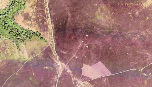
Robin Hood-related localities in or near Dunkery Hill, Somerset. Click cluster marker for locality markers. Click locality marker for link to page.

