The printable version is no longer supported and may have rendering errors. Please update your browser bookmarks and please use the default browser print function instead.
| Locality |
|---|
| Coordinate |
52.428545, -1.849729 |
|---|
| Adm. div. |
Worcestershire |
|---|
| Vicinity |
Connects Robin Hood Lane and Highfield Road in Hall Green |
|---|
| Type |
Thoroughfare |
|---|
| Interest |
Miscellaneous |
|---|
| Status |
Extant |
|---|
| First Record |
|
|---|
Loading map...
{"minzoom":false,"maxzoom":false,"mappingservice":"leaflet","width":"34%","height":"400px","centre":false,"title":"","label":"","icon":"","lines":[],"polygons":[],"circles":[],"rectangles":[],"copycoords":false,"static":false,"zoom":false,"defzoom":9,"layers":["OpenStreetMap","NLS","Stamen.Terrain"],"image layers":[],"overlays":[],"resizable":false,"fullscreen":true,"scrollwheelzoom":true,"cluster":false,"clustermaxzoom":20,"clusterzoomonclick":true,"clustermaxradius":80,"clusterspiderfy":true,"geojson":"","clicktarget":"","imageLayers":[],"locations":[{"text":"\u003Cdiv class=\"mw-parser-output\"\u003E\u003Cp\u003ESherwood Road (Hall Green)\n\u003C/p\u003E\u003C/div\u003E","title":"Sherwood Road (Hall Green)\n","link":"","lat":52.428545,"lon":-1.849729,"icon":""}],"imageoverlays":null}
Sherwood Road (Hall Green).
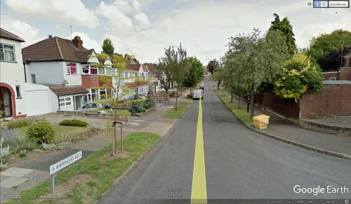
Sherwood Road / Google Earth Street View.
By Henrik Thiil Nielsen, 2018-01-12. Revised by Henrik Thiil Nielsen, 2021-01-06.
Sherwood Road is a roughly L-shaped road that connects Robin Hood Lane and Highfield Road in Hall Green.
Gazetteers
Also see

