
Robin Hood Way (Nottinghamshire)
| Locality | |
|---|---|
| Coordinate | 52.95028, -1.15314 |
| Adm. div. | Nottinghamshire |
| Vicinity | From Nottingham in the south to Clumber Park in the north, from near Moorgreen in the west to southwell in the east |
| Type | Thoroughfare |
| Interest | Robin Hood name |
| Status | Extant |
| First Record | 1985 |

By Henrik Thiil Nielsen, 2020-10-08. Revised by Henrik Thiil Nielsen, 2021-01-07.
The Robin Hood Way is a recreational footpath in Nottinghamshire, established in 1985. This convoluted path has a total length of c. 168 km. From Nottingham in the south to Clumber Park in the north, from near Moorgreen in the west to southwell in the east.
The idea of a Robin Hood-themed recreational path or series of connected paths was conceived in 1980 by Chris Thompson, then social secretary of the Nottingham Wayfarers' Rambling Club. The official opening took place in May of 1985. As is the case elsewhere the Robin Hood-related sites in Nottinghamshire tend to cluster, but as these clusters are scattered over a fairly wide area, any route connecting a number of them will inevitably mainly pass through areas that do not have obvious Robin Hood-connections. There are nearly 30 designated access points to the Robin Hood Way, i.e. areas with parking spaces near the route. From south to north, these include, among others, Nottingham Castle, where the route begins, Wollaton Park, Bestwood Country Park, localities in the Blidworth area, Newstead Abbey, Southwell, Rufford Abbey Country Park, Archway House, Creswell Crags, Clumber Park, and Sherwood Forest Visitor Centre. As of 1994, the Robin Hood Way is divided into 18 sections, and 14 circular walks from the route are described in the 1994 edition of The Robin Hood Walks, a book published by the Nottingham Wayfarers' Rambling Club.[1]
The Robin Hood-related localities connected by the Robin Hood Way include the following:
- Blidworth (Mansfield)
- Fountain Dale (Blidworth)
- Friar Tuck's Hut (Blidworth)
- Friar Tuck's Well (Blidworth)
- Little John Inn (Ravenshead)
- Maid Marian Way (Nottingham)
- Major Oak (Sherwood Forest)
- Nottingham Castle (Nottingham)
- Papplewick (Hucknall)
- Robin Hood (Edwinstowe)
- Robin Hood Hill (Oxton)
- Robin Hood Statue (Nottingham Castle)
- Robin Hood's Cave (Walesby)
- Robin Hood's Larder (Sherwood Forest)
- Robin Hood's Stable (Papplewick)
- Robin Hood's Well (High Park Wood, Moorgreen)
- Sherwood Forest
- Will Scarlet's Grave (Blidworth).
Gazetteers
- Not included in Dobson, R. B., ed.; Taylor, J., ed. Rymes of Robyn Hood: an Introduction to the English Outlaw (London, 1976), pp. 293-311.
Sources
- Nottingham Wayfarers' Rambling Club; Price, Roland, introd. The Robin Hood Walks: A Comprehensive Guide to Walks in Robin Hood Country including the Third Edition of the Guide to the Full Route of Nottinghamshire's First Recreational Footpath, The Robin Hood Way (Leicester: Cordee, ©1994), pp. ix-xiii
- Wikipedia: Robin Hood Way.
Maps
Since the Robin Hood Way extends over a large area, it would not be helpful to list links to high-resolution maps here. See instead maps listed on the pages dealing with individual localities (as listed above).
Background
- LDWA: Robin Hood Way
- Newark & Sherwood District Council: The Robin Hood Way
- Robin Hood Way Association
- The Robin Hood Way at Clumber Park
- The Walking Englishman: Robin Hood Way
- Walks in Central Nottinghamshire: Tag Archives: Robin Hood Way.
Also see
Notes
- ↑ Nottingham Wayfarers' Rambling Club; Price, Roland, introd. The Robin Hood Walks: A Comprehensive Guide to Walks in Robin Hood Country including the Third Edition of the Guide to the Full Route of Nottinghamshire's First Recreational Footpath, The Robin Hood Way (Leicester: Cordee, ©1994). The above is mainly based on pp. ix-xiii of that source, supplemented by Wikipedia: Robin Hood Way.
Image gallery
Click any image to display it in the lightbox, where you can navigate between images by clicking in the right or left side of the current image.
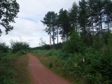
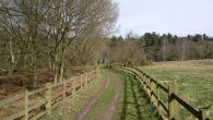
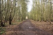
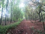
Robin Hood Way through Claypit Wood / Tim Heaton, 19 Sep. 2009, Creative Commons, via Geograph.

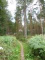
A track through Sherwood Forest, part of the Robin Hood Way / Phil Champion, 7 Sep. 2019, Creative Commons, via Geograph.
Robin Hood Way, close to Robin Hood's Cave / Jonathan Thacker, 13 Oct. 2018, Creative Commons, via Geograph.
Robin Hood Way, just north of the junction with Whitewater Lane / Jonathan Thacker, 1 Oct. 2018, Creative Commons, via Geograph.
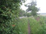
Robin Hood's Way, passing though an area of woodland and heath / Jonathan Thacker, 1 Oct. 2018, Creative Commons, via Geograph.
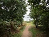
Part of Robin Hood's Way / Chris Morgan, 1 Apr. 2015, Creative Commons, via Geograph.
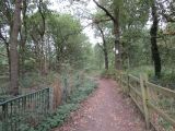
Robin Hood Way, footpath through Blackcliffe Hill Plantation / Richard Croft, 13 Dec. 2011, Creative Commons, via Geograph.
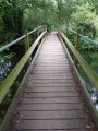
Robin Hood Way over the River Meden / Tim Heaton, 19 Apr. 2009, Creative Commons, via Geograph.
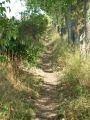
Bridle Lane near Walesby on The Robin Hood Way / Richard Croft, 22 Aug. 2011, Creative Commons, via Geograph.
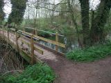
The Robin Hood Way crossing the River Meden at Conjure Alders / Richard Croft, 13 Dec. 2011, Creative Commons, via Geograph.
Robin Hood Way towards the River Meden; Blackcliffe Hill Plantation in the distance / Tim Heaton, 21 Apr. 2009, Creative Commons, via Geograph.
North on Robin Hood's Way / Steve Fareham, 14 Mar. 2008, Creative Commons, via Geograph.
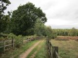
Bridleway to Normanton Larches on The Robin Hood Way / Richard Croft, 12 Feb. 2011, Creative Commons, via Geograph.
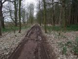
The Robin Hood Way through Normanton Larches / Richard Croft, 12 Feb. 2011, Creative Commons, via Geograph.
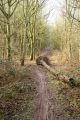
A minor detour required on The Robin Hood Way in Normanton Larches / Richard Croft, 14 Feb. 2011, Creative Commons, via Geograph.
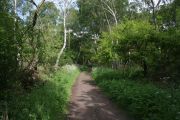
The Robin Hood Way, Sherwood Forest / Kate Jewell, 31 May 2009, Creative Commons, via Geograph.
Robin Hood Way along West Drayton Avenue / Tim Heaton, 14 Mar. 2009, Creative Commons, via Geograph.
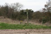
Bridleway junction on The Robin Hood Way / Richard Croft, 12 Feb. 2011, Creative Commons, via Geograph.
Robin Hood Way towards Duncan Wood / Tim Heaton, 19 Sep. 2009, Creative Commons, via Geograph.
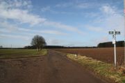
Robin Hood Way and the A614 / Jonathan Thacker, 10 June 2011, Creative Commons, via Geograph.
Path crossing the Robin Hood Way / Chris, 17 Mar. 2014, Creative Commons, via Geograph.
Robin Hood Way south of Haughton Hall Farm / Tim Heaton, 12 Apr. 2009, Creative Commons, via Geograph.
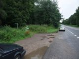
Robin Hood Way alongside the A614 / Tim Heaton, 12 Apr. 2009, Creative Commons, via Geograph.
Robin Hood Way following the lane from Holbeck Woodhouse towards Holbeck; Chapel of St Winifred on the left / Tim Heaton, Creative Commons, via Geograph and Wikipedia.
On the Robin Hood Way: a long-distance path that meanders across Nottinghamshire, linking places connected with the Robin Hood tradition. / Graham Hogg, 30 Mar. 2015, Creative Commons, via Geograph.
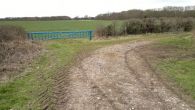
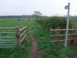
Blue gate by Robin Hood Way / Chris Morgan, 30 Mar. 2015, Creative Commons, via Geograph.
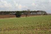
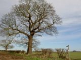
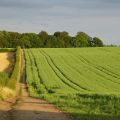
Farmland view from The Robin Hood Way near Clumber Park / Richard Croft, 12 Feb. 2011, Creative Commons, via Geograph.
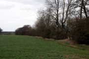
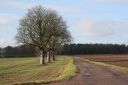
Farmland beside the Robin Hood Way / Graham Hogg, 30 Mar. 2015, Creative Commons, via Geograph.
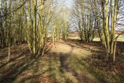
The Robin Hood Way in the copse beside the A614 / Richard Croft, 12 Feb. 2011, Creative Commons, via Geograph.
Robin Hood Way south of Edwinstowe / David Lally, 5 July 2014, Creative Commons, via Geograph.
Robin Hood Way through Normanton Larches / John Slater, 4 Oct. 2015, Creative Commons, via Geograph.


