
Robin Hood Way (Kingston-upon-Thames) (2): Difference between revisions
From International Robin Hood Bibliography
m (Text replacement - "|service=leaflet}}" to "|service=leaflet|enablefullscreen=yes}}") |
m (Text replacement - "Creative Commons via Geograph" to "Creative Commons, via Geograph") |
||
| Line 1: | Line 1: | ||
__NOTOC__{{PnItemTop|Lat=51.430831|Lon=-0.256965|AdmDiv=Surrey|Vicinity=Kingston Vale|Type=Thoroughfare|Interest=Robin Hood name|Status=Extant|Demonym=English|Riding=|GreaterLondon=Yes|Year=|Aka=|Century=|Cluster1=Kingston Vale|Cluster2=|Cluster3=|Image=geograph-2479227-by-Alex-McGregor.jpg|Postcards=|ExtraCat1=|ExtraCat2=|ExtraCat3=|ExtraCat4=|ExtraCat5=|ExtraLink1=Robin Hood Way (Kingston-upon-Thames) (1)|ExtraLink2=|ExtraLink3=|ExtraLink4=|ExtraLink5=|ExtraLinkName1=|ExtraLinkName2=|ExtraLinkName3=|ExtraLinkName4=|ExtraLinkName5=|GeopointPrefix=|GeopointSuffix=|StatusSuffix=|DatePrefix=|DateSuffix=}} | __NOTOC__{{PnItemTop|Lat=51.430831|Lon=-0.256965|AdmDiv=Surrey|Vicinity=Kingston Vale|Type=Thoroughfare|Interest=Robin Hood name|Status=Extant|Demonym=English|Riding=|GreaterLondon=Yes|Year=|Aka=|Century=|Cluster1=Kingston Vale|Cluster2=|Cluster3=|Image=geograph-2479227-by-Alex-McGregor.jpg|Postcards=|ExtraCat1=|ExtraCat2=|ExtraCat3=|ExtraCat4=|ExtraCat5=|ExtraLink1=Robin Hood Way (Kingston-upon-Thames) (1)|ExtraLink2=|ExtraLink3=|ExtraLink4=|ExtraLink5=|ExtraLinkName1=|ExtraLinkName2=|ExtraLinkName3=|ExtraLinkName4=|ExtraLinkName5=|GeopointPrefix=|GeopointSuffix=|StatusSuffix=|DatePrefix=|DateSuffix=}} | ||
{{#display_map:{{#var:Coords}}~{{#replace:{{PAGENAME}}|'|'}}|width=34%|service=leaflet|enablefullscreen=yes}}<div class="pnMapLegend">Robin Hood Way.</div> | {{#display_map:{{#var:Coords}}~{{#replace:{{PAGENAME}}|'|'}}|width=34%|service=leaflet|enablefullscreen=yes}}<div class="pnMapLegend">Robin Hood Way.</div> | ||
[[File:{{#var:Pnimage}}|thumb|right|500px|Robin Hood Way / [https://www.geograph.org.uk/photo/2479227 Alex McGregor, 7 June 2011, Creative Commons via Geograph.]]] | [[File:{{#var:Pnimage}}|thumb|right|500px|Robin Hood Way / [https://www.geograph.org.uk/photo/2479227 Alex McGregor, 7 June 2011, Creative Commons, via Geograph.]]] | ||
<p id="byline">By Henrik Thiil Nielsen, 2013-08-07. Revised by {{#realname:{{REVISIONUSER}}}}, {{REVISIONYEAR}}-{{REVISIONMONTH}}-{{REVISIONDAY2}}.</p> | <p id="byline">By Henrik Thiil Nielsen, 2013-08-07. Revised by {{#realname:{{REVISIONUSER}}}}, {{REVISIONYEAR}}-{{REVISIONMONTH}}-{{REVISIONDAY2}}.</p> | ||
<div class="no-img"> | <div class="no-img"> | ||
| Line 11: | Line 11: | ||
{{ImgGalleryIntro}} | {{ImgGalleryIntro}} | ||
<gallery widths="195px"> | <gallery widths="195px"> | ||
File:geograph-2479227-by-Alex-McGregor.jpg|Robin Hood Way / [https://www.geograph.org.uk/photo/2479227 Alex McGregor, 7 June 2011, Creative Commons via Geograph.] | File:geograph-2479227-by-Alex-McGregor.jpg|Robin Hood Way / [https://www.geograph.org.uk/photo/2479227 Alex McGregor, 7 June 2011, Creative Commons, via Geograph.] | ||
File:robin-hood-way-kingston-vale-google-earth-street-view.jpg|Robin Hood Way / Google Earth Street View. | File:robin-hood-way-kingston-vale-google-earth-street-view.jpg|Robin Hood Way / Google Earth Street View. | ||
</gallery> | </gallery> | ||
{{PnItemNav}} | {{PnItemNav}} | ||
Revision as of 11:21, 30 May 2019
Robin Hood Way.
[[File:|thumb|right|500px|Robin Hood Way / Alex McGregor, 7 June 2011, Creative Commons, via Geograph.]]
By Henrik Thiil Nielsen, 2013-08-07. Revised by Henrik Thiil Nielsen, 2019-05-30.
'Robin Hood Way' is the name of a stretch of the A3 between Wimbledon and Kingston Vale. A residential street in the vicinity was apparently also named Robin Hood Way during the years c. 1944-46. See Robin Hood Way (Kingston-upon-Thames) (1).
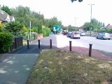
Robin Hood Way / Alex McGregor, 7 June 2011, Creative Commons, via Geograph.
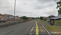
Robin Hood Way / Google Earth Street View.

