Robin Hood Junction (Robin Hood, Wakefield): Difference between revisions
From International Robin Hood Bibliography
m (Text replacement - "VicinitySuffix=|" to "") |
m (Text replacement - "<!-- {{ImgGalleryIntro}} <gallery widths="195px"> FOR EACH IMAGE: File:_FILENAME.jpg|_LEGEND / [_URL _PHOTOGRAPHER, _DAY _MON. _YEAR, Creative Commons.] </gallery>-->" to "") |
||
| Line 23: | Line 23: | ||
<references/> | <references/> | ||
</div | </div> | ||
{{PnItemNav}} | {{PnItemNav}} | ||
Revision as of 02:57, 18 December 2017
Approximate site of Robin Hood Junction.
By Henrik Thiil Nielsen, 2016-12-31. Revised by Henrik Thiil Nielsen, 2017-12-18.
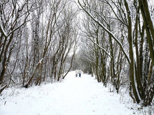
Robin Hood Junction in the village of Robin Hood, Wakefield, on the East and West Yorkshire Union Railway, is first recorded, as far as I know, on the 6" O.S. map of the area published in 1908. The railway was established in 1891 and extended a few years later. It closed in 1966.[1] As seen in the photo below the tarcks have now been replaced by a nice footpath.
Maps
- 6" O.S. map Yorkshire 233 (1854; rev. 1848-51)
- 6" O.S. map Yorkshire CCXXXIII.NE (1894; rev. 1892)
- 6" O.S. map Yorkshire CCXXXIII.NE 1908; rev. 1905)
- 6" O.S. map Yorkshire CCXXXIII.NE (1908; rev. 1905) (georeferenced)
- 6" O.S. map Yorkshire CCXXXIII.NE (1931; rev. 1931-32) [Sic]
- 6" O.S. map Yorkshire CCXXXIII.NE (1947; rev. 1938)
- 6" O.S. map Yorkshire CCXXXIII.NE (1949; rev. 1948).

