Robin Hood Inn (Mirfield)
From International Robin Hood Bibliography
Approximate indication of the site of the Robin Hood.
By Henrik Thiil Nielsen, 2017-01-11. Revised by Henrik Thiil Nielsen, 2018-07-12.
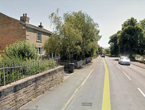
The Robin Hood Inn is indicated on a 6" O.S. map of the area published in 1855, based on surveying done in 1850-51. The last 6" O.S. map to label the inn as such is one published 1908, based on surveying done in 1905 (see Maps section below). I think the house show in the Google Earth Street View photo displayed elsewhere on this page was the Robin Hood more than a hundred years ago.
Gazetteers
- Not included in Dobson, R. B., ed.; Taylor, J., ed. Rymes of Robyn Hood: an Introduction to the English Outlaw (London, 1976), pp. 293-311.
Maps
- 6" O.S. map Yorkshire 247 (1855; surveyed 1850-51) ("The Robin Hood Inn")
- 6" O.S. map Yorkshire 247 (1894; rev. 1888-92) ("Inn")
- 6" O.S. map Yorkshire CCXLVII.NW (1908; rev. 1905) ("Robin Hood Inn")
- 6" O.S. map Yorkshire CCXLVII.NW (1908; rev. 1905) (georeferenced)
- 6" O.S. map Yorkshire CCXLVII.NW (1930; rev. 1930-31) [sic] (inn not indicated)
- 6" O.S. map Yorkshire CCXLVII.NW (1947; rev. 1938) (inn not indicated)
- 6" O.S. map Yorkshire CCXLVII.NW (1949; rev. 1948) (inn not indicated).

