From International Robin Hood Bibliography
The printable version is no longer supported and may have rendering errors. Please update your browser bookmarks and please use the default browser print function instead.
| Locality |
|---|
| Coordinate |
51.313844, -0.597371 |
|---|
| Adm. div. |
Surrey |
|---|
| Vicinity |
Side street of Robin Hood Road near St John's, Woking |
|---|
| Type |
Thoroughfare |
|---|
| Interest |
Robin Hood name |
|---|
| Status |
Extant |
|---|
| First Record |
|
|---|
Loading map...
{"minzoom":false,"maxzoom":false,"mappingservice":"leaflet","width":"34%","height":"400px","centre":false,"title":"","label":"","icon":"","lines":[],"polygons":[],"circles":[],"rectangles":[],"copycoords":false,"static":false,"zoom":false,"defzoom":9,"layers":["OpenStreetMap","NLS","Stamen.Terrain"],"image layers":[],"overlays":[],"resizable":false,"fullscreen":true,"scrollwheelzoom":true,"cluster":false,"clustermaxzoom":20,"clusterzoomonclick":true,"clustermaxradius":80,"clusterspiderfy":true,"geojson":"","clicktarget":"","imageLayers":[],"locations":[{"text":"\u003Cdiv class=\"mw-parser-output\"\u003E\u003Cp\u003ERobin Hood Close (St John's, Woking)\n\u003C/p\u003E\u003C/div\u003E","title":"Robin Hood Close (St John's, Woking)\n","link":"","lat":51.313844,"lon":-0.597371,"icon":""}],"imageoverlays":null}
Robin Hood Close.
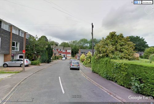
Robin Hood Close / Google Earth Street View.
By Henrik Thiil Nielsen, 2017-11-20. Revised by Henrik Thiil Nielsen, 2021-01-07.
The small residential street Robin Hood Close is a side street of Robin Hood Road near St John's, Woking.
Gazetteers
Background
Also see

