Robin Hood Close (Giggleswick)
| Locality | |
|---|---|
| Coordinates | ?54.094051, -2.282371 |
| Adm. div. | West Riding of Yorkshire |
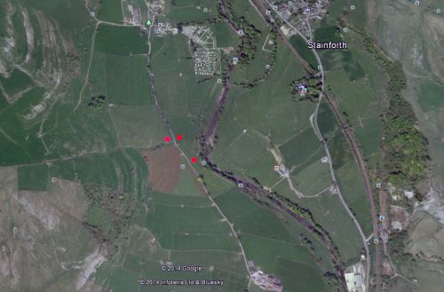
| Vicinity | ?1 km NNE of Stackhouse, between the Ribble and Stainforth Lane |
| Type | Area |
| Interest | Robin Hood name |
| Status | Defunct? |
| First Record | 1845 |


By Henrik Thiil Nielsen, 2014-08-27. Revised by Henrik Thiil Nielsen, 2017-05-08.
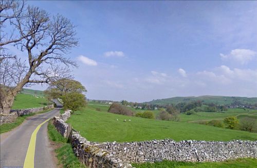
A.H. Smith, citing an 1845 tithe award as his source, lists Robin Hood Close as a field-name under Giggleswick.[1] It seems not unlikely this was another name for Robin Hood's Pasture, which is indicated on an 1851 O.S. 6" map of the Stainforth area[2] (formerly West Riding, now North Yorkshire). The Pasture is bordered on the west by Stainforth Lane, and on the east by the Ribble. With access to the tithe award it would no doubt be easy to tell whether Robin Hood Close and Robin Hood's Pasture are in fact two names for the same enclosed field. Immediately north or northwest of Robin Hood's Pasture, Robin Hood's Mill is indicated on the 6" map just referred to. Robin Hood's Pasture is not indicated on the O.S. 6" maps of 1896 and 1910 (see Maps section below).
Gazetteers
- Not included in Dobson, R. B., ed.; Taylor, J., ed. Rymes of Robyn Hood: an Introduction to the English Outlaw (London, 1976), pp. 293-311.
Maps
- 6" O.S. Map Sheet 132 (1851, surveyed 1847) (Robin Hood's Pasture indicated).
- 6" O.S. Map Yorkshire Sheet CXXXII (1896, surveyed 1893-94) (Robin Hood's Pasture not indicated).
- 6" O.S. Map CXXXII.NW (1910, surveyed 1907) (Robin Hood's Pasture not indicated).
Sources
- Smith, A.H. The Place-Names of the West Riding of Yorkshire (English Place-Name Society, vols. XXX-XXXVII) (Cambridge, 1961-63), vol. VI, p. 146.
Also see
- Stainforth place-name cluster
- Robin Hood's Pasture (Stackhouse)
- Robin Hood's Mill (Stackhouse)
- Places named Robin Hood's Close.
Notes
- ↑ Smith, A.H. The Place-Names of the West Riding of Yorkshire (English Place-Name Society, vols. XXX-XXXVII) (Cambridge, 1961-63), vol. VI, p. 146.
- ↑ 6" O.S. Map Sheet 132. (1851, surveyed 1847)
Template:BeforeNavTemplate:NavTemplate:PreviousWest Riding of Yorkshire place-namesTemplate:BeforeNavTemplate:NavTemplate:Next
Template:BeforeNavTemplate:NavTemplate:PreviousYorkshire place-namesTemplate:BeforeNavTemplate:NavTemplate:Next
Template:BeforeNavTemplate:NavTemplate:PreviousPlace-namesTemplate:BeforeNavTemplate:NavTemplate:Next"th" can not be assigned to a declared number type with value 19.
