From International Robin Hood Bibliography
The printable version is no longer supported and may have rendering errors. Please update your browser bookmarks and please use the default browser print function instead.
| Locality |
|---|
| Coordinate |
53.397492, -1.542933 |
|---|
| Adm. div. |
West Riding of Yorkshire |
|---|
| Vicinity |
c. 5 km NW of Sheffield |
|---|
| Type |
Thoroughfare |
|---|
| Interest |
Robin Hood name |
|---|
| Status |
Extant |
|---|
| First Record |
|
|---|
Loading map...
{"minzoom":false,"maxzoom":false,"mappingservice":"leaflet","width":"34%","height":"400px","centre":false,"title":"","label":"","icon":"","lines":[],"polygons":[],"circles":[],"rectangles":[],"copycoords":false,"static":false,"zoom":false,"defzoom":9,"layers":["OpenStreetMap","NLS","Stamen.Terrain"],"image layers":[],"overlays":[],"resizable":false,"fullscreen":true,"scrollwheelzoom":true,"cluster":false,"clustermaxzoom":20,"clusterzoomonclick":true,"clustermaxradius":80,"clusterspiderfy":true,"geojson":"","clicktarget":"","imageLayers":[],"locations":[{"text":"\u003Cdiv class=\"mw-parser-output\"\u003E\u003Cp\u003ERobin Hood Chase (Stannington)\n\u003C/p\u003E\u003C/div\u003E","title":"Robin Hood Chase (Stannington)\n","link":"","lat":53.397492,"lon":-1.542933,"icon":""}],"imageoverlays":null}
Robin Hood Chase.
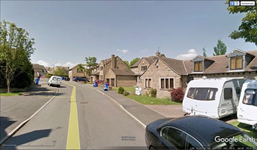
Robin Hood Chase, Stannington / Google Earth Street View.
By Henrik Thiil Nielsen, 2013-08-07. Revised by Henrik Thiil Nielsen, 2021-01-06.
Robin Hood Chase is a street in Stannington, immediately south of River Loxley. Just south of it is a possibly related Friar Close (Stannington). The houses in the street seem to be of late 20th century date.
Gazetteers
Also see

