
Robin Hood Beck (Bassenthwaite)

By Henrik Thiil Nielsen, 2017-09-09. Revised by Henrik Thiil Nielsen, 2020-05-17.
Robin Hood Beck in Bassenthwaite has its origin c. 150 m NE of the Robin Hood (Bassenthwaite) vicinity or passes the latter there. It runs under the road to Uldale at Robin Hood Beck Bridge, c. 1.3 km NE of Castle Inn on the B5291 and c. 600 m NNW of 'Robin Hood'. The only source I have found for this river name is the title of a 2005 photo by John Holmes on the Geograph site.[1] He seems to know the area well,[2] so most probably the name is in local use. Template:PnItemQry
Gazetteers
- Not included in Dobson, R. B., ed.; Taylor, J., ed. Rymes of Robyn Hood: an Introduction to the English Outlaw (London, 1976), pp. 293-311.
Sources
Maps
- 6" O.S. map Cumberland XLVI (1867; surveyed 1864-65)
- 6" O.S. map Cumberland XLVI.SE (1900; rev. 1898)
- 6" O.S. map Cumberland XLVI.SE (1900; rev. 1898) (georeferenced)
- 6" O.S. map Cumberland XLVI.SE (1926; rev. 1923).
Background
Notes
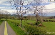
Upstream: Robin Hood Beck c. 150 m NE of 'Robin Hood' / Google Earth Street View.
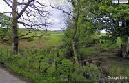
Downstream: Robin Hood Beck at Robin Hood Beck Bridge, south side of road / Google Earth Street View.
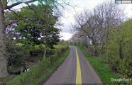
Downstream: Robin Hood Beck at Robin Hood Beck Bridge, north side of road / Google Earth Street View.

