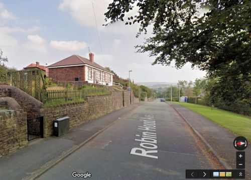
Robin Hood Avenue (Sutton)
From International Robin Hood Bibliography
Robin Hood Avenue.
By Henrik Thiil Nielsen, 2017-01-19. Revised by Henrik Thiil Nielsen, 2019-04-05.
Very likely the name of this street in the south of Macclesfield, a little west of Sutton, was inspired by the presence, at least as late as 1938, of (what was probably) a farmstead named 'Robinhood' in the immediate vicinity. On the latest of the O.S. maps listed below, the avenue seems to be indicated as a projected street, but it does not yet have a name.
Gazetteers
- Not included in Dobson, R. B., ed.; Taylor, J., ed. Rymes of Robyn Hood: an Introduction to the English Outlaw (London, 1976), pp. 293-311
- Not included in Dodgson, John McN.; Rumble, Alexander R. The Place-Names of Cheshire, pts. I-V (English Place-Name Society, vols. XLIV-XLVIII, LIV, LXXIV) (Cambridge, 1970-72; [s.l.], 1981; Nottingham, 1997).
Maps
Maps of the area; Robin Hood Avenue not indicated as it did not yet exist.
- 6" O.S. map Cheshire XXXVI (1882; surveyed 1871-72)
- 6" O.S. map Cheshire XXXVI.SE (1898; rev. 1896-97)
- 6" O.S. map Cheshire XXXVI.SE (1898; rev. 1896-97) (georeferenced)
- 6" O.S. map Cheshire XXXVI.SE (1910; rev. 1907)
- 6" O.S. map Cheshire XXXVI.SE (c. 1933; rev. 1907)
- 6" O.S. map Cheshire XXXVI.SE (c. 1937; rev. 1907)
- 6" O.S. map Cheshire XXXVI.SE (c. 1944; rev. c. 1938).

