From International Robin Hood Bibliography
The printable version is no longer supported and may have rendering errors. Please update your browser bookmarks and please use the default browser print function instead.
| Locality |
|---|
| Coordinate |
53.602132, -1.443591 |
|---|
| Adm. div. |
West Riding of Yorkshire |
|---|
| Vicinity |
750 m ESE of center of Royston |
|---|
| Type |
Thoroughfare |
|---|
| Interest |
Robin Hood name |
|---|
| Status |
Extant |
|---|
| First Record |
|
|---|
Loading map...
{"minzoom":false,"maxzoom":false,"mappingservice":"leaflet","width":"34%","height":"400px","centre":false,"title":"","label":"","icon":"","lines":[],"polygons":[],"circles":[],"rectangles":[],"copycoords":false,"static":false,"zoom":false,"defzoom":9,"layers":["OpenStreetMap","NLS","Stamen.Terrain"],"image layers":[],"overlays":[],"resizable":false,"fullscreen":true,"scrollwheelzoom":true,"cluster":false,"clustermaxzoom":20,"clusterzoomonclick":true,"clustermaxradius":80,"clusterspiderfy":true,"geojson":"","clicktarget":"","imageLayers":[],"locations":[{"text":"\u003Cdiv class=\"mw-parser-output\"\u003E\u003Cp\u003ERobin Hood Avenue (Royston, Barnsley)\n\u003C/p\u003E\u003C/div\u003E","title":"Robin Hood Avenue (Royston, Barnsley)\n","link":"","lat":53.602132,"lon":-1.443591,"icon":""}],"imageoverlays":null}
Robin Hood Avenue.
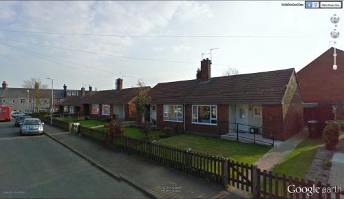
Robin Hood Avenue / Google Earth Street View.
By Henrik Thiil Nielsen, 2014-10-19. Revised by Henrik Thiil Nielsen, 2021-01-06.
Robin Hood Avenue, a street in a residential area in Royston – now a suburban village within the Metropolitan borough of Barnsley, located c. 14 km SW of Wentbridge – runs along the western boundary of an area that was once a field of arable known as 'Robin Hood'.
Gazetteers
Also see

