Robin Hood (Wisbech): Difference between revisions
From International Robin Hood Bibliography
mNo edit summary |
m (Text replacement - "No Copy in NLS" to "No copy in NLS") |
||
| (17 intermediate revisions by the same user not shown) | |||
| Line 1: | Line 1: | ||
__NOTOC__{{ | __NOTOC__{{PlaceNamesItemTop|Lat=52.665111|Lon=0.160970|AdministrativeDivision=Cambridgeshire|Vicinity=At the Market Place|Type=Public house|Interest=Robin Hood name| | ||
Status=Defunct|Demonym=|Riding=|GreaterLondon=|Year=1850|Aka=|Century=19|Cluster1=|Cluster2=|Cluster3=|Image=robin-hood-wisbech-google-earth-street-view.jpg|Postcards=|ExtraCat1=|ExtraCat2=|ExtraCat3=|ExtraCat4=|ExtraCat5=|ExtraLink1=|ExtraLink2=|ExtraLink3=|ExtraLink4=|ExtraLink5=|ExtraLinkName1=|ExtraLinkName2=|ExtraLinkName3=|ExtraLinkName4=|ExtraLinkName5=|GeopointPrefix=|GeopointSuffix=|VicinitySuffix=|StatusSuffix=|DatePrefix=|DateSuffix=}} | Status=Defunct|Demonym=|Riding=|GreaterLondon=|Year=1850|Aka=|Century=19|Cluster1=|Cluster2=|Cluster3=|Image=robin-hood-wisbech-google-earth-street-view.jpg|Postcards=|ExtraCat1=|ExtraCat2=|ExtraCat3=|ExtraCat4=|ExtraCat5=|ExtraLink1=|ExtraLink2=|ExtraLink3=|ExtraLink4=|ExtraLink5=|ExtraLinkName1=|ExtraLinkName2=|ExtraLinkName3=|ExtraLinkName4=|ExtraLinkName5=|GeopointPrefix=|GeopointSuffix=|VicinitySuffix=|StatusSuffix=|DatePrefix=|DateSuffix=}} | ||
{{#display_map:{{#var:Coords}}~{{#replace:{{PAGENAME}}|'|'}}|width=34% | {{#display_map:{{#var:Coords}}~{{#replace:{{PAGENAME}}|'|'}}|width=34%|enablefullscreen=yes}}<div class="pnMapLegend">The Market Place in Wisbech, where the Robin Hood was located.</div> | ||
[[File:{{#var: | [[File:{{#var:Image}}|thumb|right|500px|The Market Place in Wisbech / Google Earth street View.]]<div class="no-img"> | ||
<p id="byline">By Henrik Thiil Nielsen, 2017-12-20. Revised by {{#realname:{{REVISIONUSER}}}}, {{REVISIONYEAR}}-{{REVISIONMONTH}}-{{REVISIONDAY2}}.</p | <p id="byline">By Henrik Thiil Nielsen, 2017-12-20. Revised by {{#realname:{{REVISIONUSER}}}}, {{REVISIONYEAR}}-{{REVISIONMONTH}}-{{REVISIONDAY2}}.</p> | ||
An 1850 trade directory lists a pub named the Robin Hood at the market place in Wisbech. The proprietor was then a George Cole Thurston.<ref>{{:Slater, Isaac 1850a}}, p. 55 of the Cambridgeshire section.</ref> | An 1850 trade directory lists a pub named the Robin Hood at the market place in Wisbech. The proprietor was then a George Cole Thurston.<ref>{{:Slater, Isaac 1850a}}, p. 55 of the Cambridgeshire section.</ref> | ||
{{ | |||
Some of the O.S. maps listed below indicate inns and a hotel on the perimeter of the Market Place, but they include no names.{{PlaceNamesItemAllusionsAndRecords}} | |||
== Gazetteers == | == Gazetteers == | ||
* Not included in {{:Dobson, Richard Barrie 1976a}}, pp. 293-311. | * Not included in {{:Dobson, Richard Barrie 1976a}}, pp. 293-311. | ||
| Line 11: | Line 13: | ||
== Sources == | == Sources == | ||
* {{:Slater, Isaac 1850a}}, p. 55 of the Cambridgeshire section. | * {{:Slater, Isaac 1850a}}, p. 55 of the Cambridgeshire section. | ||
== Maps == | |||
* | * 25" O.S. map ''Cambridgeshire'' VII.3 (1888; surveyed 1885). No copy in NLS | ||
* [https://maps.nls.uk/geo/explore/#zoom=18&lat=52.6652&lon=0.1606&layers=168&b=5 25" O.S. map ''Cambridgeshire'' VII.3 (1902; rev. 1900)] (georeferenced) | |||
* | * [https://maps.nls.uk/view/114484231#zoom=5&lat=5288&lon=11230&layers=BT 25" O.S. map ''Cambridgeshire'' VII.3 (1902; rev. 1900)] | ||
* [https://maps.nls.uk/view/114484234#zoom=5&lat=5221&lon=11242&layers=BT 25" O.S. map ''Cambridgeshire'' VII.3 (1927; rev. 1925)] | |||
* [https://maps.nls.uk/view/101570680#zoom=5&lat=4725&lon=3420&layers=BT 6" O.S. map ''Cambridgeshire'' VII.NE (1887; surveyed 1886)] | |||
* [https://maps.nls.uk/geo/explore/#zoom=18&lat=52.6651&lon=0.1606&layers=6&b=5 6" O.S. map ''Cambridgeshire'' VII.NE (1903; rev. 1900)] (georeferenced) | |||
* [https://maps.nls.uk/view/101570677#zoom=6&lat=4769&lon=3436&layers=BT 6" O.S. map ''Cambridgeshire'' VII.NE (1903; rev. 1900)] | |||
* [https://maps.nls.uk/view/101570674#zoom=6&lat=4784&lon=3335&layers=BT 6" O.S. map ''Cambridgeshire'' VII.NE (1927; rev. 1925)] | |||
* [https://maps.nls.uk/view/101570671#zoom=6&lat=4805&lon=3384&layers=BT 6" O.S. map ''Cambridgeshire'' VII.NE (''c.'' 1933; rev. 1925)] | |||
* [https://maps.nls.uk/view/101570668#zoom=6&lat=4752&lon=3388&layers=BT 6" O.S. map ''Cambridgeshire'' VII.NE (''c.'' 1946; rev. 1938)] | |||
* [https://maps.nls.uk/view/101570665#zoom=6&lat=4849&lon=3437&layers=BT 6" O.S. map ''Cambridgeshire'' VII.NE (1953; rev. 1950).] | |||
== Background == | |||
* [https://en.wikipedia.org/wiki/Wisbech Wikipedia: Wisbech.] | |||
{{ | {{PlaceNamesItemAlsoSee}} | ||
== Notes == | == Notes == | ||
| Line 25: | Line 38: | ||
{{ | {{PlaceNamesItemNavigation}} | ||
Latest revision as of 01:11, 13 February 2021
| Locality | |
|---|---|
| Coordinate | 52.665111, 0.16097 |
| Adm. div. | Cambridgeshire |
| Vicinity | At the Market Place |
| Type | Public house |
| Interest | Robin Hood name |
| Status | Defunct |
| First Record | 1850 |
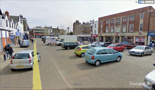
The Market Place in Wisbech, where the Robin Hood was located.
By Henrik Thiil Nielsen, 2017-12-20. Revised by Henrik Thiil Nielsen, 2021-02-13.
An 1850 trade directory lists a pub named the Robin Hood at the market place in Wisbech. The proprietor was then a George Cole Thurston.[1]
Some of the O.S. maps listed below indicate inns and a hotel on the perimeter of the Market Place, but they include no names.
Gazetteers
- Not included in Dobson, R. B., ed.; Taylor, J., ed. Rymes of Robyn Hood: an Introduction to the English Outlaw (London, 1976), pp. 293-311.
Sources
- Slater, Isaac, compil. Slater's (Late Pigot & Co.) Royal National and Commercial Directory and Topography of the Counties of Bedfordshire, Buckinghamshire, Cambridgeshire, Huntingdonshire, Norfolk, Oxfordshire, and Suffolk (Manchester and London, 1850), p. 55 of the Cambridgeshire section.
Maps
- 25" O.S. map Cambridgeshire VII.3 (1888; surveyed 1885). No copy in NLS
- 25" O.S. map Cambridgeshire VII.3 (1902; rev. 1900) (georeferenced)
- 25" O.S. map Cambridgeshire VII.3 (1902; rev. 1900)
- 25" O.S. map Cambridgeshire VII.3 (1927; rev. 1925)
- 6" O.S. map Cambridgeshire VII.NE (1887; surveyed 1886)
- 6" O.S. map Cambridgeshire VII.NE (1903; rev. 1900) (georeferenced)
- 6" O.S. map Cambridgeshire VII.NE (1903; rev. 1900)
- 6" O.S. map Cambridgeshire VII.NE (1927; rev. 1925)
- 6" O.S. map Cambridgeshire VII.NE (c. 1933; rev. 1925)
- 6" O.S. map Cambridgeshire VII.NE (c. 1946; rev. 1938)
- 6" O.S. map Cambridgeshire VII.NE (1953; rev. 1950).
Background
Also see
Notes

