
Robin Hood (Leather Lane, Holborn): Difference between revisions
m (Text replacement - "|service=leaflet}}" to "|service=leaflet|enablefullscreen=yes}}") |
m (→Maps) |
||
| Line 17: | Line 17: | ||
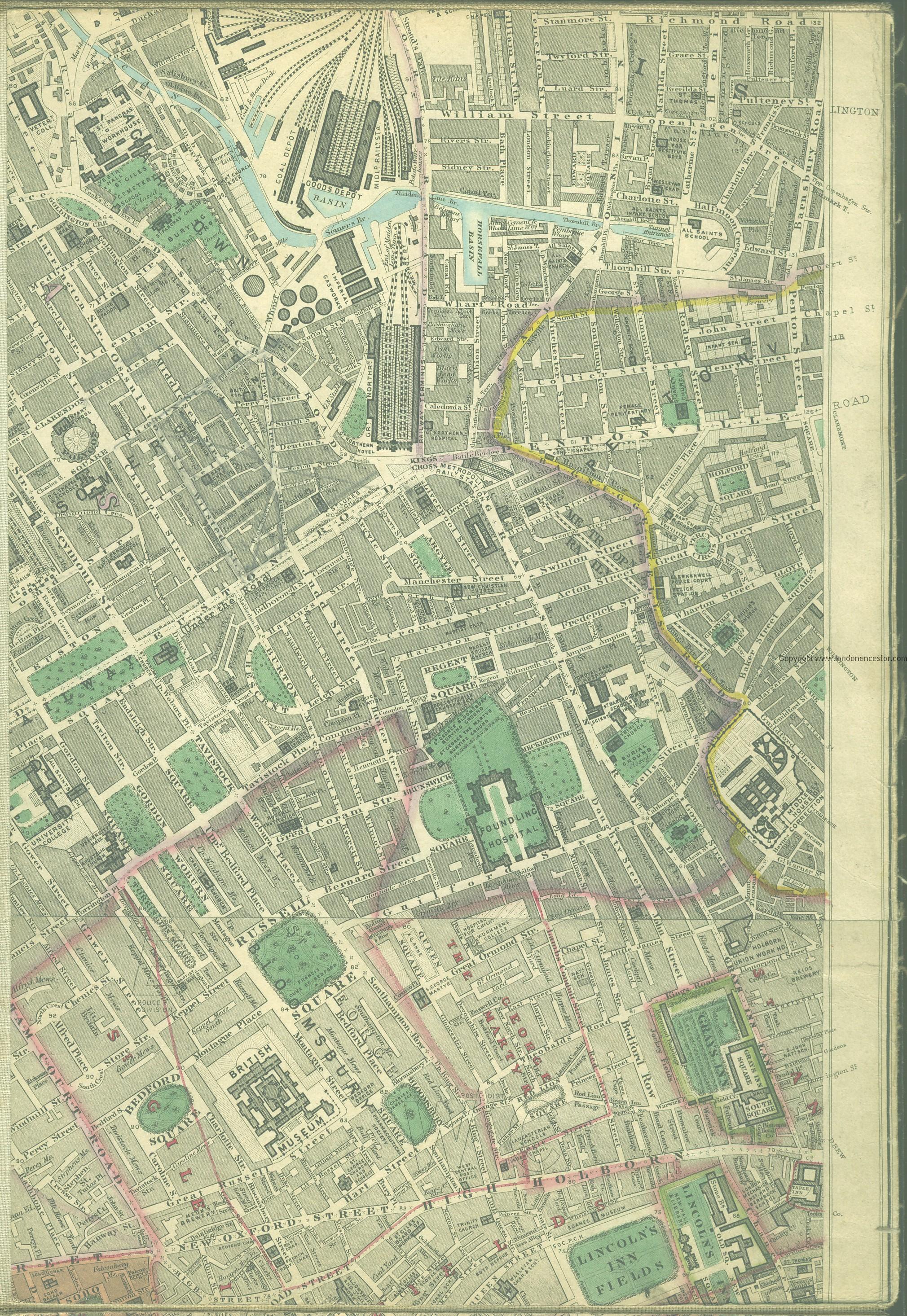
* [http://www.mappalondon.com/london/north-west/bloomsbury.jpg Edward Stanford's ''Library Map of London'' (1862-71), Bloomsbury section] | * [http://www.mappalondon.com/london/north-west/bloomsbury.jpg Edward Stanford's ''Library Map of London'' (1862-71), Bloomsbury section] | ||
* [http://maps.nls.uk//view/103313321#zoom=5&lat=9026&lon=7969&layers=BT 25" O.S. map ''London'' XXVI (1936; rev. 1914)] | * [http://maps.nls.uk//view/103313321#zoom=5&lat=9026&lon=7969&layers=BT 25" O.S. map ''London'' XXVI (1936; rev. 1914)] | ||
* [http://maps.nls.uk/geo/explore/#zoom=18&lat=51.5189&lon=-0.1089&layers=168&b=5 25" O.S. map ''London'' (1915- Numbered sheets) V.10 (1936; rev. 1914)] (georeferenced) | * [http://maps.nls.uk/geo/explore/#zoom=18&lat=51.5189&lon=-0.1089&layers=168&b=5 25" O.S. map ''London'' (1915- Numbered sheets) V.10 (1936; rev. 1914)] (georeferenced) | ||
* [http://maps.nls.uk//view/102345964#zoom=6&lat=5018&lon=5624&layers=BT 6" O.S. map ''Middlesex'' XVII (1880-82; surveyed 1868-73)] | * [http://maps.nls.uk//view/102345964#zoom=6&lat=5018&lon=5624&layers=BT 6" O.S. map ''Middlesex'' XVII (1880-82; surveyed 1868-73)] | ||
* [http://maps.nls.uk//view/102347415#zoom=6&lat=9552&lon=4726&layers=BT 6" O.S. map ''Surrey'' III (1880; surveyed 1868-73)] | * [http://maps.nls.uk//view/102347415#zoom=6&lat=9552&lon=4726&layers=BT 6" O.S. map ''Surrey'' III (1880; surveyed 1868-73)] | ||
* [http://maps.nls.uk//view/91617035#zoom=5&lat=5674&lon=6089&layers=BT 6" O.S. map ''London'' VII.SW (1894-96; rev. 1893-95)] | * [http://maps.nls.uk//view/91617035#zoom=5&lat=5674&lon=6089&layers=BT 6" O.S. map ''London'' VII.SW (1894-96; rev. 1893-95)] | ||
* [http://maps.nls.uk//view/101436343#zoom=5&lat=5592&lon=4378&layers=BT 6" O.S. map ''Surrey'' III.NW (1898; rev. 1893-95)] | * [http://maps.nls.uk//view/101436343#zoom=5&lat=5592&lon=4378&layers=BT 6" O.S. map ''Surrey'' III.NW (1898; rev. 1893-95)] | ||
* [http://maps.nls.uk/geo/explore/#zoom=17&lat=51.5188&lon=-0.1088&layers=6&b=5 6" O.S. map ''Surrey'' III.NW (1898; rev. 1893-95)] (georeferenced) | * [http://maps.nls.uk/geo/explore/#zoom=17&lat=51.5188&lon=-0.1088&layers=6&b=5 6" O.S. map ''Surrey'' III.NW (1898; rev. 1893-95)] (georeferenced) | ||
* [http://maps.nls.uk//view/102345864#zoom=6&lat=5545&lon=6035&layers=BT 6" O.S. map ''London'' sheet K (1920; rev. 1913-14)] | * [http://maps.nls.uk//view/102345864#zoom=6&lat=5545&lon=6035&layers=BT 6" O.S. map ''London'' sheet K (1920; rev. 1913-14)] | ||
* [http://maps.nls.uk//view/102345861#zoom=6&lat=5771&lon=5895&layers=BT 6" O.S. map ''London'' sheet K (''c.'' 1946; rev. 1938).] | * [http://maps.nls.uk//view/102345861#zoom=6&lat=5771&lon=5895&layers=BT 6" O.S. map ''London'' sheet K (''c.'' 1946; rev. 1938).] | ||
Revision as of 17:03, 31 May 2019
[[File:|thumb|right|500px|The Robin Hood was originally, perhaps always, located somewhere around this area shown in the photo / Google Earth Street View.]]
By Henrik Thiil Nielsen, 2018-01-21. Revised by Henrik Thiil Nielsen, 2019-05-31.
The Robin Hood or Robin Hood and Little John in Leather Lane existed from at least 1767 to 1910. The street number seems to have varied. First the pub was at No. 8, then 9 and by 1895 No. 10 Leather Lane.[1] In 1786, the pub was located on the east side of the lane, for asked about its location in relation to Robin Hood Yard, which was on that side of the lane, a party to a case at the Old Bailey said that it "joins the yard". Information on publicans gleaned from trade directories etc. from the period 1767–1910 can be found at UK Pub History (see Sources section below).
There were three Robin Hood pubs in Holborn: Robin Hood (High Holborn), Robin Hood (Holborn), Robin Hood (Leather Lane, Holborn). When one comes across references to one or other of them in records, for instance Old Bailey case reports such as those listed below, it can be difficult to determine which is meant, but the one we are concerned with on this page is often identified as being in Leather Lane.Template:PnItemQry
Gazetteers
- Not included in Dobson, R. B., ed.; Taylor, J., ed. Rymes of Robyn Hood: an Introduction to the English Outlaw (London, 1976), pp. 293-311.
Sources
Maps
- Edward Stanford's Library Map of London (1862-71), Bloomsbury section
- 25" O.S. map London XXVI (1936; rev. 1914)
- 25" O.S. map London (1915- Numbered sheets) V.10 (1936; rev. 1914) (georeferenced)
- 6" O.S. map Middlesex XVII (1880-82; surveyed 1868-73)
- 6" O.S. map Surrey III (1880; surveyed 1868-73)
- 6" O.S. map London VII.SW (1894-96; rev. 1893-95)
- 6" O.S. map Surrey III.NW (1898; rev. 1893-95)
- 6" O.S. map Surrey III.NW (1898; rev. 1893-95) (georeferenced)
- 6" O.S. map London sheet K (1920; rev. 1913-14)
- 6" O.S. map London sheet K (c. 1946; rev. 1938).
Notes
- ↑ UK Pub History: Robin Hood, 9 Leather Lane, Holborn.
- ↑ For 1767 also see 1767 Record below. Also see the following pages at UK Pub History: The London 1839 Public House & Publican Directory - as listed in London 1839 Pigots Directory - R3; London 1841 Public House & Publican Directory - R3; The London 1842 Robsons Public House & Publican Directory - R2; London 1856 Public House & Publican Directory - R2; London 1869 Public House & Publican Directory - R2; The London 1884 Public House & Publican Directory - R2; The London 1891 Public House & Publican Directory.; The London 1899 Public House & Publican Directory - R3; London publicans in 1910 - Post Office directory R3.