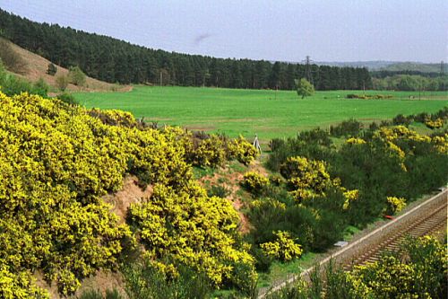
Robin Hood's Hills (Kirkby in Ashfield)
| Locality | |
|---|---|
| Coordinates | 53.0878, -1.2296 |
| Adm. div. | Nottinghamshire |
| Vicinity | 2.9 km SSE of Kirkby in Ashfield |
| Type | Natural feature |
| Interest | Robin Hood name |
| Status | Extant |
| First Record | 1774 |

By Henrik Thiil Nielsen, 2016-10-03. Revised by Henrik Thiil Nielsen, 2017-05-07.
Robin Hood's Hills in Kirkby Forest (formerly part of Sherwood Forest) not quite 3 km SSE of Kirkby in Ashfield, Nottinghamshire, are a group of sandstone hillocks forming a natural amphitheatre, their highest point being 195 m above sea level. In the immediate vicinity are found Robin Hood's Chair and Robin Hood's Cave. The name "Robin Hood's Hills" is first recorded on John Chapman's map of Nottinghamshire, surveyed 1774 and published 1776.[1] The hills now form the NW boundary of Kirkby Forest Golf Course.[2] Some 1.25 km SSW of Robin Hood's Hills and the Chair, 325 m NW of New Annesley, was the Robin Hood public house.
A visitor from down under, most probably in 2014, visited the locality during a ramble in Nottinghamshire:
Gazetteers
- Dobson, R. B., ed.; Taylor, J., ed. Rymes of Robyn Hood: an Introduction to the English Outlaw (London, 1976), p. 302, s.n. 'Robin Hood's Hills'.
Sources
- Gover, J.E.B.; Mawer, Allen; Stenton, F.M. The Place-Names of Nottinghamshire (English Place-Name Society, vol. XVII) (Cambridge, 1940), p. 122, and see pp. 11, 294.
- Rising to Gale: Wellington/Melbourne: Walking my horizon: Nottingham.
- Wikipedia: Robin Hood Hills, Nottinghamshire.
Maps
- Chapman, John, cartog. Nottingham Shire Survey'd in 1774 ([London], 1776). Not seen, but cf. J.E.B. Gover, cited under Sources above.
- 6" O.S. map Nottinghamshire XXVII.SE (1886; surveyed 1877-78).
- 6" O.S. map Nottinghamshire XXVII.SE (1900; rev. 1898).
- 6" O.S. map Nottinghamshire XXVII.SE (1921; rev. 1913-14).
- 6" O.S. map Nottinghamshire XXVII.SE (c. 1949; rev. 1938).
Also see
Notes
- ↑ Chapman, John, cartog. Nottingham Shire Survey'd in 1774 ([London], 1776); not seen, but cf. Gover, J.E.B.; Mawer, Allen; Stenton, F.M. The Place-Names of Nottinghamshire (English Place-Name Society, vol. XVII) (Cambridge, 1940), p. 122. Dobson, R. B., ed.; Taylor, J., ed. Rymes of Robyn Hood: an Introduction to the English Outlaw (London, 1976), p. 302, s.n. 'Robin Hood's Hills', incorrectly refer to "Chapman and André's 1775 Map of Nottinghamshire" (their italics).
- ↑ See 6" O.S. maps dated 1921 and later in Maps section below.
- ↑ Rising to Gale: Wellington/Melbourne: Walking my horizon: Nottingham. IRHB's brackets
"th" can not be assigned to a declared number type with value 18.
