
Marian's Inclosure (Forest of Dean): Difference between revisions
m (Text replacement - "|service=leaflet}}" to "|service=leaflet|enablefullscreen=yes}}") |
m (Text replacement - "Creative Commons via Geograph" to "Creative Commons, via Geograph") |
||
| Line 42: | Line 42: | ||
<gallery widths="195px"> | <gallery widths="195px"> | ||
1441524_1bc37257.jpg|Looking west from the A4136 approaching Staunton, the main Gloucester to Monmouth Road, through Marian's Inclosure / [http://www.geograph.org.uk/photo/1441524 Jonathan Billinger, 6 Aug. 2009; Creative Commons, via Geograph.] | 1441524_1bc37257.jpg|Looking west from the A4136 approaching Staunton, the main Gloucester to Monmouth Road, through Marian's Inclosure / [http://www.geograph.org.uk/photo/1441524 Jonathan Billinger, 6 Aug. 2009; Creative Commons, via Geograph.] | ||
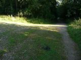
1726071_a7536889.jpg|Path, Marian's Inclosure / [http://www.geograph.org.uk/photo/1726071 Derek Harper, 26 feb. 2010; Creative Commons via Geograph.] | 1726071_a7536889.jpg|Path, Marian's Inclosure / [http://www.geograph.org.uk/photo/1726071 Derek Harper, 26 feb. 2010; Creative Commons, via Geograph.] | ||
3122622_ddadf120.jpg|Path in Marian's Inclosure; a junction of paths and forest tracks / [http://www.geograph.org.uk/photo/3122622 Jeremy Bolwell, 9 Sep. 2012; Creative Commons, via Geograph.] | 3122622_ddadf120.jpg|Path in Marian's Inclosure; a junction of paths and forest tracks / [http://www.geograph.org.uk/photo/3122622 Jeremy Bolwell, 9 Sep. 2012; Creative Commons, via Geograph.] | ||
geograph-3427204-by-David-Smith.jpg|Marian's Inclosure, from a lay-by by the A4136 / [http://www.geograph.org.uk/photo/3427204 David Smith, 16 Apr. 2013; Creative Commons, via Geograph.] | geograph-3427204-by-David-Smith.jpg|Marian's Inclosure, from a lay-by by the A4136 / [http://www.geograph.org.uk/photo/3427204 David Smith, 16 Apr. 2013; Creative Commons, via Geograph.] | ||
Revision as of 11:23, 30 May 2019
[[File:|thumb|right|500px|Looking west from the A4136 approaching Staunton, the main Gloucester to Monmouth Road, through Marian's Inclosure / Jonathan Billinger, 6 Aug. 2009; Creative Commons, via Geograph.]]
By Henrik Thiil Nielsen, 2018-09-25. Revised by Henrik Thiil Nielsen, 2019-05-30.
"Marian's Inclosure" is the name of the part of the Forest of Dean immediately east of Staunton and northwest of Coleford, Gloucestershire. In this area of the forest is the site of Marian's Brick Works, which is situated just 150 meters from that of Robin Hood Iron Mine with which it was probably closely connected. It seems likely that the Inclosure was named after the Brick Works, whose name was in turn probably inspired by that of the iron mine. A further three localities or thoroughfares within or adjacent to the Inclosure are named after it. Maid Marian is thus likely directly or indirectly commemorated in no less than five place-names in this area.
For the Robin Hood connection, see further the page on Marian's Brick Works (Forest of Dean). Currently the earliest source for the place-name "Marian's Inclosure" known to IRHB is a 6" O.S. map of the area published in 1884 (see maps below).Template:PnItemQry
Gazetteers
- Not included in Dobson, R. B., ed.; Taylor, J., ed. Rymes of Robyn Hood: an Introduction to the English Outlaw (London, 1976), pp. 293-311.
Maps
- 25" O.S. map Monmouthshire XV.2 (c. 1882; surveyed 1880). (No Copy in NLS)]
- 25" O.S. map Gloucestershire XXX.15 (1895; surveyed 1879-80)
- 25" O.S. map Gloucestershire XXX.15 (1902; rev. 1900)
- 25" O.S. map Monmouthshire XV.2 (1902; rev. 1900) (georeferenced).
- 25" O.S. map Monmouthshire XV.2 (1902; rev. 1900)
- 25" O.S. map Gloucestershire XXX.15 (1922; rev. 1920)
- 6" O.S. map Gloucestershire XXX.SE (1884; surveyed 1878-80)
- 6" O.S. map Gloucestershire XXX.SE (1903; rev. 1900) (georeferenced).
- 6" O.S. map Gloucestershire XXX.SE (1903; rev. 1900)
- 6" O.S. map Monmouthshire XV.NW (1903; rev. 1900)
- 6" O.S. map Monmouthshire XV (1924; rev. 1918)
- 6" O.S. map Gloucestershire XXX (1924; rev. 1920-21)
- 1:25,000 O.S. map SO51 (1949) (georeferenced)
- 1:25,000 O.S. map SO51 (1949).
Background

Looking west from the A4136 approaching Staunton, the main Gloucester to Monmouth Road, through Marian's Inclosure / Jonathan Billinger, 6 Aug. 2009; Creative Commons, via Geograph.

Path, Marian's Inclosure / Derek Harper, 26 feb. 2010; Creative Commons, via Geograph.
Path in Marian's Inclosure; a junction of paths and forest tracks / Jeremy Bolwell, 9 Sep. 2012; Creative Commons, via Geograph.

Marian's Inclosure, from a lay-by by the A4136 / David Smith, 16 Apr. 2013; Creative Commons, via Geograph.


