Locksley Drive (Knaphill, Woking): Difference between revisions
m (→Maps) |
m (Text replacement - "ImgGalleryIntro" to "ImageGalleryIntroduction") |
||
| (14 intermediate revisions by 2 users not shown) | |||
| Line 1: | Line 1: | ||
__NOTOC__{{ | __NOTOC__{{PlaceNamesItemTop|Lat=51.317285|Lon=-0.599174|AdministrativeDivision=Surrey|Vicinity=Connecting Robin Hood Road and Lockfield Drive, between Knaphill and St John's, Woking|Type=Thoroughfare|Interest=Miscellaneous|Status=Extant|Demonym=|Riding=|GreaterLondon=|Year=|Aka=|Century=20|Cluster1=Knaphill|Cluster2=|Cluster3=|Image=locksley-drive-knaphill-google-earth-street-view.jpg|Postcards=|ExtraCat1=Places named Loxley|ExtraCat2=|ExtraCat3=|ExtraCat4=|ExtraCat5=|ExtraLink1=|ExtraLink2=|ExtraLink3=|ExtraLink4=|ExtraLink5=|ExtraLinkName1=|ExtraLinkName2=|ExtraLinkName3=|ExtraLinkName4=|ExtraLinkName5=|GeopointPrefix=|GeopointSuffix=|StatusSuffix=|DatePrefix=|DateSuffix=}} | ||
{{#display_map:{{#var:Coords}}~{{#replace:{{PAGENAME}}|'|'}}|width=34% | {{#display_map:{{#var:Coords}}~{{#replace:{{PAGENAME}}|'|'}}|width=34%|enablefullscreen=yes}}<div class="pnMapLegend">Locksley Drive.</div> | ||
[[File:locksley-drive-knaphill-google-earth-street-view.jpg|thumb|right|500px|Locksley Drive / Google Earth Street View.]] | [[File:locksley-drive-knaphill-google-earth-street-view.jpg|thumb|right|500px|Locksley Drive / Google Earth Street View.]]<div class="no-img"> | ||
<p id="byline">By Henrik Thiil Nielsen, 2017-11-20. Revised by {{#realname:{{REVISIONUSER}}}}, {{REVISIONYEAR}}-{{REVISIONMONTH}}-{{REVISIONDAY2}}.</p> | <p id="byline">By Henrik Thiil Nielsen, 2017-11-20. Revised by {{#realname:{{REVISIONUSER}}}}, {{REVISIONYEAR}}-{{REVISIONMONTH}}-{{REVISIONDAY2}}.</p> | ||
A short bit of road which connects Robin Hood Road and Lockfield Drive about midway between Knaphill and St John's, Woking, is named Locksley Drive. As there are several other Robin Hood-related place-names in the vicinity, it seems very likely the name is inspired by the Robin Hood tradition. | A short bit of road which connects Robin Hood Road and Lockfield Drive about midway between Knaphill and St John's, Woking, is named Locksley Drive. As there are several other Robin Hood-related place-names in the vicinity, it seems very likely the name is inspired by the Robin Hood tradition. | ||
Since it is uncertain whether Locksley is here to be understood as the name of the place Robin Hood came from according to certain 16th century traditions or as an alias of the outlaw himself, it cannot really be classified as a bona fide Robin Hood name. Instead I have put it in the "Miscellaneous" category. Locksley Drive is not shown or labelled on any of the maps listed below, the latest dating from ''c.'' 1946. | Since it is uncertain whether Locksley is here to be understood as the name of the place Robin Hood came from according to certain 16th century traditions or as an alias of the outlaw himself, it cannot really be classified as a bona fide Robin Hood name. Instead I have put it in the "Miscellaneous" category. Locksley Drive is not shown or labelled on any of the maps listed below, the latest dating from ''c.'' 1946. | ||
{{ | {{PlaceNamesItemAllusionsAndRecords}} | ||
== Gazetteers == | == Gazetteers == | ||
* Not included in {{:Dobson, Richard Barrie 1976a}}, pp. 293-311. | * Not included in {{:Dobson, Richard Barrie 1976a}}, pp. 293-311. | ||
| Line 27: | Line 26: | ||
* [https://en.wikipedia.org/wiki/Knaphill Wikipedia: Knaphill.] | * [https://en.wikipedia.org/wiki/Knaphill Wikipedia: Knaphill.] | ||
{{ | {{PlaceNamesItemAlsoSee}} | ||
</div> | |||
<!--<div id="gallery"> | |||
{{ | {{ImageGalleryIntroduction}} | ||
<gallery widths="195px"> | <gallery widths="195px"> | ||
FOR EACH IMAGE: File:_FILENAME.jpg|_LEGEND / [_URL _PHOTOGRAPHER_, _DAY_ _MON_. _YEAR_, Creative Commons.]] | FOR EACH IMAGE: File:_FILENAME.jpg|_LEGEND / [_URL _PHOTOGRAPHER_, _DAY_ _MON_. _YEAR_, Creative Commons.]] | ||
</gallery>--> | </gallery> | ||
</div>--> | |||
{{PlaceNamesItemNavigation}} | |||
{{ | |||
[[Category:Places named Loxley]] | [[Category:Places named Loxley]] | ||
Latest revision as of 13:51, 7 January 2021
| Locality | |
|---|---|
| Coordinate | 51.317285, -0.599174 |
| Adm. div. | Surrey |
| Vicinity | Connecting Robin Hood Road and Lockfield Drive, between Knaphill and St John's, Woking |
| Type | Thoroughfare |
| Interest | Miscellaneous |
| Status | Extant |
| First Record | |
By Henrik Thiil Nielsen, 2017-11-20. Revised by Henrik Thiil Nielsen, 2021-01-07.
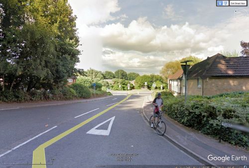
A short bit of road which connects Robin Hood Road and Lockfield Drive about midway between Knaphill and St John's, Woking, is named Locksley Drive. As there are several other Robin Hood-related place-names in the vicinity, it seems very likely the name is inspired by the Robin Hood tradition.
Since it is uncertain whether Locksley is here to be understood as the name of the place Robin Hood came from according to certain 16th century traditions or as an alias of the outlaw himself, it cannot really be classified as a bona fide Robin Hood name. Instead I have put it in the "Miscellaneous" category. Locksley Drive is not shown or labelled on any of the maps listed below, the latest dating from c. 1946.
Gazetteers
- Not included in Dobson, R. B., ed.; Taylor, J., ed. Rymes of Robyn Hood: an Introduction to the English Outlaw (London, 1976), pp. 293-311.
Maps
Locksley Drive shown but not labelled on these maps.
- 25" O.S. map Surrey XVI.11 (1916; rev. 1913)
- 25" O.S. map Surrey XVI.11 (1936; rev. 1934)
- 25" O.S. map Surrey XVI.11 (1916; rev. 1913)
- 6" O.S. map Surrey XVI (1873; surveyed 1870-71)
- 6" O.S. map Surrey XVI.SE (1897; rev. 1894-95)
- 6" O.S. map Surrey XVI.SE (1897; rev. 1894-95) (georeferenced)
- 6" O.S. map Surrey XVI.SE (1920; rev. 1913)
- 6" O.S. map Surrey XVI.SE (1937; rev. 1934-35)
- 6" O.S. map Surrey XVI.SE (c. 1944; rev. 1938)
- 6" O.S. map Surrey XVI.SE (c. 1946; rev. 1938).
Background
Also see

