
Little Johns (South Ockendon)
[[File:|thumb|right|500px|'Little Johns' can be seen in the distance on the left (east) side of the road / David Anstiss, 25 Nov. 2012, Creative Commons, via Geograph.]]
By Henrik Thiil Nielsen, 2018-02-19. Revised by Henrik Thiil Nielsen, 2019-04-05.
A field or close east and north of Mollands Lane is recorded as "Little Johns" in the 1839 tithe award for South Ockendon. It was owned by Catherine Oliphant and occupied by William Mays, state of cultivation was "Arable" and area Template:AcreRoodPerchToM2 m2. The somewhat larger (Template:AcreRoodPerchToM2 m2) close immediately east of it was entered as "Great Johns". [1]
While it is of course a possibility that it may have been reinterpreted along such lines, it is quite uncertain if the name "Little Johns" was meant to referer to Robin Hood's second in command. Elsewhere in South Ockendon, in 1922, a smaller area of grassland was known as "Little Jennys". We also cannot be certain if "Little Johns", "Great Johns" and "Little Jennys" were thought of as being in the plural or the singular possessive, though the latter seems the more likely since there was evidently only a single piece of land with each of these names.[2]Template:PnItemQry
Gazetteers
- Not included in Dobson, R. B., ed.; Taylor, J., ed. Rymes of Robyn Hood: an Introduction to the English Outlaw (London, 1976), pp. 293-311.
MS sources
- Tithe award for "South Ockenden" [sic], online at the Genealogist.co.uk, Piece 12, Sub-Piece 251, Image 016, No. 365 (subscription required)
- Accompanying map, online at the Genealogist.co.uk, Piece 12, Sub-Piece 251, Sub-Image 001 (subscription required).
Maps
- 25" O.S. map Essex LXXV.16 (1897; rev. 1895) (georeferenced)
- 6" O.S. map Essex LXXV (1872; surveyed 1865-66)
- 6" O.S. map Essex LXXV.SE (1898; rev. 1895)
- 6" O.S. map Essex LXXV.SE (1898; rev. 1895) (georeferenced)
- 6" O.S. map Essex nLXXXVIII (1921; rev. 1915)
- 6" O.S. map Essex nLXXXVIII.SW (1921; rev. 1915)
- 6" O.S. map Essex nLXXXVIII.SW (c. 1945; rev. 1938)
- 1:25,000 O.S. map TQ68 (1958; surveyed 1938-55) (georeferenced)
- 1:1 million–1:10k (1900s) TQ611826 (georeferenced).
Background
MSS
- Tithe award for "South Ockenden" [sic], online at the Genealogist.co.uk, Piece 12, Sub-Piece 251, Image 016, No. 363 (subscription required)
- Tithe award for "South Ockenden" [sic], online at the Genealogist.co.uk, Piece 12, Sub-Piece 251, Image 034, No. 60 (dated 1922) (subscription required).
Web
Notes
- ↑ Tithe award for "South Ockenden" [sic], online at the Genealogist.co.uk, Piece 12, Sub-Piece 251, Image 016 (subscription required); Genealogist.co.uk, Piece 12, Sub-Piece 251, Sub-Image 001; map (subscription required).
- ↑ Tithe award for "South Ockenden" [sic], online at the Genealogist.co.uk, Piece 12, Sub-Piece 251, Image 034 (dated 1922) (subscription required).
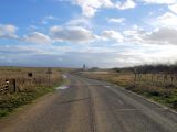
'Little Johns' can be seen in the distance on the left (east) side of the road / David Anstiss, 25 Nov. 2012, Creative Commons, via Geograph.

Little Johns (red outline) and Great Johns (yellow outline) / Google Earth Street View.

