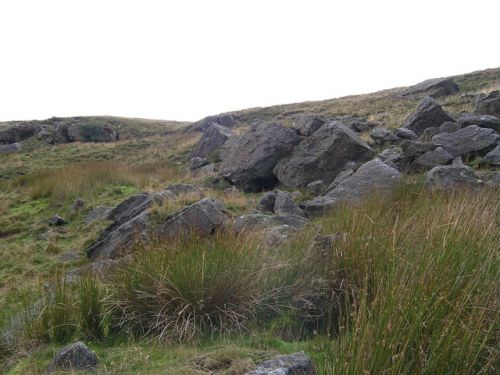
Little John (Hardcastle Moor)
| Locality | |
|---|---|
| Coordinate | 54.0839, -1.8399 |
| Adm. div. | West Riding of Yorkshire |
| Vicinity | c. 6 km W of Pateley Bridge |
| Type | Miscellaneous |
| Interest | Robin Hood name |
| Status | Defunct? |
| First Record | 1854 |

By Henrik Thiil Nielsen, 2016-08-09. Revised by Henrik Thiil Nielsen, 2021-01-06.
The first 6" O.S. map of the Bewerley–Thornthwaite–Padside area, published in 1854, surveyed 1849-50, has the name "Little John" next to what must be the marker for a quarry,[1] on Hardcastle Moor, towards the SE end of the present Yorkshire Dales National Park. The quarry was situated immediately east of a footpath, not shown on Google Maps, but then running approximately NNW to SSE through the area. The quarry is not indicated on the later 6" O.S. maps.[2] It is uncertain if the name had anything to do with Robin Hood's second-in-command; in the immediate vicinity was a quarry named Little Betty.
This part of Yorkshire then belonged to the West Riding but is now part of the North Riding. A search for "Little John" and "Hardcastle Moor" on 9 August 2016 yielded no relevant results.
Gazetteers
- Not included in Dobson, R. B., ed.; Taylor, J., ed. Rymes of Robyn Hood: an Introduction to the English Outlaw (London, 1976), pp. 293-311.
Maps
- 6" O.S. map Yorkshire 135 (1854, surveyed 1849-50)
- 6" O.S. map Yorkshire CXXXV (1895, rev. 1889-90)
- 6" O.S. map Yorkshire CXXXV.NW (1910, rev. 1907)
- 6" O.S. map Yorkshire CXXXV.NW (1910, rev. 1907).
Also see
Notes
- ↑ 6" O.S. map Yorkshire 135 (1854, surveyed 1849-50); for the marker see Cassini Historical Maps: Keys and Legends.
- ↑ See maps section below.
