From International Robin Hood Bibliography
The printable version is no longer supported and may have rendering errors. Please update your browser bookmarks and please use the default browser print function instead.
| Locality |
|---|
| Coordinate |
51.66545, -0.370158 |
|---|
| Adm. div. |
Hertfordshire |
|---|
| Vicinity |
Side street of Robin Hood Drive in Bushey |
|---|
| Type |
Thoroughfare |
|---|
| Interest |
Robin Hood name |
|---|
| Status |
Extant |
|---|
| First Record |
|
|---|
Loading map...
{"minzoom":false,"maxzoom":false,"mappingservice":"leaflet","width":"34%","height":"400px","centre":false,"title":"","label":"","icon":"","lines":[],"polygons":[],"circles":[],"rectangles":[],"copycoords":false,"static":false,"zoom":false,"defzoom":9,"layers":["OpenStreetMap","NLS","Stamen.Terrain"],"image layers":[],"overlays":[],"resizable":false,"fullscreen":true,"scrollwheelzoom":true,"cluster":false,"clustermaxzoom":20,"clusterzoomonclick":true,"clustermaxradius":80,"clusterspiderfy":true,"geojson":"","clicktarget":"","imageLayers":[],"locations":[{"text":"\u003Cdiv class=\"mw-parser-output\"\u003E\u003Cp\u003EFriars Way (Bushey)\n\u003C/p\u003E\u003C/div\u003E","title":"Friars Way (Bushey)\n","link":"","lat":51.66545,"lon":-0.370158,"icon":""}],"imageoverlays":null}
Friars Way (Bushey).
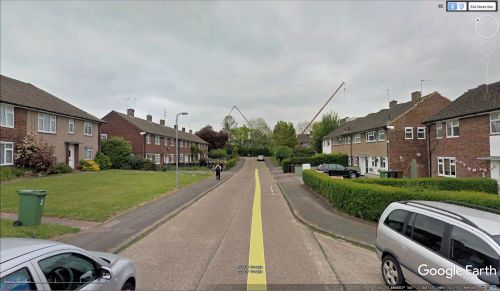
Friars Way / Google Earth Street View.
By Henrik Thiil Nielsen, 2018-01-10. Revised by Henrik Thiil Nielsen, 2021-01-06.
Friars Way in Bushey must be named after Friar Tuck, being located in the immediate vicinity of Robin Hood Drive and not far from Marion Close.
Gazetteers
Also see

