From International Robin Hood Bibliography
| Locality |
|---|
| Coordinate |
51.66545, -0.370158 |
|---|
| Adm. div. |
Hertfordshire |
|---|
| Vicinity |
Side street of Robin Hood Drive in Bushey |
|---|
| Type |
Thoroughfare |
|---|
| Interest |
Robin Hood name |
|---|
| Status |
Extant |
|---|
| First Record |
|
|---|
Loading map...
{"minzoom":false,"maxzoom":false,"mappingservice":"leaflet","width":"34%","height":"400px","centre":false,"title":"","label":"","icon":"","lines":[],"polygons":[],"circles":[],"rectangles":[],"copycoords":false,"static":false,"zoom":false,"defzoom":9,"layers":["OpenStreetMap","NLS","Stamen.Terrain"],"image layers":[],"overlays":[],"resizable":false,"fullscreen":true,"scrollwheelzoom":true,"cluster":false,"clustermaxzoom":20,"clusterzoomonclick":true,"clustermaxradius":80,"clusterspiderfy":true,"geojson":"","clicktarget":"","imageLayers":[],"locations":[{"text":"\u003Cdiv class=\"mw-parser-output\"\u003E\u003Cp\u003EFriars Way (Bushey)\n\u003C/p\u003E\u003C/div\u003E","title":"Friars Way (Bushey)\n","link":"","lat":51.66545,"lon":-0.370158,"icon":""}],"imageoverlays":null}
Friars Way (Bushey).
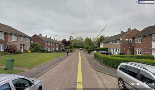
Friars Way / Google Earth Street View.
By Henrik Thiil Nielsen, 2018-01-10. Revised by Henrik Thiil Nielsen, 2021-01-06.
Friars Way in Bushey must be named after Friar Tuck, being located in the immediate vicinity of Robin Hood Drive and not far from Marion Close.
Gazetteers
Also see

