Sherwood Road (Winnersh): Difference between revisions
From International Robin Hood Bibliography
m (Text replacement - "PnItemAlsoSee" to "PlaceNamesItemAlsoSee") |
m (Text replacement - "PlaceNamesItemQuery" to "PlaceNamesItemAllusionsAndRecords") |
||
| Line 5: | Line 5: | ||
Sherwood Road in Winnersh is a residential side street of Robinhood Lane. | Sherwood Road in Winnersh is a residential side street of Robinhood Lane. | ||
Since the road is not included on any of the late 19th to mid-20th century O.S. maps listed below, it probably dates from the post-WWII period.{{ | Since the road is not included on any of the late 19th to mid-20th century O.S. maps listed below, it probably dates from the post-WWII period.{{PlaceNamesItemAllusionsAndRecords}} | ||
== Gazetteers == | == Gazetteers == | ||
* Not included in {{:Dobson, Richard Barrie 1976a}}, pp. 293-311. | * Not included in {{:Dobson, Richard Barrie 1976a}}, pp. 293-311. | ||
Revision as of 00:59, 6 January 2021
| Locality | |
|---|---|
| Coordinate | 51.432155, -0.873865 |
| Adm. div. | Berkshire |
| Vicinity | Side street of Robinhood Lane in Winnersh |
| Type | Thoroughfare |
| Interest | Miscellaneous |
| Status | Extant |
| First Record | |
Sherwood Road, Winnersh
By Henrik Thiil Nielsen, 2018-05-28. Revised by Henrik Thiil Nielsen, 2021-01-06.
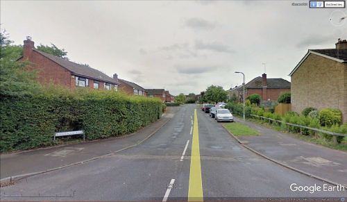
Sherwood Road in Winnersh is a residential side street of Robinhood Lane.
Since the road is not included on any of the late 19th to mid-20th century O.S. maps listed below, it probably dates from the post-WWII period.
Gazetteers
- Not included in Dobson, R. B., ed.; Taylor, J., ed. Rymes of Robyn Hood: an Introduction to the English Outlaw (London, 1976), pp. 293-311.
Maps
- 25" O.S. map Berkshire XXXVIII.6 (c. 1875; surveyed 1871). No Copy in NLS
- 25" O.S. map Berkshire XXXVIII.6 (1899; rev. 1898)
- 25" O.S. map Berkshire XXXVIII.6 (1899; rev. 1898) (georeferenced)
- 25" O.S. map Berkshire XXXVIII.6 (1912; rev. 1910)
- 25" O.S. map Berkshire XXXVIII.6 (1933; rev. 1932)
- 6" O.S. map Berkshire XXXVIII (1883; surveyed 1871-72)
- 6" O.S. map Berkshire XXXVIII.NW (1900; rev. 1898)
- 6" O.S. map Berkshire XXXVIII.NW (1900; rev. 1898) (georeferenced)
- 6" O.S. map Berkshire XXXVIII.NW (1913; rev. 1910)
- 6" O.S. map Berkshire XXXVIII.NW (c. 1934; rev. 1932)
- 6" O.S. map Berkshire XXXVIII.NW (c. 1944; rev. 1938).
Also see

