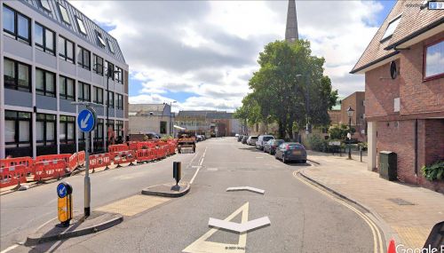
Robin Hood (Southampton) (2)
| Locality | |
|---|---|
| Coordinate | Near 50.9, -1.404737 |
| Adm. div. | Hampshire |
| Vicinity | Present Castle Way or West Street, formerly French Street |
| Type | Public house |
| Interest | Robin Hood name |
| Status | Defunct |
| First Record | 1775 |
| A.k.a. | Robin Hood Inn |
By Henrik Thiil Nielsen, 2022-05-04. Revised by Henrik Thiil Nielsen, 2022-05-04.
A pub named the Robin Hood at 12 French Street in Southampton appears in the records from 1775 to 1855.
There is now no 12 French Street. At present, this street extends north from Town Quay to about the Medieval Merchant's House on the corner of French Street and Vyse Lane. On a 6" O.S. map of Southampton published in 1871, the stretch of the present Castle Way extending from there to St Michael's Church appears also to be part of French Street, while the stretch of the present Castle Way extending north from the church to the present West Street was evidently considered part of the latter. The 1898 revision of the map has French Street from Town Quay to somewhere near the church so labelled, while the present Castle Way north of there and the present West Street are not named. After WWII, French Street was renumbered and part of it renamed 'Castle Way'.[1] In modern terms, the site of the Robin Hood is probably on 'Castle Way', possibly on West Street.
Gazetteers
- Not included in Dobson, R. B., ed.; Taylor, J., ed. Rymes of Robyn Hood: an Introduction to the English Outlaw (London, 1976), pp. 293-311.
Sources
Maps
- 25" map Hampshire and Isle of Wight LXV.10 (c. 1871; surveyed 1865–67). No copy in NLS
- 25" O.S. map Hampshire & Isle of Wight LXV.10 (1897; rev. 1895) (georeferenced)
- 25" O.S. map Hampshire & Isle of Wight LXV.10 (1897; rev. 1895)
- 25" O.S. map Hampshire & Isle of Wight LXV.10 (1910; rev. 1907)
- 25" O.S. map Hampshire & Isle of Wight LXV.10 (1933; rev. 1931)
- 25" O.S. map Hampshire & Isle of Wight LXV.10 (1934; rev. 1934)
- 6" O.S. map Hampshire & Isle of Wight LXV (1871; surveyed 1866–69)
- 6" O.S. map Hampshire & Isle of Wight LXV.SW (1898; rev. 1895) (georeferenced)
- 6" O.S. map Hampshire & Isle of Wight LXV.SW (1898; rev. 1895)
- 6" O.S. map Hampshire & Isle of Wight LXV.SW (1910; rev. 1907–08)
- 6" O.S. map Hampshire & Isle of Wight LXV.SW (c. 1935; rev. 1931–34)
- 6" O.S. map Hampshire & Isle of Wight LXV.SW (c. 1943; rev. 1938)
- 6" O.S. map Hampshire & Isle of Wight LXV.SW (c. 1946; rev. 1938).
Background
Also see
Notes

