
Locksley School (Tuckswood, Norwich): Difference between revisions
From International Robin Hood Bibliography
m (Text replacement - "|service=leaflet}}" to "|service=leaflet|enablefullscreen=yes}}") |
rh>Henryfunk m (Text replacement - "</div> {{ImgGalleryIntro}} " to "</div> <div id="gallery"> {{ImgGalleryIntro}} ") |
||
| Line 13: | Line 13: | ||
</div> | </div> | ||
<div id="gallery"> | |||
{{ImgGalleryIntro}} | {{ImgGalleryIntro}} | ||
<gallery widths="195px"> | <gallery widths="195px"> | ||
| Line 18: | Line 19: | ||
File:locksley-school-tuckswood-2-google-earth-street-view.jpg|The Locksley School, entrance from Peterkin Road / Google Earth Street View. | File:locksley-school-tuckswood-2-google-earth-street-view.jpg|The Locksley School, entrance from Peterkin Road / Google Earth Street View. | ||
</gallery> | </gallery> | ||
</div> | |||
{{PnItemNav}} | {{PnItemNav}} | ||
Revision as of 23:52, 14 May 2020
Locksley School (Tuckswood, Norwich).
[[File:|thumb|right|500px|The Locksley School in Tuckswood, Norwich / Google Earth Street View.]]
By Henrik Thiil Nielsen, 2018-01-11. Revised by 3.138.114.94, 2020-05-14.
The Locksley School is one of many establishments and localities with Robin Hood-themed names in the Tuckswood area between Ipswich and Hall roads. Norwich.Template:PnItemQry
Gazetteers
- Not included in Dobson, R. B., ed.; Taylor, J., ed. Rymes of Robyn Hood: an Introduction to the English Outlaw (London, 1976), pp. 293-311.
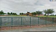
The Locksley School seen from Locksley Road / Google Earth Street View.
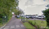
The Locksley School, entrance from Peterkin Road / Google Earth Street View.

