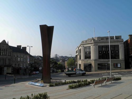
Barnsley
| Locality | |
|---|---|
| Coordinate | 53.552625, -1.479723 |
| Adm. div. | West Riding of Yorkshire |
| Vicinity | c. 9 km SSE of Wakefield |
| Type | Settlement |
| Interest | Literary locale |
| Status | Extant |
| First Record | c. 1847 |

By Henrik Thiil Nielsen, 2018-07-15. Revised by Henrik Thiil Nielsen, 2021-01-07.
Barnsley can claim a tenuous connection with Robin Hood in that a fair young damsel who is abducted in the ballad of 'Robin Hood and the Tanner's Daughter', the C version of Erlinton (Child 8), is the offspring of "John Hobbes of Barneslee".
This slight claim is in fact even less impressive than it seems at first sight, for the Robin Hood-themed version of Erlinton was written, in 1847 or slightly earlier, by the literary forger John Payne Collier.[1] and while "Barneslee" can of course be taken to refer to the town of Barnsley, one cannot rule out the possibility that Collier intended it to sound like a garbled echo of "Barnsdale".
Quotations
[Erlinton (Child 8 C), st. 5:][2]
'Where dost thou dwell, my prettie maide?
I prithee tell to me;'
'I am a tanner's daughter,' she said,
'John Hobbes of Barneslee.'
Gazetteers
- Not included in Dobson, R. B., ed.; Taylor, J., ed. Rymes of Robyn Hood: an Introduction to the English Outlaw (London, 1976), pp. 293-311.
Maps
- 25" O.S. map Yorkshire CCLXXIV.7 (1893; surveyed 1888-90)
- 25" O.S. map Yorkshire CCLXXIV.7 (1906; rev. 1904)
- 25" O.S. map Yorkshire CCLXXIV.7 (1932; rev. 1929)
- 25" O.S. map Yorkshire CCLXXIV.11 (1893; surveyed 1889-90)
- 25" O.S. map Yorkshire CCLXXIV.11 (1906; rev. 1904)
- 25" O.S. map Yorkshire CCLXXIV.11 (1932; rev. 1929)
- 25" O.S. map Yorkshire CCLXXIV.7 (1906; rev. 1904) (georeferenced)
- 6" O.S. map Yorkshire 274 (1855; surveyed 1850-51)
- 6" O.S. map Yorkshire CCLXXIV.NE (1894; surveyed 1888-90)
- 6" O.S. map Yorkshire CCLXXIV.NE (1907; rev. 1904)
- 6" O.S. map Yorkshire CCLXXIV.NE (1932; rev. 1929)
- 6" O.S. map Yorkshire CCLXXIV.NE (1944-47; rev. 1938)
- 6" O.S. map Yorkshire CCLXXIV.NE (1949; rev. 1948)
- 6" O.S. map Yorkshire 274 (1855; surveyed 1850-51)
- 6" O.S. map Yorkshire CCLXXIV.SE (1894; surveyed 1888-90)
- 6" O.S. map Yorkshire CCLXXIV.SE (1907; rev. 1903-1904)
- 6" O.S. map Yorkshire CCLXXIV.NE (1907; rev. 1904) (georeferenced)
- 6" O.S. map Yorkshire CCLXXIV.SE (1932; rev. 1929)
- 6" O.S. map Yorkshire CCLXXIV.SE (1945; rev. 1938)
- 6" O.S. map Yorkshire CCLXXIV.SE (1950; rev. 1948).
Background
Also see
Notes
