Robin Hood Hill Lane (Outwood)
From International Robin Hood Bibliography
| Locality | |
|---|---|
| Coordinate | 53.703626, -1.521083 |
| Adm. div. | West Riding of Yorkshire |
| Vicinity | Potovens Lane, between Wrenthorpe and Outwood |
| Type | Thoroughfare |
| Interest | Robin Hood name |
| Status | Defunct |
| First Record | 1854 |
| A.k.a. | Potovens Lane; Robin Hood Street |
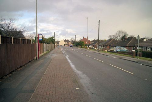
Potovens Lane, formerly Robin Hodo Hill Lane, and perhaps yet earlier: Robin Hood Street.

Potovens Lane, once Robin Hood Hill Lane / Mark Anderson, 15 Jan. 2018, Creative Commons, via Geograph.
By Henrik Thiil Nielsen, 2020-08-15. Revised by Henrik Thiil Nielsen, 2021-01-06.
North of the Bradford Road intersection, Potovens Lane was known as 'Robin Hood Hill Lane' in the mid-19th century.
The street appears with that name attached to it on a 6" O.S. map of the area published in 1854, based on surveying carried out 1848 to 1851 (see Maps below). In subsequent maps it has its present name. Its former name was suggested by the fact that it crosses Robin Hood Hill. The lane may well have been known as 'Robin Hood Street' in the mid-17th century, see Robin Hood Street Close (Outwood).
Gazetteers
- Not included in Dobson, R. B., ed.; Taylor, J., ed. Rymes of Robyn Hood: an Introduction to the English Outlaw (London, 1976), pp. 293-311.
Maps
- 25" O,S, map Yorkshire CCXXXIII.14 (c. 1894; surveyed c. 1892). No copy in NLS.
- 25" O.S. map Yorkshire CCXXXIII.14 (1907; rev. 1905) (georeferenced)
- 25" O.S. map Yorkshire CCXXXIII.14 (1907; rev. 1905)
- 25" O.S. map Yorkshire CCXXXIII.14 (1914; rev. 1913)
- 25" O.S. map Yorkshire CCXXXIII.14 (1942; rev. 1939)
- 6" O.S. map Yorkshire 233 (1854; surveyed 1848–51)
- 6" O.S. map Yorkshire CCXXXIII.SW (1894; surveyed 1892)
- 6" O.S. map Yorkshire CCXXXIII.SW (1908; rev. 1906) (georeferenced)
- 6" O.S. map Yorkshire CCXXXIII.SW (1908; rev. 1906)
- 6" O.S. map Yorkshire CCXXXIII.SW (1931; rev. 1931–32)
- 6" O.S. map Yorkshire CCXXXIII.SW (1947; rev. 1939)
- 6" O.S. map Yorkshire CCXXXIII.SW (1949; rev. 1948).
Also see
