Robin Hood (Millhouses)
| Locality | |
|---|---|
| Coordinate | 53.346312, -1.497542 |
| Adm. div. | West Riding of Yorkshire |
| Vicinity | At the junction of Millhouses Lane, Whirlowdale Road and Abbeydale Road in Millhouses, Sheffield |
| Type | Public house |
| Interest | Robin Hood name |
| Status | Extant |
| First Record | 1822 |
| A.k.a. | Robin Hood and Little John; Robin Hood Inn; Robin Hood Hotel |
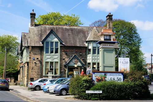
By Henrik Thiil Nielsen, 2013-08-07. Revised by Henrik Thiil Nielsen, 2022-05-05.
The Robin Hood in Millhouses first appears in the records in 1822. Local pub enthusiasts have collected half a hundred entries from trade directories and siomilar sources from 1822 to 1951. The name is cited variously as Robin Hood (seven times from 1822 to 1879), Robin Hood and Little John (1841 and 1859), Robin Hood Inn (1861) and Robin Hood Hotel (1911).[1] Pub History lists information on publicans for the years 1879-1919.[2] The pub is included as "Robin Hood & Little John P.H." on the 6" O.S. map of Yorkshire published 1854 and surveyed 1851, as "Robin Hood Hotel (P.H.)" on the 25" O.S. map of Yorkshire published 1893 and surveyed 1875-90 as well as the 25" O.S. map of Derbyshire published 1898 and revised 1896. Some other maps have simply "P.H.", while others do not indicate or label the pub in any way.
Gazetteers
- Not included in Dobson, R. B., ed.; Taylor, J., ed. Rymes of Robyn Hood: an Introduction to the English Outlaw (London, 1976), pp. 293-311.
Sources
Maps
- 25" O.S. map Derbyshire XI.8 (c. 1877; surveyed c. 1875). No copy in NLS
- 25" O.S. map Yorkshire CCXCVIII.3 (1893; surveyed 1875-90)
- 25" O.S. map Yorkshire CCXCVIII.3 (1905; rev. 1903) (georeferenced)
- 25" O.S. map Yorkshire CCXCVIII.3 (1905; rev. 1903)
- 25" O.S. map Yorkshire CCXCVIII.3 (1923; rev. 1920)
- 25" O.S. map Yorkshire CCXCVIII.3 (1937; rev. 1935)
- 25" O.S. map Derbyshire XI.8 (1898; rev. 1896)
- 6" O.S. map Yorkshire 298 (1854; surveyed 1851)
- 6" O.S. map Yorkshire CCXCVIII.NE (1893; surveyed 1890)
- 6" O.S. map Derbyshire XI.NE (1899; rev. 1896) (georeferenced)
- 6" O.S. map Derbyshire XI.NE (1899; rev. 1896)
- 6" O.S. map Yorkshire CCXCVIII.NE (1906; rev. 1903)
- 6" O.S. map Derbyshire XI (1924; rev. 1914-15)
- 6" O.S. map Derbyshire XI.NE (1924; rev. 1914-15)
- 6" O.S. map Yorkshire CCXCVIII (1924; rev. 1920)
- 6" O.S. map Yorkshire CCXCVIII.NE (1924; rev. 1920)
- 6" O.S. map Yorkshire CCXCVIII.NE (1947; rev. 1938)
- 6" O.S. map Yorkshire CCXCVIII.NE (1950; rev. 1948).
Background
Also see
Notes
Image gallery
Click any image to display it in the lightbox, where you can navigate between images by clicking in the right or left side of the current image.
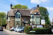
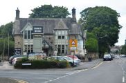
The Robin Hood on Millhouses Lane, Sheffield / Ian S., 3 May, 2014, Creative Commons, via Geograph.
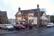
The Robin Hood Public House in Millhouses / Jonathan Clitheroe, 15 Dec. 2011, Creative Commons, via Geograph.
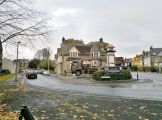
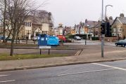
Robin Hood at Millhouses about to get a lift! / Chris Morgan, 6 Nov. 2012, Creative Commons, via Geograph.
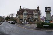
The Robin Hood Public House on Millhouses Lane, Sheffield / Ian S., 20 Jan, 2018, Creative Commons, via Geograph.
Robin Hood Pub from Archer Road junction / Martin Bridge, 25 Oct. 2009, Creative Commons, via Geograph.]
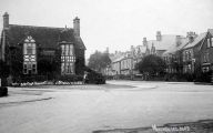
The Robin Hood, no doubt from a postcard / Stuart0742 via Sheffield History.
The Robin Hood. Same view as preceding, but much later / Stuart0742 via Sheffield History.
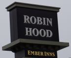
The Robin Hood Public House on Millhouses Lane, Sheffield / Ian S., 25 Jan, 2018, Creative Commons, via Geograph.

