Robin Hood's Well (High Park Wood, Moorgreen)
| Locality | |
|---|---|
| Coordinate | 53.0374, -1.2605 |
| Adm. div. | Nottinghamshire |
| Vicinity | c. 125 m NE of site of Beauvale Priory |
| Type | Natural feature |
| Interest | Robin Hood name |
| Status | Extant |
| First Record | 1851 |
| A.k.a. | John's Well |

By Henrik Thiil Nielsen, 2018-02-27. Revised by Henrik Thiil Nielsen, 2021-01-07. Photos and information courtesy Ross Parish who writes books and a blog on English holy wells. Additional photos kindly provided by Chris.
Robin Hood's Well in High Park Wood, Moorgreen, Greasley civil parish, Nottinghamshire, is a spring known from D.H. Lawrence's Sons and Lovers (1913) and Lady Chatterley's Lover (1928). In the latter it appears under the name "John's Well".[1] It is situated c. 125 m NE of the site of Beauvale Priory, which is now farmland.[2]
The well is noted in the English Place-Name Society's volume on Nottinghamshire,[3] but without a source or date, which is probably an indication that no early source was known. The earliest reference IRHB has found is dated 1851, while the earliest map to include the well seen so far is a 6" O.S. map of the area published in 1880.
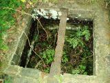
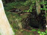
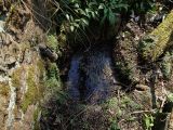
A report to the General Board of Health on the Sewerage, Drainage, and Supply of Water, and the Sanitary Condition of the Inhabitants of the Parish of Eastwood, and the Hamlets of Newthorpe, Moorgreen, and Brinsley, in the Parish of Greasley (1853) mentions the well no less than seven times, citing accounts and results of examinations carried out in 1851 and 1852.[4] The report is concerned mainly with technical matters, but it may be noted that while the two examinations of the well led to widely divergent estimates of the amount of water it would be able to supply, they did agree that this was much higher than was the case with the other springs in the area. Ross Parish notes that it is evident from old photos that there was a considerable water flow, but the water table must have been lowered since then, for the well is now "a sluggish spring", which "arises to flow into a mossy oval basin which is reached by steps down to one side".[2]
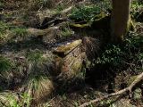
It is believed that the area around the well once served as the venue for Midsummer Eve dances. It was at that time kept as a lawn, but after the owner of the site decided to use it as a pheasantry – before 1928 when Lady Chatterley's Lover was published (see Quotations below) – the grass was let grow and the dancing stopped. If the site was thus once well known locally as the focal point of a seasonal festival, it has since become more widely known through its appearance, under its real name, in Sons and Lovers (see 1913 Allusion below) and as "John's Well" in Lady Chatterley's Lover, where the trysts between Lady Chatterley and the gamekeeper, Oliver Mellors, take place in the Gamekeeper's Hut (see image gallery below). Of this structure, which in part enclosed the well, only the foundations remain, and the site is inaccessible as it is situated in private woodland.[2]
Quotations
The next afternoon she went to the wood again. She followed the broad riding that swerved round and up through the larches to a spring called John's Well. It was cold on this hillside, and not a flower in the darkness of larches. But the icy little spring softly pressed upwards from its tiny well-bed of pure, reddish-white pebbles. How icy and clear it was! Brilliant! The new keeper had no doubt put in fresh pebbles. She heard the faint tinkle of water, as the tiny overflow trickled over and downhill. Even above the hissing boom of the larchwood, that spread its bristling, leafless, wolfish darkness on the down-slope, she heard the tinkle as of tiny water-bells. This place was a little sinister, cold, damp. Yet the well must have been a drinking-place for hundreds of years. Now no more. Its tiny cleared space was lush and cold and dismal.
'Do you think there is a second key to that little hut not far from John's Well, where the pheasants are reared?’ she said. 'There may be. Why?' 'I happened to find it today — and I’d never seen it before. I think it’s a darling place. I could sit there sometimes, couldn't I?' 'Was Mellors there?' 'Yes! That’s how I found it: his hammering. He didn’t seem to like my intruding at all. In fact he was almost rude when I asked about a second key.'
She fled as much as possible to the wood. One afternoon, as she sat brooding, watching the water bubbling coldly in John’s Well, the keeper had strode up to her.
Allusions
1913 - Lawrence, D H - Sons and Lovers
Carston, Waite and Co. found they had struck on a good thing, so, down the valleys of the brooks from Selby and Nuttall, new mines were sunk, until soon there were six pits working. From Nuttall, high up on the sandstone among the woods, the railway ran, past the ruined priory of the Carthusians and past Robin Hood’s Well, down to Spinney Park, then on to Minton, a large mine among corn-fields; from Minton across the farm-lands of the valley side to Bunker’s Hill, branching off there, and running north to Beggarlee [p. 10:] and Selby, that looks over at Crich and the hills of Derbyshire; six mines like black studs on the countryside, linked by a loop of fine chain, the railway.[6]
Gazetteers
- Dobson, R. B., ed.; Taylor, J., ed. Rymes of Robyn Hood: an Introduction to the English Outlaw (London, 1976), p. 303, s.n. Robin Hood's Well.
Sources
- Gover, J.E.B.; Mawer, Allen; Stenton, F.M. The Place-Names of Nottinghamshire (English Place-Name Society, vol. XVII) (Cambridge, 1940), pp. 145, 294
- Lee, William; Macaulay, C., introd. Public Health Act (11 & 12 Vict. Cap. 63.) Report to the General Board of Health on a Preliminary Inquiry into the Sewerage, Drainage, and Supply of Water, and the Sanitary Condition of the Inhabitants of the Parish of Eastwood, and the Hamlets of Newthorpe, Moorgreen, and Brinsley, in the Parish of Greasley, All in the County of Nottingham (London, 1853), pp. 16-17, 18 (bis), 19 (quater).
Maps
Well indicated and labelled on these maps.
- 25" O.S. map Nottinghamshire XXXII.15 (1880; surveyed 1878)
- 25" O.S. map Nottinghamshire XXXII.11 (1900; rev. 1899)
- 25" O.S. map Nottinghamshire XXXII.11 (1900; rev. 1899) (georeferenced)
- 25" O.S. map Nottinghamshire XXXII.15 (1915; rev. 1913-14)
- 6" O.S. map Nottinghamshire XXXII.SE (1886; surveyed 1878-79)
- 6" O.S. map Nottinghamshire XXXII.SE (1901; rev. 1899)
- 6" O.S. map Nottinghamshire XXXII.SE (1901; rev. 1899) (georeferenced)
- 6" O.S. map Nottinghamshire XXXII.SE (1919; rev. 1913-14)
- 6" O.S. map Nottinghamshire XXXII.SE (1921; rev. 1913-14)
- 6" O.S. map Derbyshire XLI (1921; rev. 1913-14)
- 6" O.S. map Nottinghamshire XXXII.SE (c. 1949; rev. 1938)
- 1" O.S. map Derby (Hills) Sheet 125 (1897; rev. 1895) (georeferenced)
- 1" O.S. map Derby (Outline) Sheet 125 (1897; rev. 1895) (georeferenced)
- 1" O.S. map Nottingham (1960; surveyed 1958) (georeferenced)
- ½" Bartholomew map Derby & Nottingham Sheet 13 (1902) (georeferenced)
- ½" Bartholomew map Peak District – Great Britain Sheet 29 (1943) (georeferenced)
- 1:25,000 O.S. map SK54 (1951; surveyed 1938-50) (georeferenced)
- 1:1 million–1:10K (1900s) (georeferenced)
- 1:1m to 1:63K (1920s-1940s) (georeferenced).
Discussion
- Our Nottinghamshire: Robin Hood's Well: A Healing Well by R.B. Parish.
Background
- D.H. Lawrence Research Centre: Struggle, by John Worthen
- Lawrence, D.H. Complete Works of D. H. Lawrence (Series One). Version 10 ([s.l.], ©2015), Kindle Locations 75123-75129 (ch. 8), 75210-75214 (ch. 8), 75591-75592 (ch. 10)
- Nottingham Wayfarers' Rambling Club; Price, Roland, introd. The Robin Hood Walks: A Comprehensive Guide to Walks in Robin Hood Country including the Third Edition of the Guide to the Full Route of Nottinghamshire's First Recreational Footpath, The Robin Hood Way (Leicester: Cordee, ©1994), pp. 23, 98, 107, 110
- Wikipedia: Lady Chatterley's Lover
- Wikipedia: D. H. Lawrence
- Short Notice Local Walk - (near Eastwood)
- Wikipedia: Greasley.
Brief mention
Also see
Notes
- ↑ D.H. Lawrence Research Centre: Struggle, by John Worthen; Our Nottinghamshire: Robin Hood's Well: A Healing Well by R.B. Parish; Eastwood & Kimberley Advertiser: Robin Hood’s Well (27 Oct. 2012); Short Notice Local Walk - (near Eastwood).
- ↑ 2.0 2.1 2.2 Our Nottinghamshire: Robin Hood's Well: A Healing Well by R.B. Parish.
- ↑ Gover, J.E.B.; Mawer, Allen; Stenton, F.M. The Place-Names of Nottinghamshire (English Place-Name Society, vol. XVII) (Cambridge, 1940), pp. 145, 294.
- ↑ Lee, William; Macaulay, C., introd. Public Health Act (11 & 12 Vict. Cap. 63.) Report to the General Board of Health on a Preliminary Inquiry into the Sewerage, Drainage, and Supply of Water, and the Sanitary Condition of the Inhabitants of the Parish of Eastwood, and the Hamlets of Newthorpe, Moorgreen, and Brinsley, in the Parish of Greasley, All in the County of Nottingham (London, 1853), pp. 16-17, 18 (bis), 19 (quater); for 1852 and 1853 report see there pp. 16, 17.
- ↑ Lawrence, D.H. Complete Works of D. H. Lawrence (Series One). Version 10 ([s.l.], ©2015), Kindle Locations 75123-75129 (ch. 8), 75210-75214 (ch. 8), 75591-75592 (ch. 10).
- ↑ Lawrence, D.H.; Baron, Helen, ed.; Baron, Carl, ed.; Morrison, Blake, introd. Sons and Lovers (Penguin Classics) (London etc., 2006), pp. 9-10.
Image gallery
Click any image to display it in the lightbox, where you can navigate between images by clicking in the right or left side of the current image.
Basin at Robin Hood's Well / Courtesy Ross Parish, March 2013 or earlier.
Another basin at Robin Hood's Well / Courtesy Ross Parish, March 2013 or earlier.
Basins at Robin Hood's Well / Courtesy Ross Parish, March 2013 or earlier.
The Gamekeeper's Hut / [s.n.]. Robin Hood's Well, High Park Wood, Moorgreen (Peveril Series) ([s.l.], [s.d.]). Photographic postcard (b./w.). 87 x 139 mm; HTN collection.


