Friar Close (Stannington)
From International Robin Hood Bibliography
| Locality | |
|---|---|
| Coordinate | 53.396756, -1.542177 |
| Adm. div. | West Riding of Yorkshire |
| Vicinity | c. 5 km NW of Sheffield |
| Type | Thoroughfare |
| Interest | Robin Hood name |
| Status | Extant |
| First Record | |
Friar Close.
By Henrik Thiil Nielsen, 2020-02-04. Revised by Henrik Thiil Nielsen, 2021-01-06.
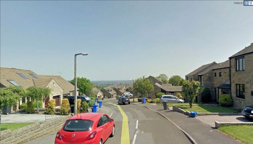
Friar Close is a residential cul-de-sac in Stannington, immediately south of River Loxley. Just north of it is a Robin Hood Chase. With a neighbouring street named after the outlaw it seems likely that Friar Close was so named with Friar Tuck and/or the Curtal Friar in mind. The houses in the street seem to be of late 20th century date.
Gazetteers
- Not included in Dobson, R. B., ed.; Taylor, J., ed. Rymes of Robyn Hood: an Introduction to the English Outlaw (London, 1976), pp. 293-311.
Also see

