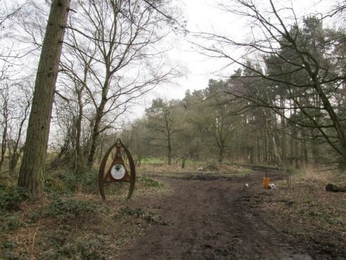
Fountain Dale (Blidworth)
| Locality | |
|---|---|
| Coordinate | 53.1049, -1.1541 |
| Adm. div. | Nottinghamshire |
| Vicinity | 2.2 km NNW of Ravenshead |
| Type | Area |
| Interest | Literary locale |
| Status | Extant |
| First Record | 1826 |

By Henrik Thiil Nielsen, 2016-10-08. Revised by Henrik Thiil Nielsen, 2021-01-06.
The B-version of the ballad of Robin Hood and the Curtal Friar, from a broadside dated c. 1660, refers to the friar's place of residence as both "Fountains Abby" and "Fountains Dale".[1] According to Dobson & Taylor, since the early 19th century the Fountains Dale of the ballad has been identified with a wooded area – one of the few surviving vestiges of Sherwood Forest – north of Ravenshead and Blidworth. The name 'Fountain Dale' is first found applied to this area on the Greenwood brothers' 1826 map of Nottinghamshire.[2] It was earlier known as Langton Lodge.[3] While it is of course possible that the name Fountain Dale as applied to the locality under discussion may have left no (as yet discovered) mark on the records during the period c. 1660-1825, it is perhaps just as likely that Langton was deliberately renamed in the early 19th century in an attempt to strengthen Nottinghamshire's claim to being the only true home of Robin Hood. Fountains Abbey is of course in Yorkshire, but with a Fountain Dale in Nottinghamshire the ownership of the story of Robin Hood's famous meeting with the curtal friar could be wrested from the northern neighbours. This of course leaves open the question what prompted the author of the ballad to invent the alternative name "Fountain Dale" for (the area round) Fountains Abbey. He would, in any case, not have been the first poet in literary history to invent a place-name.
Gazetteers
- Not included in Dobson, R. B., ed.; Taylor, J., ed. Rymes of Robyn Hood: an Introduction to the English Outlaw (London, 1976), pp. 293-311.
Sources
- Gover, J.E.B.; Mawer, Allen; Stenton, F.M. The Place-Names of Nottinghamshire (English Place-Name Society, vol. XVII) (Cambridge, 1940), p. 116.
- Greenwood, C., cartog.; Greenwood, J., cartog. Map of the County of Nottingham, from an Actual Survey made in the Years 1824 & 1825 (London, 1826). Not seen, but cf. preceding.
Maps
- 6" O.S. map Nottinghamshire XXVIII.SW (1885; surveyed 1877-83)
- 6" O.S. map Nottinghamshire XXVIII.SW (1900; surveyed 1897-98)
- 6" O.S. map Nottinghamshire XXVIII.SW (1920; surveyed 1913)
- 6" O.S. map Nottinghamshire XXVIII.SW (c. 1949; rev. 1939).
Background
- Nottingham Wayfarers' Rambling Club; Price, Roland, introd. The Robin Hood Walks: A Comprehensive Guide to Walks in Robin Hood Country including the Third Edition of the Guide to the Full Route of Nottinghamshire's First Recreational Footpath, The Robin Hood Way (Leicester: Cordee, ©1994), pp. 114-17
- UK Wanderings: Fountain Dale and Blidworth.
Also see
Notes
- ↑ Dobson, R. B., ed.; Taylor, J., ed. Rymes of Robyn Hood: an Introduction to the English Outlaw (London, 1976), pp. 161-64. Fountains Abbey: sts. 7, 39. Fountains Dale: sts. 10, 11, 39, 41.
- ↑ Dobson, R. B., ed.; Taylor, J., ed. Rymes of Robyn Hood: an Introduction to the English Outlaw (London, 1976), p. 301, s.n. '(Fountain Dale)'; Greenwood, C., cartog.; Greenwood, J., cartog. Map of the County of Nottingham, from an Actual Survey made in the Years 1824 & 1825 (London, 1826); Gover, J.E.B.; Mawer, Allen; Stenton, F.M. The Place-Names of Nottinghamshire (English Place-Name Society, vol. XVII) (Cambridge, 1940), p. 116.
- ↑ Gover, J.E.B.; Mawer, Allen; Stenton, F.M. The Place-Names of Nottinghamshire (English Place-Name Society, vol. XVII) (Cambridge, 1940), p. 116.
