Blidworth (Mansfield)
From International Robin Hood Bibliography
| Locality | |
|---|---|
| Coordinate | 53.097695, -1.115276 |
| Adm. div. | Nottinghamshire |
| Vicinity | c. 7 km SE of central Mansfield |
| Type | Settlement |
| Interest | Local tradition |
| Status | Extant |
| First Record | 1994 |
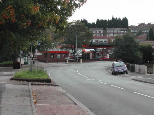
Blidworth.

Blidworth Village / Tom Courtney, 9 Oct. 2005, Creative Commons.
By Henrik Thiil Nielsen, 2020-10-09. Revised by Henrik Thiil Nielsen, 2021-01-07.
Situated in the Sherwood Forest area, Blidworth and its vicinity not only include several localities named after or connected with Robin Hood and members of his band, Blidworth itself is said to be the village from where Robin Hood took Maid Marian to be married at Edwinstowe.[1] There is apparently also a local tradition to the effect that Maid Marian was born in Blidworth.[2]
Gazetteers
- Not included in Dobson, R. B., ed.; Taylor, J., ed. Rymes of Robyn Hood: an Introduction to the English Outlaw (London, 1976), pp. 293-311.
Sources
Maps
- 25" O.S. map Nottinghamshire XXVIII.15 (1900; rev. 1898) (georeferenced)
- 6" O.S. map Nottinghamshire XXVIII.SE (1884; surveyed 1883)
- 6" O.S. map Nottinghamshire XXVIII.NE (1900; rev. 1897) (georeferenced)
- 6" O.S. map Nottinghamshire XXVIII.SE (1900; rev. 1897–98)
- 6" O.S. map Nottinghamshire XXVIII.SE (1920; rev. 1913)
- 6" O.S. map Nottinghamshire XXVIII.SW (1885; surveyed 1877–83)
- 6" O.S. map Nottinghamshire XXVIII.SW (1900; rev. 1897–98)
- 6" O.S. map Nottinghamshire XXVIII.SW (1920; rev. 1913)
- 6" O.S. map Nottinghamshire XXVIII.SW (c. 1949; rev. 1939)
- 25" O.S. map Nottinghamshire XXVIII.10 (1885; surveyed 1884)
- 25" O.S. map Nottinghamshire XXVIII.10 (1885; surveyed 1884)
- 25" O.S. map Nottinghamshire XXVIII.10 (1900; rev. 1897)
- 25" O.S. map Nottinghamshire XXVIII.10 (1915; rev. 1913)
- 25" O.S. map Nottinghamshire XXVIII.11 (1885; surveyed 1883)
- 25" O.S. map Nottinghamshire XXVIII.11 (1900; rev. 1897)
- 25" O.S. map Nottinghamshire XXVIII.11 (1916; rev. 1913)
- 25" O.S. map Nottinghamshire XXVIII.11 (1946; rev. 1939)
- 25" O.S. map Nottinghamshire XXVIII.14 (1884; surveyed 1883)
- 25" O.S. map Nottinghamshire XXVIII.14 (1900; rev. 1898)
- 25" O.S. map Nottinghamshire XXVIII.14 (1915; rev. 1913)
- 25" O.S. map Nottinghamshire XXVIII.15 (1885; surveyed 1884)
- 25" O.S. map Nottinghamshire XXVIII.15 (1900; rev. 1898)
- 25" O.S. map Nottinghamshire XXVIII.15 (1915; rev. 1913).
Background
Also see
Notes
- ↑ Nottingham Wayfarers' Rambling Club; Price, Roland, introd. The Robin Hood Walks: A Comprehensive Guide to Walks in Robin Hood Country including the Third Edition of the Guide to the Full Route of Nottinghamshire's First Recreational Footpath, The Robin Hood Way (Leicester: Cordee, ©1994), p. 32.
- ↑ Wikipedia: Blidworth.
